TopoQuest Logo
Do you find TopoQuest useful?
Help keep TopoQuest running and adding new maps/features by donating!
Bitcoin:  19c7KJd3qBynnjoSw5npx9KScwjBe4ifkT
Litecoin:  LXs6TkuXGGXo1vDsWCkWVdjQX94eUKd6ui
Home View Maps Find Maps Find Places Resources & Links


Saint Helen NW, Michigan Topographic Map

USGS Map Title: Saint Helen NW, MI
USGS Map MRC: 44084D4
DRG (GeoTIFF) Download: o44084d4.tif


Neighboring USGS Topographic Map Quads:


  Roscommon North, MI  
44084E5
 

  Eldorado, MI  
44084E4
 

  Luzerne, MI  
44084E3
 

  Roscommon South, MI  
44084D5
 

  Saint Helen NW, MI  
44084D4
 

  Saint Helen NE, MI  
44084D3
 

  Backus Lake, MI  
44084C5
 

  Saint Helen, MI  
44084C4
 

  Ogemaw Springs, MI  
44084C3


Map MRC Location:

N45°
W85°
N45°
W84°
H8 H7 H6 H5 H4 H3 H2 H1
G8 G7 G6 G5 G4 G3 G2 G1
F8 F7 F6 F5 F4 F3 F2 F1
E8 E7 E6 E5 E4 E3 E2 E1
D8 D7 D6 D5 D4 D3 D2 D1
C8 C7 C6 C5 C4 C3 C2 C1
B8 B7 B6 B5 B4 B3 B2 B1
A8 A7 A6 A5 A4 A3 A2 A1
N44°
W85°
N44°
W84°

Saint Helen NW, MI USGS 1:24K Topographic Map Preview:
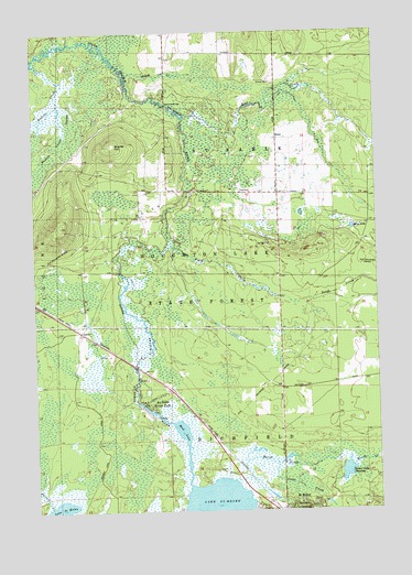
Saint Helen NW, MI USGS Topographic Map
Click on map above to begin viewing in our Map Viewer.

This topographic map contains these locations and features:
Feature Name Type Latitude Longitude GNIS ID View Map
Asum CreekStreamN44.4889°W84.4656°620292View Map
Au Sable River ParkPopulated PlaceN44.4034°W84.4603°620330View Map
Bear LakeLakeN44.4488°W84.3839°620857View Map
Beaver Lake FloodingReservoirN44.3853°W84.3869°620947View Map
Brants HillSummitN44.4709°W84.4709°621903View Map
Cedar CreekStreamN44.3872°W84.4128°622897View Map
East CreekStreamN44.4778°W84.4417°625168View Map
GeelsPopulated PlaceN44.4220°W84.4836°1617579View Map
Geels Post Office (historical)Post OfficeN44.4219°W84.4839°2508862View Map
Geels Station (historical)LocaleN44.4222°W84.4836°2508849View Map
Hudson CreekStreamN44.4925°W84.4997°628768View Map
KenoPopulated PlaceN44.4722°W84.4106°1617656View Map
Keno Post Office (historical)Post OfficeN44.4722°W84.4106°2508857View Map
Kirtland Community CollegeSchoolN44.4931°W84.4122°2508893View Map
Kirtland Community College Department of Public SafetyBuildingN44.4907°W84.4133°2737588View Map
Lake Saint Helen Baptist ChurchChurchN44.3756°W84.4097°2508866View Map
Marsh CreekStreamN44.3831°W84.4283°631613View Map
Mud LakeLakeN44.3989°W84.4534°632993View Map
Russell CreekStreamN44.3764°W84.4950°636401View Map
Saint Helen Oil FieldOilfieldN44.4542°W84.4431°1623613View Map
Sherman BridgeBridgeN44.4811°W84.4509°1623623View Map
South CreekStreamN44.4447°W84.4500°638335View Map
Township of Au SableCivilN44.4655°W84.4306°1625866View Map

Note: Coordinates in the location and feature list above are referenced to NAD83 datum.


Copyright (C) 2008-2025 Ryan Niemi / Sunset Dynamics ... All Rights Reserved