TopoQuest Logo
Do you find TopoQuest useful?
Help keep TopoQuest running and adding new maps/features by donating!
Bitcoin:  19c7KJd3qBynnjoSw5npx9KScwjBe4ifkT
Litecoin:  LXs6TkuXGGXo1vDsWCkWVdjQX94eUKd6ui
Home View Maps Find Maps Find Places Resources & Links


Saint Johns North, Arizona Topographic Map

USGS Map Title: Saint Johns North, AZ
USGS Map MRC: 34109E3
DRG (GeoTIFF) Download: o34109e3.tif


Neighboring USGS Topographic Map Quads:


  Cedar Lake Wash, AZ  
34109F4
 

  Schnebly Well, AZ  
34109F3
 

  Valle Bonito, AZ  
34109F2
 

  Zion Reservoir, AZ  
34109E4
 

  Saint Johns North, AZ  
34109E3
 

  Kearn Lake, AZ  
34109E2
 

  Salado, AZ  
34109D4
 

  Saint Johns South, AZ  
34109D3
 

  Mesa Parada NW, AZ  
34109D2


Map MRC Location:

N35°
W110°
N35°
W109°
H8 H7 H6 H5 H4 H3 H2 H1
G8 G7 G6 G5 G4 G3 G2 G1
F8 F7 F6 F5 F4 F3 F2 F1
E8 E7 E6 E5 E4 E3 E2 E1
D8 D7 D6 D5 D4 D3 D2 D1
C8 C7 C6 C5 C4 C3 C2 C1
B8 B7 B6 B5 B4 B3 B2 B1
A8 A7 A6 A5 A4 A3 A2 A1
N34°
W110°
N34°
W109°

Saint Johns North, AZ USGS 1:24K Topographic Map Preview:
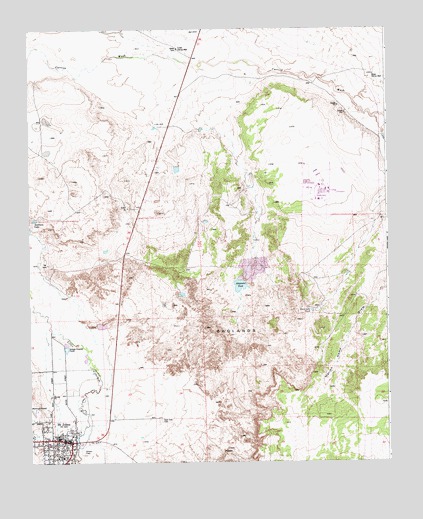
Saint Johns North, AZ USGS Topographic Map
Click on map above to begin viewing in our Map Viewer.

This topographic map contains these locations and features:
Feature Name Type Latitude Longitude GNIS ID View Map
Alejandro TankReservoirN34.5508°W109.3017°578View Map
Apache County Sheriff's OfficeBuildingN34.5017°W109.3652°2672249View Map
Apache County Superior CourtBuildingN34.5022°W109.3654°2669543View Map
BadlandsAreaN34.5359°W109.3026°948View Map
Carrizo Wash BridgeBridgeN34.6150°W109.3184°21558View Map
Coronado Elementary SchoolSchoolN34.5078°W109.3602°3284View Map
Coronado Evaporation ReservoirReservoirN34.5600°W109.2773°21583View Map
Coronado Generating Station DamDamN34.5600°W109.2773°21584View Map
Deep Lake TankReservoirN34.5435°W109.2768°3783View Map
Lower Carrizo WellWellN34.6189°W109.3226°7457View Map
McIntosh SpringSpringN34.5134°W109.2932°1675536View Map
Northland Pioneer College Saint Johns CenterSchoolN34.5058°W109.3688°2672185View Map
Pioneer SchoolSchoolN34.5061°W109.3690°9523View Map
Saint John the Baptist Catholic ChurchChurchN34.5064°W109.3609°2671296View Map
Saint JohnsPopulated PlaceN34.5059°W109.3609°10711View Map
Saint Johns Catholic CemeteryCemeteryN34.5124°W109.3299°4304View Map
Saint Johns City ParkParkN34.5117°W109.3673°21795View Map
Saint Johns Emergency Medical ServicesBuildingN34.5020°W109.3637°2672439View Map
Saint Johns Fire DepartmentBuildingN34.5019°W109.3637°2672339View Map
Saint Johns Public LibraryBuildingN34.5064°W109.3690°2669471View Map
Saint Johns Recreation CenterBuildingN34.5029°W109.3675°2670156View Map
Sorenson LakeLakeN34.5700°W109.3731°11560View Map
Upper Carrizo WellWellN34.6117°W109.2548°13071View Map

Note: Coordinates in the location and feature list above are referenced to NAD83 datum.


Copyright (C) 2008-2025 Ryan Niemi / Sunset Dynamics ... All Rights Reserved