TopoQuest Logo
Do you find TopoQuest useful?
Help keep TopoQuest running and adding new maps/features by donating!
Bitcoin:  19c7KJd3qBynnjoSw5npx9KScwjBe4ifkT
Litecoin:  LXs6TkuXGGXo1vDsWCkWVdjQX94eUKd6ui
Home View Maps Find Maps Find Places Resources & Links


Saint Pauls, North Carolina Topographic Map

USGS Map Title: Saint Pauls, NC
USGS Map MRC: 34078G8
DRG (GeoTIFF) Download: o34078g8.tif


Neighboring USGS Topographic Map Quads:


  Parkton, NC  
34079H1
 

  Hope Mills, NC  
34078H8
 

  Cedar Creek, NC  
34078H7
 

  Rennert, NC  
34079G1
 

  Saint Pauls, NC  
34078G8
 

  Duart, NC  
34078G7
 

  Northwest Lumberton, NC  
34079F1
 

  Northeast Lumberton, NC  
34078F8
 

  Tar Heel, NC  
34078F7


Map MRC Location:

N35°
W79°
N35°
W78°
H8 H7 H6 H5 H4 H3 H2 H1
G8 G7 G6 G5 G4 G3 G2 G1
F8 F7 F6 F5 F4 F3 F2 F1
E8 E7 E6 E5 E4 E3 E2 E1
D8 D7 D6 D5 D4 D3 D2 D1
C8 C7 C6 C5 C4 C3 C2 C1
B8 B7 B6 B5 B4 B3 B2 B1
A8 A7 A6 A5 A4 A3 A2 A1
N34°
W79°
N34°
W78°

Saint Pauls, NC USGS 1:24K Topographic Map Preview:
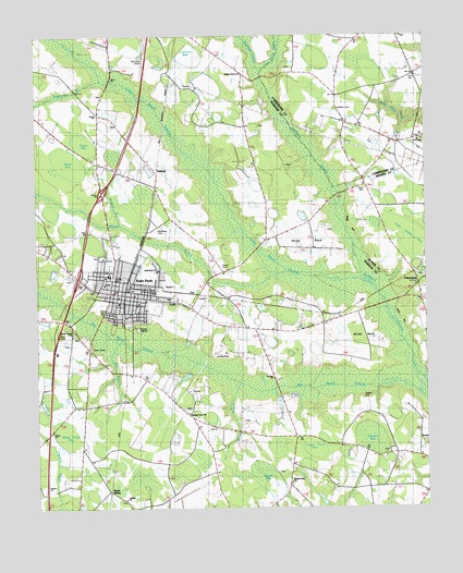
Saint Pauls, NC USGS Topographic Map
Click on map above to begin viewing in our Map Viewer.

This topographic map contains these locations and features:
Feature Name Type Latitude Longitude GNIS ID View Map
Antioch ChurchChurchN34.7527°W78.9714°980213View Map
Beaverdam BranchStreamN34.8641°W78.9789°980823View Map
Big BranchStreamN34.7946°W78.9725°981323View Map
Big Marsh Volunteer Fire DepartmentBuildingN34.8026°W78.9770°2639249View Map
Brisson BranchStreamN34.8252°W78.9725°1005927View Map
Buckhorn SwampStreamN34.8654°W78.9270°1025196View Map
Buies NeckCapeN34.7954°W78.8953°1026163View Map
Buies NeckPopulated PlaceN34.7977°W78.8947°1019394View Map
Cold Camp CreekStreamN34.8654°W78.9270°1025249View Map
County Line CemeteryCemeteryN34.8346°W78.8931°983609View Map
Currie BayBasinN34.7602°W78.9275°1025031View Map
Davis BayBasinN34.8432°W78.9898°1025032View Map
Deerfield Farm Mobile Home ParkPopulated PlaceN34.8314°W78.9310°2505454View Map
Evans BayBasinN34.8460°W78.9823°1025035View Map
Everett ParkParkN34.8113°W78.9750°1026201View Map
Evergreen Rehabilitation CenterBuildingN34.8472°W78.9805°2505845View Map
Fisher CemeteryCemeteryN34.8132°W78.9392°985098View Map
French ChurchChurchN34.7768°W78.9853°985406View Map
Grays Creek Fire Department Station 18BuildingN34.8643°W78.8780°2639715View Map
Great Marsh ChurchChurchN34.7971°W78.9878°986029View Map
Hopes Pond BayBasinN34.7671°W78.9120°1025038View Map
Horse BranchStreamN34.7832°W78.9356°1025399View Map
Horse NeckPopulated PlaceN34.8188°W78.9109°1006246View Map
Horse NeckCapeN34.8204°W78.9128°1026162View Map
Lammon BayBasinN34.8693°W78.9509°1025043View Map
Little Gallberry BayBasinN34.8207°W78.8806°1025478View Map
Little Marsh SwampStreamN34.8107°W78.8945°988703View Map
Mallory ChurchChurchN34.8360°W78.9231°989260View Map
McKinnon CemeteryCemeteryN34.8240°W78.9614°989600View Map
McMillan CemeteryCemeteryN34.8557°W78.9025°989622View Map
Mercer BranchStreamN34.8132°W78.9192°989731View Map
Molloys Grove ChurchChurchN34.8649°W78.9334°1007563View Map
Mount Vernon ChurchChurchN34.8477°W78.8759°990595View Map
Mount Vernon ChurchChurchN34.8482°W78.8753°990596View Map
Mount Zion ChurchChurchN34.8057°W78.8825°990627View Map
OaklandPopulated PlaceN34.8388°W78.9606°991471View Map
Odom PondReservoirN34.8038°W78.9917°980003View Map
Pleasant Grove ChurchChurchN34.7757°W78.9514°992465View Map
Pleasant View SchoolSchoolN34.7571°W78.9189°992585View Map
Powers BayBasinN34.7677°W78.8934°1025051View Map
Powers CemeteryCemeteryN34.7790°W78.8945°992777View Map
Rozier SidingPopulated PlaceN34.7552°W78.9767°1025662View Map
Saint Paul ChurchChurchN34.7846°W78.9242°1007567View Map
Saint Paul High SchoolSchoolN34.8118°W78.9767°1007565View Map
Saint PaulsPopulated PlaceN34.8066°W78.9711°994075View Map
Saint Pauls City Fire DepartmentBuildingN34.8054°W78.9806°2638450View Map
Saint Pauls Elementary SchoolSchoolN34.8074°W78.9623°1006800View Map
Saint Pauls Emergency Response UnitBuildingN34.8056°W78.9734°2720689View Map
Saint Pauls High SchoolSchoolN34.8118°W78.9770°1006802View Map
Saint Pauls Middle SchoolSchoolN34.8104°W78.9823°1006799View Map
Saint Pauls Police DepartmentBuildingN34.8061°W78.9734°2770022View Map
Saint Pauls Post OfficePost OfficeN34.8073°W78.9745°2774096View Map
Sandy Grove ChurchChurchN34.8652°W78.9328°994276View Map
Solid Rock ChurchChurchN34.8135°W78.9606°1007566View Map
Southern Comforts AerodromeAirportN34.8653°W78.9667°997866View Map
Tailwinds AirportAirportN34.8275°W78.9303°2679254View Map
TobermoryPopulated PlaceN34.8093°W78.8770°1025752View Map
Tobermory Volunteer Fire DepartmentBuildingN34.8097°W78.8763°2639164View Map
Town of Saint PaulsCivilN34.8087°W78.9749°2407393View Map
Township of Saint PaulsCivilN34.8083°W78.9707°1027121View Map
Tyson CemeteryCemeteryN34.8340°W78.8936°1007564View Map
White Pond BayBasinN34.7710°W78.9892°1025060View Map
WNCR-AM (Saint Pauls)TowerN34.7929°W78.9817°1018375View Map

Note: Coordinates in the location and feature list above are referenced to NAD83 datum.


Copyright (C) 2008-2024 Ryan Niemi / Sunset Dynamics ... All Rights Reserved