TopoQuest Logo
Do you find TopoQuest useful?
Help keep TopoQuest running and adding new maps/features by donating!
Bitcoin:  19c7KJd3qBynnjoSw5npx9KScwjBe4ifkT
Litecoin:  LXs6TkuXGGXo1vDsWCkWVdjQX94eUKd6ui
Home View Maps Find Maps Find Places Resources & Links


Salem, Michigan Topographic Map

USGS Map Title: Salem, MI
USGS Map MRC: 42083D5
DRG (GeoTIFF) Download: o42083d5.tif


Neighboring USGS Topographic Map Quads:


  Kent Lake, MI  
42083E6
 

  Milford, MI  
42083E5
 

  Walled Lake, MI  
42083E4
 

  South Lyon, MI  
42083D6
 

  Salem, MI  
42083D5
 

  Northville, MI  
42083D4
 

  Ann Arbor East, MI  
42083C6
 

  Denton, MI  
42083C5
 

  Wayne, MI  
42083C4


Map MRC Location:

N43°
W84°
N43°
W83°
H8 H7 H6 H5 H4 H3 H2 H1
G8 G7 G6 G5 G4 G3 G2 G1
F8 F7 F6 F5 F4 F3 F2 F1
E8 E7 E6 E5 E4 E3 E2 E1
D8 D7 D6 D5 D4 D3 D2 D1
C8 C7 C6 C5 C4 C3 C2 C1
B8 B7 B6 B5 B4 B3 B2 B1
A8 A7 A6 A5 A4 A3 A2 A1
N42°
W84°
N42°
W83°

Salem, MI USGS 1:24K Topographic Map Preview:
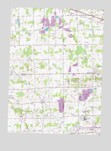
Salem, MI USGS Topographic Map
Click on map above to begin viewing in our Map Viewer.

This topographic map contains these locations and features:
Feature Name Type Latitude Longitude GNIS ID View Map
Blackwood DrainCanalN42.4692°W83.5949°621550View Map
Bob-O-Link Golf ClubLocaleN42.4906°W83.5180°1623249View Map
Brae-Burn Golf ClubLocaleN42.3909°W83.5510°1623253View Map
Briar Pointe Plaza Shopping CenterLocaleN42.4729°W83.5048°2343600View Map
BrookvillePopulated PlaceN42.3773°W83.5785°622053View Map
Cattails Golf ClubLocaleN42.4453°W83.6231°2649479View Map
Charter Township of LyonCivilN42.4795°W83.6062°1626650View Map
Colonel Samuel White Historical MarkerParkN42.4521°W83.5008°2648764View Map
Colonel Samuel White Homestead Historical MarkerParkN42.4521°W83.5008°2648765View Map
Deerfield Elementary SchoolSchoolN42.4831°W83.5337°2649561View Map
Detroit House of CorrectionLocaleN42.3914°W83.5208°1623317View Map
Henry Ford Hospital Medical Center - PlymouthBuildingN42.3833°W83.5196°2343141View Map
Interchange 159CrossingN42.4975°W83.5361°2648731View Map
Interchange 160CrossingN42.4931°W83.5147°2648730View Map
Lake AngelaLakeN42.4861°W83.6158°620124View Map
Lapham CemeteryCemeteryN42.3778°W83.5681°2646785View Map
Links of NoviLocaleN42.4606°W83.5467°2649482View Map
Lyon Township CemeteryCemeteryN42.4492°W83.5728°2649511View Map
Lyon Township Fire Department Station 2BuildingN42.4617°W83.6102°2619980View Map
Marbury State ParkParkN42.4289°W83.5351°2345361View Map
Marbury State Park HeadquartersLocaleN42.4292°W83.5348°2345362View Map
Maybury SanitariumHospitalN42.4270°W83.5322°631768View Map
Maybury State ParkParkN42.4294°W83.5328°2650140View Map
Missionary Baptist ChurchChurchN42.4636°W83.5530°632504View Map
Moraine SchoolSchoolN42.4356°W83.5063°632671View Map
Northville Gas Storage FieldOilfieldN42.4150°W83.5472°1623536View Map
Northville Township Fire Department Station 2BuildingN42.4215°W83.5229°2619961View Map
Northville Water and Sewer BuildingBuildingN42.4034°W83.5114°2344206View Map
Novi City ParkParkN42.4789°W83.5167°2649562View Map
Novi Fire Department Station 4BuildingN42.4640°W83.5335°2620013View Map
Novi Lyon DrainCanalN42.4798°W83.5794°633774View Map
Novi Middle SchoolSchoolN42.4793°W83.5301°2344223View Map
Our Lady of Providence SchoolSchoolN42.4020°W83.5119°634210View Map
Plymouth Community Fire Department Station 3BuildingN42.3780°W83.5094°2620163View Map
Providence Medical Center - Providence ParkBuildingN42.4863°W83.5253°2344492View Map
Providence Park HospitalHospitalN42.4886°W83.5193°2734529View Map
River Bank Golf CourseLocaleN42.4606°W83.5958°2649481View Map
SalemPopulated PlaceN42.4061°W83.5799°637102View Map
Salem Bible ChurchChurchN42.4064°W83.5800°2648929View Map
Salem Elementary SchoolSchoolN42.4033°W83.5783°2648927View Map
Salem Hills Golf ClubLocaleN42.4048°W83.5916°1623614View Map
Salem Post Office (historical)Post OfficeN42.4050°W83.5783°2648928View Map
Salem Post Office (historical)Post OfficeN42.3775°W83.5786°2646712View Map
Salem Station (historical)LocaleN42.4068°W83.5781°2648926View Map
Salem Township Fire DepartmentBuildingN42.4058°W83.5778°2619999View Map
Salem-Walker CemeteryCemeteryN42.4103°W83.6238°637114View Map
Scott Regional Prison (historical)BuildingN42.3984°W83.5170°2340834View Map
South Lyon East High SchoolSchoolN42.4637°W83.5575°2340906View Map
Sump DrainStreamN42.4081°W83.5166°639067View Map
Tanglewood Golf ClubLocaleN42.4569°W83.5811°2649480View Map
Thayer CemeteryCemeteryN42.4075°W83.5497°1614699View Map
Thornton Creek Elementary SchoolSchoolN42.4533°W83.5041°2649491View Map
Township of SalemCivilN42.3904°W83.6064°1627035View Map
Walnut Creek Golf ClubLocaleN42.4753°W83.5649°1623370View Map
West Market Square Shopping CenterLocaleN42.4920°W83.5239°2339967View Map
West Novi Post Office (historical)Post OfficeN42.4944°W83.5417°2649071View Map
West Salem ChurchChurchN42.4109°W83.6235°1616168View Map
William Allan AcademySchoolN42.4345°W83.5401°2340015View Map

Note: Coordinates in the location and feature list above are referenced to NAD83 datum.


Copyright (C) 2008-2025 Ryan Niemi / Sunset Dynamics ... All Rights Reserved