TopoQuest Logo
Do you find TopoQuest useful?
Help keep TopoQuest running and adding new maps/features by donating!
Bitcoin:  19c7KJd3qBynnjoSw5npx9KScwjBe4ifkT
Litecoin:  LXs6TkuXGGXo1vDsWCkWVdjQX94eUKd6ui
Home View Maps Find Maps Find Places Resources & Links


Salome, Arizona Topographic Map

USGS Map Title: Salome, AZ
USGS Map MRC: 33113G5
DRG (GeoTIFF) Download: o33113g5.tif


Neighboring USGS Topographic Map Quads:


  Harcuvar Peak, AZ  
33113H6
 

  Cunningham Pass, AZ  
33113H5
 

  Webber Canyon, AZ  
33113H4
 

  Harcuvar, AZ  
33113G6
 

  Salome, AZ  
33113G5
 

  Socorro Peak, AZ  
33113G4
 

  Hope, AZ  
33113F6
 

  Harrisburg Valley, AZ  
33113F5
 

  Socorro Mine, AZ  
33113F4


Map MRC Location:

N34°
W114°
N34°
W113°
H8 H7 H6 H5 H4 H3 H2 H1
G8 G7 G6 G5 G4 G3 G2 G1
F8 F7 F6 F5 F4 F3 F2 F1
E8 E7 E6 E5 E4 E3 E2 E1
D8 D7 D6 D5 D4 D3 D2 D1
C8 C7 C6 C5 C4 C3 C2 C1
B8 B7 B6 B5 B4 B3 B2 B1
A8 A7 A6 A5 A4 A3 A2 A1
N33°
W114°
N33°
W113°

Salome, AZ USGS 1:24K Topographic Map Preview:
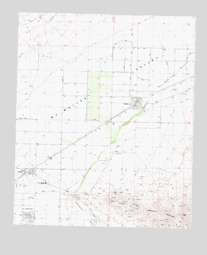
Salome, AZ USGS Topographic Map
Click on map above to begin viewing in our Map Viewer.

This topographic map contains these locations and features:
Feature Name Type Latitude Longitude GNIS ID View Map
Arizona Public Service Salome SubstationLocaleN33.7720°W113.5944°22738View Map
Blue Star ClaimMineN33.7809°W113.5296°1735View Map
Browns WellWellN33.7548°W113.5841°22745View Map
Bunker Hill MineMineN33.7650°W113.5402°2198View Map
Campbell House ClaimMineN33.7645°W113.5471°2414View Map
Centennial ParkParkN33.7895°W113.5605°24151View Map
Four Winds MineMineN33.7709°W113.5558°22759View Map
Hercules MineMineN33.7706°W113.5505°5731View Map
Indian Hills AirparkAirportN33.7598°W113.6115°45627View Map
La Paz County Sheriff's Office SalomeBuildingN33.7796°W113.6109°22790View Map
Landmark LetterPillarN33.7650°W113.5574°6863View Map
Mesquite WellWellN33.7706°W113.6144°22772View Map
Outback Ranch AirstripAirportN33.8466°W113.5728°2651003View Map
Petes WellWellN33.8045°W113.5521°9356View Map
S MountainSummitN33.7650°W113.5574°11618View Map
SalomePopulated PlaceN33.7811°W113.6147°10736View Map
Salome Airport (historical)AirportN33.7736°W113.6202°22786View Map
Salome Census Designated PlaceCensusN33.7778°W113.6061°2409240View Map
Salome Elementary SchoolSchoolN33.7816°W113.6199°22787View Map
Salome High SchoolSchoolN33.7750°W113.6033°10737View Map
Salome Post OfficePost OfficeN33.7818°W113.6133°2670136View Map
Salome Railroad StationBuildingN33.7820°W113.6155°22789View Map
Salome WashStreamN33.7675°W113.5847°10739View Map
Twin PeaksSummitN33.7575°W113.5055°12952View Map
USGSA DepotLocaleN33.8309°W113.5163°13026View Map
WendenPopulated PlaceN33.8225°W113.5416°13469View Map
Wenden Airfield (historical)AirportN33.8139°W113.5452°22797View Map
Wenden Bible ChurchChurchN33.8199°W113.5407°2671451View Map
Wenden Census Designated PlaceCensusN33.8324°W113.5432°2409543View Map
Wenden Elementary SchoolSchoolN33.8244°W113.5412°22798View Map
Wenden Fire DepartmentBuildingN33.8223°W113.5436°2672346View Map
Wenden Post OfficePost OfficeN33.8218°W113.5422°2669809View Map

Note: Coordinates in the location and feature list above are referenced to NAD83 datum.


Copyright (C) 2008-2024 Ryan Niemi / Sunset Dynamics ... All Rights Reserved