TopoQuest Logo
Do you find TopoQuest useful?
Help keep TopoQuest running and adding new maps/features by donating!
Bitcoin:  19c7KJd3qBynnjoSw5npx9KScwjBe4ifkT
Litecoin:  LXs6TkuXGGXo1vDsWCkWVdjQX94eUKd6ui
Home View Maps Find Maps Find Places Resources & Links


Salt Mountain, Utah Topographic Map

USGS Map Title: Salt Mountain, UT
USGS Map MRC: 40112E6
DRG (GeoTIFF) Download: o40112e6.tif


Neighboring USGS Topographic Map Quads:


  Timpie, UT  
40112F6
 

  Flux, UT  
40112F5


  Salt Mountain, UT  
40112E6
 

  North Willow Canyon, UT  
40112E5
 

  Hickman Knolls, UT  
40112D7
 

  Deseret Peak West, UT  
40112D6
 

  Deseret Peak East, UT  
40112D5


Map MRC Location:

N41°
W113°
N41°
W112°
H8 H7 H6 H5 H4 H3 H2 H1
G8 G7 G6 G5 G4 G3 G2 G1
F8 F7 F6 F5 F4 F3 F2 F1
E8 E7 E6 E5 E4 E3 E2 E1
D8 D7 D6 D5 D4 D3 D2 D1
C8 C7 C6 C5 C4 C3 C2 C1
B8 B7 B6 B5 B4 B3 B2 B1
A8 A7 A6 A5 A4 A3 A2 A1
N40°
W113°
N40°
W112°

Salt Mountain, UT USGS 1:24K Topographic Map Preview:
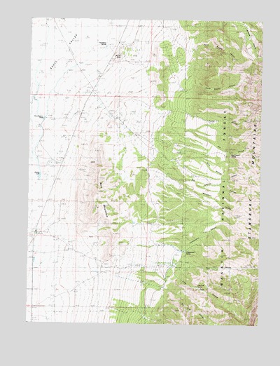
Salt Mountain, UT USGS Topographic Map
Click on map above to begin viewing in our Map Viewer.

This topographic map contains these locations and features:
Feature Name Type Latitude Longitude GNIS ID View Map
Aspen SpringSpringN40.5991°W112.6266°1454989View Map
Big Granite CanyonValleyN40.5586°W112.6691°1438673View Map
Big Pole CanyonValleyN40.5138°W112.6780°1438721View Map
Box CanyonValleyN40.5811°W112.6802°1439063View Map
Box Canyon SpringSpringN40.5704°W112.6419°1448170View Map
Chokecherry CanyonValleyN40.5316°W112.6827°1439707View Map
Chokecherry SpringSpringN40.5297°W112.6654°1439720View Map
Delle RanchLocaleN40.5683°W112.6833°1440406View Map
Deseret RanchLocaleN40.5369°W112.7439°1440413View Map
Granite Canyon SpringSpringN40.5597°W112.6300°1454988View Map
Granite Canyon SpringSpringN40.5597°W112.6314°1454990View Map
Horseshoe SpringsSpringN40.6135°W112.7105°1441916View Map
Iosepa (historical)Populated PlaceN40.5372°W112.7444°1455148View Map
Iosepa Setttement CemeteryCemeteryN40.5422°W112.7336°1989293View Map
Kanaka LakeReservoirN40.5603°W112.7448°1448536View Map
Little Granite CanyonValleyN40.5719°W112.6839°1442720View Map
Little Pole CanyonValleyN40.5208°W112.6719°1442763View Map
Little Pole SpringSpringN40.5156°W112.6592°1448612View Map
Monument CanyonValleyN40.5652°W112.6858°1443569View Map
North Broons CanyonValleyN40.6155°W112.6655°1448741View Map
Pass CanyonValleyN40.5258°W112.6708°1444233View Map
Rock Bottom PondReservoirN40.5839°W112.7430°1448930View Map
Round CanyonValleyN40.5866°W112.6791°1448941View Map
Round KnollSummitN40.6102°W112.7022°1448942View Map
Salt MountainSummitN40.5472°W112.7130°1445289View Map
South Broons CanyonValleyN40.6013°W112.6672°1439159View Map
Stansbury MountainsRangeN40.5172°W112.6336°1446094View Map

Note: Coordinates in the location and feature list above are referenced to NAD83 datum.


Copyright (C) 2008-2025 Ryan Niemi / Sunset Dynamics ... All Rights Reserved