TopoQuest Logo
Do you find TopoQuest useful?
Help keep TopoQuest running and adding new maps/features by donating!
Bitcoin:  19c7KJd3qBynnjoSw5npx9KScwjBe4ifkT
Litecoin:  LXs6TkuXGGXo1vDsWCkWVdjQX94eUKd6ui
Home View Maps Find Maps Find Places Resources & Links


Sampson, Florida Topographic Map

USGS Map Title: Sampson, FL
USGS Map MRC: 29082H2
DRG (GeoTIFF) Download: o29082h2.tif


Neighboring USGS Topographic Map Quads:


  Lake Butler, FL  
30082A3
 

  Raiford, FL  
30082A2
 

  Lawtey, FL  
30082A1
 

  Brooker, FL  
29082H3
 

  Sampson, FL  
29082H2
 

  Starke, FL  
29082H1
 

  Monteocha, FL  
29082G3
 

  Waldo, FL  
29082G2
 

  Keystone Heights, FL  
29082G1


Map MRC Location:

N30°
W83°
N30°
W82°
H8 H7 H6 H5 H4 H3 H2 H1
G8 G7 G6 G5 G4 G3 G2 G1
F8 F7 F6 F5 F4 F3 F2 F1
E8 E7 E6 E5 E4 E3 E2 E1
D8 D7 D6 D5 D4 D3 D2 D1
C8 C7 C6 C5 C4 C3 C2 C1
B8 B7 B6 B5 B4 B3 B2 B1
A8 A7 A6 A5 A4 A3 A2 A1
N29°
W83°
N29°
W82°

Sampson, FL USGS 1:24K Topographic Map Preview:
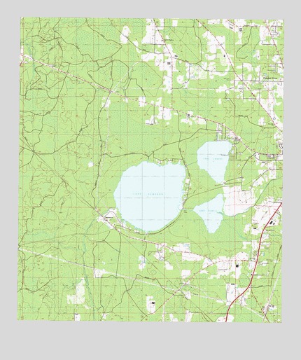
Sampson, FL USGS Topographic Map
Click on map above to begin viewing in our Map Viewer.

This topographic map contains these locations and features:
Feature Name Type Latitude Longitude GNIS ID View Map
Alligator CreekStreamN29.9205°W82.1551°277787View Map
Bayless Hiway ChurchChurchN29.9914°W82.1823°300378View Map
Bradford CountyCivilN29.9500°W82.1688°303634View Map
Bradford-Union Fire Control HeadquartersTowerN29.9794°W82.2326°300375View Map
Brown CemeteryCemeteryN29.9480°W82.2090°300374View Map
Crosby Lake CemeteryCemeteryN29.9512°W82.1469°300376View Map
Lake CrosbyLakeN29.9427°W82.1572°281084View Map
Lake RowellLakeN29.9203°W82.1583°290019View Map
Lake SampsonLakeN29.9275°W82.1875°290460View Map
Olin's Mobile Home ParkPopulated PlaceN29.9949°W82.1291°2452408View Map
Pine Level ChurchChurchN29.9605°W82.1693°288896View Map
Pleasant GrovePopulated PlaceN29.9747°W82.1432°300377View Map
Pleasant Grove ChurchChurchN29.9747°W82.1440°289050View Map
Prescott CemeteryCemeteryN29.9038°W82.1826°300372View Map
Prevatt CemeteryCemeteryN29.9044°W82.1376°300373View Map
Prevatt CreekStreamN29.9178°W82.1531°2439129View Map
Rising SchoolSchoolN29.9839°W82.1626°289721View Map
SampsonPopulated PlaceN29.9166°W82.2079°290457View Map
Sampson City Baptist ChurchChurchN29.8994°W82.1591°2452427View Map
Sampson City Volunteer Fire Department Station 9BuildingN29.8994°W82.1590°2644239View Map
Seventh Day Adventist ChurchChurchN29.9450°W82.1314°2452428View Map
Starke DivisionCivilN29.9715°W82.1554°1935939View Map
Water Oak SchoolSchoolN29.9755°W82.1434°292923View Map

Note: Coordinates in the location and feature list above are referenced to NAD83 datum.


Copyright (C) 2008-2025 Ryan Niemi / Sunset Dynamics ... All Rights Reserved