TopoQuest Logo
Do you find TopoQuest useful?
Help keep TopoQuest running and adding new maps/features by donating!
Bitcoin:  19c7KJd3qBynnjoSw5npx9KScwjBe4ifkT
Litecoin:  LXs6TkuXGGXo1vDsWCkWVdjQX94eUKd6ui
Home View Maps Find Maps Find Places Resources & Links


Sanborn Park, Colorado Topographic Map

USGS Map Title: Sanborn Park, CO
USGS Map MRC: 38108B2
DRG (GeoTIFF) Download: o38108b2.tif


Neighboring USGS Topographic Map Quads:


  Ute, CO  
38108C3
 

  Antone Spring, CO  
38108C2
 

  Pryor Creek, CO  
38108C1
 

  Norwood, CO  
38108B3
 

  Sanborn Park, CO  
38108B2
 

  Hotchkiss Reservoir, CO  
38108B1
 

  Oak Hill, CO  
38108A3
 

  Gurley Canyon, CO  
38108A2
 

  Placerville, CO  
38108A1


Map MRC Location:

N39°
W109°
N39°
W108°
H8 H7 H6 H5 H4 H3 H2 H1
G8 G7 G6 G5 G4 G3 G2 G1
F8 F7 F6 F5 F4 F3 F2 F1
E8 E7 E6 E5 E4 E3 E2 E1
D8 D7 D6 D5 D4 D3 D2 D1
C8 C7 C6 C5 C4 C3 C2 C1
B8 B7 B6 B5 B4 B3 B2 B1
A8 A7 A6 A5 A4 A3 A2 A1
N38°
W109°
N38°
W108°

Sanborn Park, CO USGS 1:24K Topographic Map Preview:
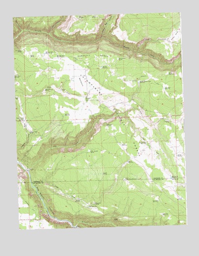
Sanborn Park, CO USGS Topographic Map
Click on map above to begin viewing in our Map Viewer.

This topographic map contains these locations and features:
Feature Name Type Latitude Longitude GNIS ID View Map
Berry ReservoirReservoirN38.1660°W108.1309°186092View Map
Big Red ReservoirReservoirN38.2489°W108.2012°186066View Map
Bolinger DitchCanalN38.1294°W108.2370°203194View Map
Burnt Stump SpringSpringN38.2232°W108.1724°186064View Map
Cartwheel ReservoirReservoirN38.1395°W108.1460°186102View Map
Clay CreekStreamN38.1600°W108.2426°186123View Map
Clay Creek SpringSpringN38.1860°W108.1360°186086View Map
Corner ReservoirReservoirN38.1411°W108.1285°186104View Map
Craig DrawValleyN38.1510°W108.2376°186095View Map
Craig Draw ReservoirReservoirN38.1375°W108.1981°186099View Map
Craig PointCliffN38.1294°W108.1765°186100View Map
Dobler SpringSpringN38.2269°W108.2384°186069View Map
Dollan ReservoirReservoirN38.1732°W108.1719°186089View Map
Dollarhide SpringSpringN38.1849°W108.1824°186085View Map
Fisher ReservoirReservoirN38.2140°W108.1354°186075View Map
Flying M & M Ranch AirportAirportN38.2183°W108.2116°2443913View Map
Goat Pen ReservoirReservoirN38.1318°W108.1428°186103View Map
Government SpringSpringN38.2298°W108.2442°186068View Map
Hanks CreekStreamN38.2269°W108.1579°185941View Map
Hanks ValleyValleyN38.2339°W108.1393°186080View Map
Hardin ReservoirReservoirN38.1631°W108.1677°186091View Map
Herman ReservoirReservoirN38.2192°W108.1849°186065View Map
Hole-in-Ground SpringSpringN38.2066°W108.2277°186072View Map
Homestead SpringSpringN38.1391°W108.1929°186098View Map
Horsefly BenchBenchN38.2258°W108.1881°186063View Map
Horsefly TrailTrailN38.2183°W108.1784°203195View Map
Horsefly Trail Reservoir Number 1ReservoirN38.2284°W108.2267°186070View Map
Horsefly Trail Reservoir Number 2ReservoirN38.2260°W108.2183°186071View Map
Impson SpringSpringN38.1562°W108.1865°186093View Map
Little Gutshall SpringSpringN38.1703°W108.1962°186088View Map
Little Red CanyonValleyN38.2368°W108.1839°185938View Map
Little Red ReservoirReservoirN38.2494°W108.1878°186067View Map
Logging Camp Draw ReservoirReservoirN38.1895°W108.2439°186081View Map
Logging Camp SpringSpringN38.1820°W108.2401°186084View Map
Mavriat ReservoirReservoirN38.1411°W108.2037°186097View Map
McKeever SawmillLocaleN38.2064°W108.2162°186073View Map
McKenzie CreekStreamN38.1258°W108.2076°186143View Map
Middle Sanborn Park ReservoirReservoirN38.2097°W108.1577°186074View Map
Mud SpringSpringN38.1521°W108.1354°186101View Map
Mud Spring ReservoirReservoirN38.1531°W108.1358°186096View Map
Red CanyonValleyN38.2396°W108.2229°185937View Map
Road ReservoirReservoirN38.2025°W108.2476°186082View Map
Rock Ballast ReservoirReservoirN38.1739°W108.1537°186090View Map
Rocky SpringSpringN38.1569°W108.2284°196876View Map
Sanborn ParkFlatN38.2028°W108.1979°186077View Map
Sanborn SchoolSchoolN38.2011°W108.1962°186078View Map
Sanborn Work CenterLocaleN38.1911°W108.2162°196877View Map
Sheep CreekStreamN38.2411°W108.2437°185919View Map
Sorenson ReservoirReservoirN38.1918°W108.2137°186083View Map
South Fork Clay CreekStreamN38.1908°W108.1698°186136View Map
Tarantula ReservoirReservoirN38.2056°W108.1387°186076View Map
Upper Craig Draw ReservoirReservoirN38.1531°W108.1703°186094View Map

Note: Coordinates in the location and feature list above are referenced to NAD83 datum.


Copyright (C) 2008-2024 Ryan Niemi / Sunset Dynamics ... All Rights Reserved