TopoQuest Logo
Do you find TopoQuest useful?
Help keep TopoQuest running and adding new maps/features by donating!
Bitcoin:  19c7KJd3qBynnjoSw5npx9KScwjBe4ifkT
Litecoin:  LXs6TkuXGGXo1vDsWCkWVdjQX94eUKd6ui
Home View Maps Find Maps Find Places Resources & Links


Sand Lake SW, Michigan Topographic Map

USGS Map Title: Sand Lake SW, MI
USGS Map MRC: 43085C6
DRG (GeoTIFF) Download: o43085c6.tif


Neighboring USGS Topographic Map Quads:


  Newaygo, MI  
43085D7
 

  Croton, MI  
43085D6
 

  Tift Corner, MI  
43085D5
 

  Grant, MI  
43085C7
 

  Sand Lake SW, MI  
43085C6
 

  Sand Lake, MI  
43085C5
 

  Casnovia, MI  
43085B7
 

  Sparta, MI  
43085B6
 

  Cedar Springs, MI  
43085B5


Map MRC Location:

N44°
W86°
N44°
W85°
H8 H7 H6 H5 H4 H3 H2 H1
G8 G7 G6 G5 G4 G3 G2 G1
F8 F7 F6 F5 F4 F3 F2 F1
E8 E7 E6 E5 E4 E3 E2 E1
D8 D7 D6 D5 D4 D3 D2 D1
C8 C7 C6 C5 C4 C3 C2 C1
B8 B7 B6 B5 B4 B3 B2 B1
A8 A7 A6 A5 A4 A3 A2 A1
N43°
W86°
N43°
W85°

Sand Lake SW, MI USGS 1:24K Topographic Map Preview:
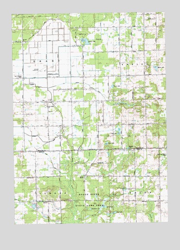
Sand Lake SW, MI USGS Topographic Map
Click on map above to begin viewing in our Map Viewer.

This topographic map contains these locations and features:
Feature Name Type Latitude Longitude GNIS ID View Map
Baldwin LakeLakeN43.2944°W85.6568°620513View Map
Bellamy Landing Strip (historical)AirportN43.3708°W85.6406°2106638View Map
Bolthouse Landing Strip (historical)AirportN43.3411°W85.7278°2104470View Map
Butler LakeLakeN43.3417°W85.6331°622367View Map
Chrishaven LakeLakeN43.2585°W85.6882°623235View Map
Clear LakeLakeN43.2556°W85.6695°623415View Map
Costen DrainCanalN43.3334°W85.6992°623860View Map
Flowing Well SchoolSchoolN43.3659°W85.6623°626194View Map
Frey LakeLakeN43.3039°W85.6641°626493View Map
Frey SchoolSchoolN43.3081°W85.6620°626494View Map
Geers DrainCanalN43.2878°W85.7197°2106563View Map
Grant ChurchChurchN43.3164°W85.7214°627148View Map
Grant SchoolSchoolN43.3192°W85.7225°627159View Map
Harwell LakeLakeN43.3214°W85.6623°627910View Map
Hickory CreekCanalN43.2917°W85.6875°2106702View Map
Hilbrand DrainCanalN43.2942°W85.6959°628267View Map
Lady of Guadalupe MissionChurchN43.3370°W85.7428°629939View Map
Longcore SchoolSchoolN43.2770°W85.7334°631004View Map
Moore LakeLakeN43.3314°W85.6686°632646View Map
Perrins Post Office (historical)Post OfficeN43.2639°W85.7208°2570700View Map
Plaiser DrainCanalN43.3319°W85.7292°2106637View Map
Plumville Post Office (historical)Post OfficeN43.3083°W85.6611°2541821View Map
Ransom CreekStreamN43.3575°W85.6878°1617392View Map
Ransom LakeLakeN43.3583°W85.6902°635644View Map
Red Pine Bible ChurchChurchN43.2775°W85.6931°2106561View Map
Rice Lake ChurchChurchN43.3339°W85.6920°635847View Map
South LakeLakeN43.2974°W85.6741°638375View Map
Spring LakeLakeN43.2600°W85.6773°638581View Map
Spring Valley SchoolSchoolN43.3367°W85.6578°638616View Map
SunPopulated PlaceN43.3228°W85.7222°2106636View Map
Sun Post Office (historical)Post OfficeN43.3222°W85.7222°2541814View Map
Township of GrantCivilN43.3370°W85.7415°1626385View Map
Veenboer DrainCanalN43.3000°W85.7272°2106635View Map
Walter CreekStreamN43.2545°W85.7023°1615741View Map

Note: Coordinates in the location and feature list above are referenced to NAD83 datum.


Copyright (C) 2008-2025 Ryan Niemi / Sunset Dynamics ... All Rights Reserved