TopoQuest Logo
Do you find TopoQuest useful?
Help keep TopoQuest running and adding new maps/features by donating!
Bitcoin:  19c7KJd3qBynnjoSw5npx9KScwjBe4ifkT
Litecoin:  LXs6TkuXGGXo1vDsWCkWVdjQX94eUKd6ui
Home View Maps Find Maps Find Places Resources & Links


Sanostee East, New Mexico Topographic Map

USGS Map Title: Sanostee East, NM
USGS Map MRC: 36108D7
DRG (GeoTIFF) Download: o36108d7.tif


Neighboring USGS Topographic Map Quads:


  Mitten Rock, NM  
36108E8
 

  Yellow Hill, NM  
36108E7
 

  Table Mesa, NM  
36108E6
 

  Sanostee West, NM  
36108D8
 

  Sanostee East, NM  
36108D7
 

  Little Water, NM  
36108D6
 

  Old Pine Spring, NM  
36108C8
 

  Tsin-nas-kid, NM  
36108C7
 

  Newcomb, NM  
36108C6


Map MRC Location:

N37°
W109°
N37°
W108°
H8 H7 H6 H5 H4 H3 H2 H1
G8 G7 G6 G5 G4 G3 G2 G1
F8 F7 F6 F5 F4 F3 F2 F1
E8 E7 E6 E5 E4 E3 E2 E1
D8 D7 D6 D5 D4 D3 D2 D1
C8 C7 C6 C5 C4 C3 C2 C1
B8 B7 B6 B5 B4 B3 B2 B1
A8 A7 A6 A5 A4 A3 A2 A1
N36°
W109°
N36°
W108°

Sanostee East, NM USGS 1:24K Topographic Map Preview:
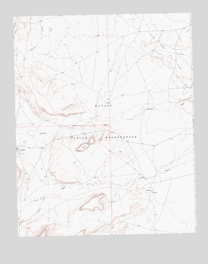
Sanostee East, NM USGS Topographic Map
Click on map above to begin viewing in our Map Viewer.

This topographic map contains these locations and features:
Feature Name Type Latitude Longitude GNIS ID View Map
12M-39 SpringSpringN36.4808°W108.8631°920898View Map
12T-338 Water WellWellN36.4833°W108.8398°926958View Map
12T-519 Water WellWellN36.4499°W108.8094°927177View Map
12T-534A Water WellWellN36.4100°W108.8659°927181View Map
12T-635 Water WellWellN36.3822°W108.8073°926942View Map
12T-647 Water WellWellN36.4436°W108.7720°927175View Map
12T-649 Water WellWellN36.4661°W108.8001°926954View Map
12T-651 Water WellWellN36.3997°W108.7937°926946View Map
Humble Number 1 Water WellWellN36.4064°W108.8695°927180View Map
NM000023 Water WellWellN36.4225°W108.7981°927184View Map
PM-1 Water WellWellN36.4244°W108.8706°926948View Map
Porcupine CanyonValleyN36.3978°W108.8540°893411View Map
Rock MesaSummitN36.4231°W108.8320°894065View Map
SanosteePopulated PlaceN36.4247°W108.8743°902349View Map
Sanostee AirportAirportN36.4239°W108.8595°936956View Map
Sanostee Census Designated PlaceCensusN36.4329°W108.8730°2409274View Map
Sanostee ChapterCivilN36.4478°W108.8452°2419130View Map
Sanostee Trading PostLocaleN36.4375°W108.8401°933937View Map
TocitoPopulated PlaceN36.3994°W108.7812°902370View Map
Tocito Dome Oil FieldOilfieldN36.4789°W108.7679°929071View Map
Tocito Trading Post (historical)LocaleN36.3994°W108.7812°933980View Map
Tse-clani-to WashStreamN36.4794°W108.8729°897498View Map

Note: Coordinates in the location and feature list above are referenced to NAD83 datum.


Copyright (C) 2008-2025 Ryan Niemi / Sunset Dynamics ... All Rights Reserved