TopoQuest Logo
Do you find TopoQuest useful?
Help keep TopoQuest running and adding new maps/features by donating!
Bitcoin:  19c7KJd3qBynnjoSw5npx9KScwjBe4ifkT
Litecoin:  LXs6TkuXGGXo1vDsWCkWVdjQX94eUKd6ui
Home View Maps Find Maps Find Places Resources & Links


Sappington, Montana Topographic Map

USGS Map Title: Sappington, MT
USGS Map MRC: 45111G7
DRG (GeoTIFF) Download: o45111g7.tif


Neighboring USGS Topographic Map Quads:


  Doherty Mountain, MT  
45111H8
 

  Negro Hollow, MT  
45111H7
 

  Milligan Canyon, MT  
45111H6
 

  Jefferson Island, MT  
45111G8
 

  Sappington, MT  
45111G7
 

  Willow Creek, MT  
45111G6
 

  Pony, MT  
45111F8
 

  Harrison, MT  
45111F7
 

  Willow Creek Reservoir, MT  
45111F6


Map MRC Location:

N46°
W112°
N46°
W111°
H8 H7 H6 H5 H4 H3 H2 H1
G8 G7 G6 G5 G4 G3 G2 G1
F8 F7 F6 F5 F4 F3 F2 F1
E8 E7 E6 E5 E4 E3 E2 E1
D8 D7 D6 D5 D4 D3 D2 D1
C8 C7 C6 C5 C4 C3 C2 C1
B8 B7 B6 B5 B4 B3 B2 B1
A8 A7 A6 A5 A4 A3 A2 A1
N45°
W112°
N45°
W111°

Sappington, MT USGS 1:24K Topographic Map Preview:
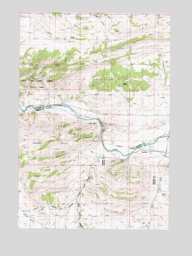
Sappington, MT USGS Topographic Map
Click on map above to begin viewing in our Map Viewer.

This topographic map contains these locations and features:
Feature Name Type Latitude Longitude GNIS ID View Map
01N01W31BDDA01 WellWellN45.7955°W111.7711°812113View Map
Alcazar (historical)LocaleN45.8188°W111.8686°1797583View Map
Antelope CreekStreamN45.7952°W111.8019°779068View Map
Cavern Post Office (historical)Post OfficeN45.8708°W111.8669°1762492View Map
Clark RanchLocaleN45.7655°W111.8325°769899View Map
Dogtown SewerStreamN45.7644°W111.8322°782449View Map
Dolomite KnobSummitN45.8360°W111.8661°1762632View Map
George Hemund DamDamN45.7716°W111.8191°795560View Map
Greer GulchValleyN45.8444°W111.8539°771985View Map
Harrison Highway MineMineN45.7663°W111.7522°804434View Map
Hemund DamDamN45.7599°W111.8591°796702View Map
Hubbard (historical)LocaleN45.8146°W111.8203°1762676View Map
Huller SpringsSpringN45.8340°W111.7899°772609View Map
Lamb RanchLocaleN45.8224°W111.8383°773192View Map
Lewis and Clark Caverns CampgroundLocaleN45.8235°W111.8564°1762586View Map
Little Antelope CreekStreamN45.7669°W111.8269°786220View Map
London HillsSummitN45.7985°W111.8630°786470View Map
NE NE Section 20 MineMineN45.8271°W111.8661°803585View Map
NE SE Section 8 MineMineN45.7644°W111.7536°804303View Map
NW SE Section 7 MineMineN45.7638°W111.7722°804611View Map
Round SpringSpringN45.8606°W111.8336°775985View Map
Sandcreek Post Office (historical)Post OfficeN45.7533°W111.7664°1797630View Map
SappingtonLocaleN45.7949°W111.7675°1743838View Map
SappingtonPopulated PlaceN45.7949°W111.7675°776220View Map
Sappington Bridge Fishing Access SiteLocaleN45.8047°W111.7505°1744474View Map
Sappington CemeteryCemeteryN45.7910°W111.7702°1743532View Map
Sappington Mica MineMineN45.7610°W111.7730°802990View Map
Sappington Post Office (historical)Post OfficeN45.7949°W111.7675°1743810View Map
Sappington School (historical)SchoolN45.7949°W111.7675°1738042View Map
SE SW Section 24 MineMineN45.8194°W111.7966°803582View Map
Woodward RanchLocaleN45.8721°W111.8683°778688View Map

Note: Coordinates in the location and feature list above are referenced to NAD83 datum.


Copyright (C) 2008-2024 Ryan Niemi / Sunset Dynamics ... All Rights Reserved