TopoQuest Logo
Do you find TopoQuest useful?
Help keep TopoQuest running and adding new maps/features by donating!
Bitcoin:  19c7KJd3qBynnjoSw5npx9KScwjBe4ifkT
Litecoin:  LXs6TkuXGGXo1vDsWCkWVdjQX94eUKd6ui
Home View Maps Find Maps Find Places Resources & Links


Bisbee, Arizona Topographic Map

USGS Map Title: Bisbee, AZ
USGS Map MRC: 31109D8
DRG (GeoTIFF) Download: o31109d8.tif


Neighboring USGS Topographic Map Quads:


  Tombstone SE, AZ  
31110E1
 

  Potter Mountain, AZ  
31109E8
 

  Gleeson SE, AZ  
31109E7
 

  Hereford, AZ  
31110D1
 

  Bisbee, AZ  
31109D8
 

  Bisbee NE, AZ  
31109D7
 

  Stark, AZ  
31110C1
 

  Naco, AZ  
31109C8
 

  Bisbee SE, AZ  
31109C7


Map MRC Location:

N32°
W110°
N32°
W109°
H8 H7 H6 H5 H4 H3 H2 H1
G8 G7 G6 G5 G4 G3 G2 G1
F8 F7 F6 F5 F4 F3 F2 F1
E8 E7 E6 E5 E4 E3 E2 E1
D8 D7 D6 D5 D4 D3 D2 D1
C8 C7 C6 C5 C4 C3 C2 C1
B8 B7 B6 B5 B4 B3 B2 B1
A8 A7 A6 A5 A4 A3 A2 A1
N31°
W110°
N31°
W109°

Bisbee, AZ USGS 1:24K Topographic Map Preview:
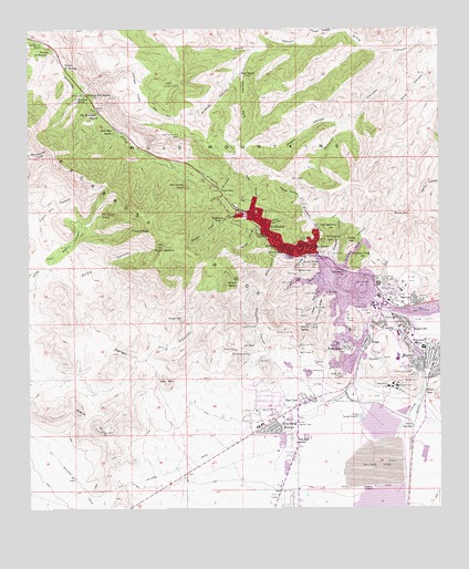
Bisbee, AZ USGS Topographic Map
Click on map above to begin viewing in our Map Viewer.

This topographic map contains these locations and features:
Feature Name Type Latitude Longitude GNIS ID View Map
Abrigo CanyonValleyN31.4162°W109.9759°472View Map
Art HillRidgeN31.4459°W109.9220°21916View Map
Bailey HillRidgeN31.4487°W109.9262°21918View Map
BakervillePopulated PlaceN31.4229°W109.8873°971View Map
Banning Toll StationLocaleN31.4829°W109.9834°1002View Map
BisbeePopulated PlaceN31.4482°W109.9284°1436View Map
Bisbee City HallBuildingN31.4418°W109.9131°21944View Map
Bisbee Covenant Presbyterian ChurchChurchN31.4423°W109.9147°2623025View Map
Bisbee Fire Station 81BuildingN31.4163°W109.8989°2657550View Map
Bisbee Fire Station Number 82BuildingN31.4480°W109.9284°2622531View Map
Bisbee High SchoolSchoolN31.4146°W109.8883°21945View Map
Bisbee Middle SchoolSchoolN31.3936°W109.9259°22085View Map
Bisbee Mining and Historical MuseumBuildingN31.4420°W109.9144°2623604View Map
Bisbee Police DepartmentBuildingN31.4273°W109.8930°2751618View Map
Bisbee Post OfficePost OfficeN31.4414°W109.9154°44907View Map
Bisbee Post OfficePost OfficeN31.3979°W109.9279°44912View Map
Bisbee Railroad StationBuildingN31.4257°W109.8923°21948View Map
Bisbee WestMineN31.4162°W109.9376°1438View Map
Black GapGapN31.4054°W109.8804°1514View Map
Bolsa CanyonValleyN31.4368°W109.9962°1793View Map
Boras MineMineN31.4129°W109.9129°1842View Map
Brewery GulchValleyN31.4423°W109.9142°1949View Map
Brewery Gulch InterchangeCrossingN31.4409°W109.9131°21963View Map
BriggsPopulated PlaceN31.4184°W109.8970°1959View Map
Briggs Sewage DisposalLocaleN31.3987°W109.8998°43165View Map
Bucky O'Neill HillCliffN31.4387°W109.9145°2119View Map
Calumet MineMineN31.4107°W109.8845°2380View Map
CampbellMineN31.4245°W109.8898°2411View Map
Carmel Community Arts and Technology Charter SchoolSchoolN31.4133°W109.8774°2544908View Map
Castle RockCliffN31.4423°W109.9179°2540View Map
Central SchoolSchoolN31.4432°W109.9145°2700View Map
Chihuahua HillSummitN31.4448°W109.9098°2818View Map
Church of ChristChurchN31.4230°W109.8873°2623392View Map
Church of the NazareneChurchN31.3984°W109.9245°2623401View Map
City of BisbeeCivilN31.3943°W109.9318°2409851View Map
CochiseMineN31.4415°W109.9076°3068View Map
Cochise County CourthouseBuildingN31.4423°W109.9217°21995View Map
ColeMineN31.4182°W109.9070°3115View Map
Cole Number ThreeMineN31.4112°W109.9092°3116View Map
Community Church of WarrenChurchN31.4122°W109.8781°2623405View Map
CongdonRidgeN31.4273°W109.9129°3171View Map
ContactMineN31.4134°W109.9298°3181View Map
Cooper Queen Community HospitalBuildingN31.4178°W109.8830°2622858View Map
Copper KingMineN31.4376°W109.9031°3229View Map
Copper King CanyonValleyN31.4376°W109.9042°3230View Map
Copper King HillSummitN31.4404°W109.9001°3231View Map
Copper QueenMineN31.4407°W109.9148°3241View Map
Copper Queen Community HospitalHospitalN31.4179°W109.8830°2667622View Map
Copper Queen Hospital HeliportAirportN31.4177°W109.8826°2622908View Map
Copper Queen Post OfficePost OfficeN31.4415°W109.9153°2622629View Map
Corta JunctionPopulated PlaceN31.3962°W109.8837°24383View Map
DallasMineN31.4212°W109.9031°3684View Map
Dern MineMineN31.4304°W109.8879°3853View Map
Don LuisPopulated PlaceN31.4026°W109.9167°4019View Map
Don Luis SchoolSchoolN31.3920°W109.9192°4020View Map
Dubacher CanyonValleyN31.4384°W109.9084°4173View Map
Durazo CanyonValleyN31.4995°W109.9081°4198View Map
Escabrosa RidgeRidgeN31.4507°W109.9626°4472View Map
Escacado CanyonValleyN31.4165°W109.9281°4473View Map
Evergreen CemeteryCemeteryN31.4307°W109.8903°4520View Map
First Assembly of GodChurchN31.4287°W109.8871°2623103View Map
First Southern Baptist ChurchChurchN31.4145°W109.8761°2623436View Map
Fissure PeakSummitN31.4470°W109.9640°4641View Map
GalenaMineN31.4140°W109.8934°4906View Map
GalenaPopulated PlaceN31.4220°W109.8931°4907View Map
Goat RanchLocaleN31.4884°W109.9362°5080View Map
Grace Lutheran ChurchChurchN31.4148°W109.8766°2623445View Map
Greenway Elementary SchoolSchoolN31.4171°W109.8808°5372View Map
Hendricks GulchValleyN31.4409°W109.9156°5723View Map
Higgins HillRidgeN31.4407°W109.9242°22068View Map
Highland ParkPopulated PlaceN31.4507°W109.9409°5807View Map
HoatsonMineN31.4273°W109.9012°5845View Map
Hope Lutheran ChurchChurchN31.3764°W109.9211°2623450View Map
Horace Mann SchoolSchoolN31.4423°W109.9204°5936View Map
Huachuca TerracePopulated PlaceN31.3968°W109.9251°6077View Map
Irish MagMineN31.4312°W109.9098°6257View Map
Jones HillSummitN31.4448°W109.9031°6492View Map
Juniper FlatsFlatN31.4845°W109.9673°6544View Map
KBZB-AM (Bisbee)TowerN31.4215°W109.8876°43443View Map
KBZB-AM (Bisbee)TowerN31.4004°W109.9006°45038View Map
KBZB-AM (Bisbee)TowerN31.4215°W109.8890°45039View Map
Knob HillSummitN31.4240°W109.9540°6738View Map
Korp CanyonValleyN31.4940°W109.8751°6770View Map
KZMK-FM (Bisbee)TowerN31.4812°W109.9590°43453View Map
Laundry HillRidgeN31.4470°W109.9234°22115View Map
Lavender Open Pit MineMineN31.4320°W109.8992°22116View Map
Lincoln SchoolSchoolN31.4462°W109.9281°7031View Map
Little Dry CanyonValleyN31.4484°W109.9987°7105View Map
Lorta Railroad StationBuildingN31.3957°W109.8840°22125View Map
Lovers LeapMineN31.4223°W109.9317°7433View Map
LowellPopulated PlaceN31.4279°W109.8937°7442View Map
Lowell Junior High SchoolSchoolN31.4292°W109.8914°22127View Map
Lucky JackRidgeN31.4262°W109.9115°7530View Map
Mason HillRidgeN31.4426°W109.9276°22136View Map
Miller HillRidgeN31.4468°W109.9159°22140View Map
Moon CanyonValleyN31.4487°W109.9279°8253View Map
Moore CanyonValleyN31.4390°W109.9965°8265View Map
Morales CreekStreamN31.4498°W109.9417°8278View Map
Mount BallardSummitN31.4434°W109.9592°988View Map
Mount MartinSummitN31.4332°W109.9401°7740View Map
Mount ReillySummitN31.4229°W109.9179°10210View Map
Mule Mountain RanchLocaleN31.4732°W109.9748°8419View Map
Mule PassGapN31.4584°W109.9429°8421View Map
Mule Pass TunnelTunnelN31.4584°W109.9423°22145View Map
Mural HillSummitN31.4515°W109.8848°8440View Map
Naco HillsSummitN31.3957°W109.9798°8476View Map
NeffPopulated PlaceN31.4793°W109.9798°24531View Map
New Life Assembly of God ChurchChurchN31.3988°W109.9236°2623183View Map
Night HawkMineN31.4157°W109.9142°8651View Map
Oak Thicket RanchLocaleN31.4584°W109.9529°8894View Map
Old Bisbee High SchoolSchoolN31.4429°W109.9170°22158View Map
Old Bisbee WestMineN31.4151°W109.9337°8930View Map
Old City Park - BisbeeParkN31.4434°W109.9142°22159View Map
Pete Moore SpringSpringN31.4516°W109.9786°9342View Map
Phelps Dodge General Office BuildingBuildingN31.4419°W109.9147°2500597View Map
PowellMineN31.4265°W109.9176°9718View Map
Ppep Tec High School Manuel Borjorquez Learning CenterSchoolN31.4225°W109.8874°2544786View Map
Quality HillSummitN31.4404°W109.9215°9857View Map
Quarry CanyonValleyN31.4426°W109.9242°9858View Map
Queen HillSummitN31.4387°W109.9145°9871View Map
Rancho de HannonLocaleN31.4940°W109.9942°9944View Map
Red MountainSummitN31.4082°W109.9587°10094View Map
Rileys El EncinarPopulated PlaceN31.4898°W109.9895°24580View Map
Rock Creek RanchLocaleN31.4965°W109.9962°10395View Map
Sacramento HillSummitN31.4362°W109.9067°10633View Map
SaginawMineN31.4298°W109.8792°10677View Map
SaginawPopulated PlaceN31.4293°W109.8834°10678View Map
Saint John's Episcopal ChurchChurchN31.4428°W109.9161°2623252View Map
Saint Patrick Catholic ChurchChurchN31.4431°W109.9213°2623518View Map
Saint Patrick SchoolSchoolN31.4432°W109.9217°10724View Map
Saint Stephen Nemanja ChurchChurchN31.4230°W109.8862°2623520View Map
San Jose Southern Baptist ChurchChurchN31.3875°W109.9203°2623278View Map
Scherer CanyonValleyN31.4932°W109.8929°11002View Map
School HillSummitN31.4445°W109.9162°11009View Map
ShattuckMineN31.4323°W109.9209°11162View Map
Sieling's Mobile VillagePopulated PlaceN31.4053°W109.9180°2622666View Map
Silver BearMineN31.4309°W109.9129°11312View Map
Silver Bear GulchValleyN31.4329°W109.9115°11313View Map
South BisbeePopulated PlaceN31.4170°W109.9037°11573View Map
Spring CanyonValleyN31.4487°W109.9306°11691View Map
Steele CanyonValleyN31.4754°W109.9051°11815View Map
SunriseMineN31.4362°W109.9195°11977View Map
Tank HillRidgeN31.4457°W109.9195°22251View Map
The Church of Jesus Christ of Latter Day SaintsChurchN31.3935°W109.9293°2623529View Map
The DivideGapN31.4584°W109.9429°12310View Map
The Mountain RanchLocaleN31.4770°W109.9792°12350View Map
TintownPopulated PlaceN31.4143°W109.8984°12499View Map
Tombstone CanyonValleyN31.4423°W109.9192°12591View Map
Trinity United Methodist ChurchChurchN31.4124°W109.8770°2623540View Map
Uncle SamMineN31.4340°W109.9201°13031View Map
Uncle Sam GulchValleyN31.4359°W109.9117°13032View Map
Wade Hampton PitBasinN31.4104°W109.9159°13260View Map
Wade Hampton Pit MineMineN31.4101°W109.9159°22278View Map
WarrenMineN31.4187°W109.8801°13359View Map
WarrenPopulated PlaceN31.4109°W109.8784°13360View Map
Warren HillRidgeN31.4454°W109.9306°22282View Map
Warren Post OfficePost OfficeN31.4136°W109.8773°2622631View Map
Warren Railroad StationBuildingN31.4112°W109.8806°22283View Map
Watkins RanchLocaleN31.4812°W109.9859°13404View Map
West Boulevard InterchangeCrossingN31.4518°W109.9351°22284View Map
White Tail DeerMineN31.4170°W109.9184°13675View Map
Wildcat CanyonValleyN31.4893°W109.9362°13781View Map
Wildcat CanyonValleyN31.4559°W109.9176°13780View Map
Williams HillRidgeN31.4482°W109.9362°22297View Map
Wolverine MinesMineN31.4218°W109.9229°13969View Map
Wood CanyonValleyN31.4526°W109.9326°13971View Map
Youngblood HillSummitN31.4482°W109.9098°14099View Map

Note: Coordinates in the location and feature list above are referenced to NAD83 datum.


Copyright (C) 2008-2024 Ryan Niemi / Sunset Dynamics ... All Rights Reserved