TopoQuest Logo
Do you find TopoQuest useful?
Help keep TopoQuest running and adding new maps/features by donating!
Bitcoin:  19c7KJd3qBynnjoSw5npx9KScwjBe4ifkT
Litecoin:  LXs6TkuXGGXo1vDsWCkWVdjQX94eUKd6ui
Home View Maps Find Maps Find Places Resources & Links


Sawtooth Ridge, California Topographic Map

USGS Map Title: Sawtooth Ridge, CA
USGS Map MRC: 35120F1
DRG (GeoTIFF) Download: o35120f1.tif


Neighboring USGS Topographic Map Quads:


  Tent Hills, CA  
35120G2
 

  Pyramid Hills, CA  
35120G1
 

  Avenal Gap, CA  
35119G8
 

  Orchard Peak, CA  
35120F2
 

  Sawtooth Ridge, CA  
35120F1
 

  Emigrant Hill, CA  
35119F8
 

  Holland Canyon, CA  
35120E2
 

  Packwood Creek, CA  
35120E1
 

  Shale Point, CA  
35119E8


Map MRC Location:

N36°
W121°
N36°
W120°
H8 H7 H6 H5 H4 H3 H2 H1
G8 G7 G6 G5 G4 G3 G2 G1
F8 F7 F6 F5 F4 F3 F2 F1
E8 E7 E6 E5 E4 E3 E2 E1
D8 D7 D6 D5 D4 D3 D2 D1
C8 C7 C6 C5 C4 C3 C2 C1
B8 B7 B6 B5 B4 B3 B2 B1
A8 A7 A6 A5 A4 A3 A2 A1
N35°
W121°
N35°
W120°

Sawtooth Ridge, CA USGS 1:24K Topographic Map Preview:
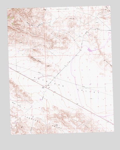
Sawtooth Ridge, CA USGS Topographic Map
Click on map above to begin viewing in our Map Viewer.

This topographic map contains these locations and features:
Feature Name Type Latitude Longitude GNIS ID View Map
Aido SpringSpringN35.7155°W120.1121°253995View Map
Barrel ValleyValleyN35.6564°W120.0918°255347View Map
Berrenda Mesa 1051 DamDamN35.7050°W120.0260°1664203View Map
Blackwell Land Company Inc Airport (historical)AirportN35.6381°W120.0122°1653704View Map
Devils DenPillarN35.7377°W120.0468°254017View Map
Franciscan CreekStreamN35.6811°W120.0654°242432View Map
Hilbrich GradeSlopeN35.6333°W120.1240°252564View Map
Kecks CornerPopulated PlaceN35.6708°W120.0818°252912View Map
Kilmer SpringSpringN35.7474°W120.0787°244300View Map
Packwood CreekStreamN35.6297°W120.0024°255686View Map
Point of RocksRangeN35.6900°W120.0043°247630View Map
Raven PassGapN35.6330°W120.0710°255691View Map
Sawtooth RidgeRidgeN35.7025°W120.1004°254222View Map
White City CanyonValleyN35.7386°W120.0660°251462View Map

Note: Coordinates in the location and feature list above are referenced to NAD83 datum.


Copyright (C) 2008-2025 Ryan Niemi / Sunset Dynamics ... All Rights Reserved