TopoQuest Logo
Do you find TopoQuest useful?
Help keep TopoQuest running and adding new maps/features by donating!
Bitcoin:  19c7KJd3qBynnjoSw5npx9KScwjBe4ifkT
Litecoin:  LXs6TkuXGGXo1vDsWCkWVdjQX94eUKd6ui
Home View Maps Find Maps Find Places Resources & Links


Scofield, Utah Topographic Map

USGS Map Title: Scofield, UT
USGS Map MRC: 39111F2
DRG (GeoTIFF) Download: o39111f2.tif


Neighboring USGS Topographic Map Quads:


  C Canyon, UT  
39111G3
 

  Scofield Reservoir, UT  
39111G2
 

  Colton, UT  
39111G1
 

  Fairview Lakes, UT  
39111F3
 

  Scofield, UT  
39111F2
 

  Jump Creek, UT  
39111F1
 

  Huntington Reservoir, UT  
39111E3
 

  Candland Mountain, UT  
39111E2
 

  Wattis, UT  
39111E1


Map MRC Location:

N40°
W112°
N40°
W111°
H8 H7 H6 H5 H4 H3 H2 H1
G8 G7 G6 G5 G4 G3 G2 G1
F8 F7 F6 F5 F4 F3 F2 F1
E8 E7 E6 E5 E4 E3 E2 E1
D8 D7 D6 D5 D4 D3 D2 D1
C8 C7 C6 C5 C4 C3 C2 C1
B8 B7 B6 B5 B4 B3 B2 B1
A8 A7 A6 A5 A4 A3 A2 A1
N39°
W112°
N39°
W111°

Scofield, UT USGS 1:24K Topographic Map Preview:
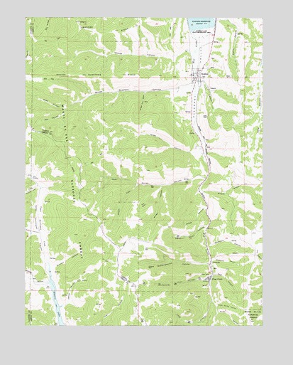
Scofield, UT USGS Topographic Map
Click on map above to begin viewing in our Map Viewer.

This topographic map contains these locations and features:
Feature Name Type Latitude Longitude GNIS ID View Map
Barn CanyonValleyN39.6458°W111.1518°1448106View Map
Belina MineMineN39.6661°W111.1877°1453030View Map
Boardinghouse CanyonValleyN39.6500°W111.1549°1438976View Map
Bobs CanyonValleyN39.7127°W111.2305°1448155View Map
Boneyard CanyonValleyN39.6558°W111.1549°1448158View Map
Box CanyonValleyN39.7127°W111.2305°1448169View Map
Broads CanyonValleyN39.6794°W111.1585°1448191View Map
Burnout CanyonValleyN39.6494°W111.2366°1439341View Map
Clear CreekPopulated PlaceN39.6458°W111.1524°1439788View Map
Clear Creek Census Designated PlaceCensusN39.6433°W111.1548°2584759View Map
Clear Creek Mines Number 3MineN39.6386°W111.1257°1454412View Map
Clear Creek Mines Number 4MineN39.6389°W111.1288°1454413View Map
Eccles CanyonValleyN39.6844°W111.1560°1440858View Map
Finn CanyonValleyN39.6436°W111.1541°1441043View Map
Flat CanyonValleyN39.6425°W111.2377°1441123View Map
Gibson MineMineN39.7064°W111.1599°1441314View Map
Granger RidgeRidgeN39.7458°W111.2091°1448437View Map
Green CanyonValleyN39.6961°W111.1585°1441462View Map
James CanyonValleyN39.6325°W111.2318°1442102View Map
Little Snider CanyonValleyN39.6327°W111.1504°1448613View Map
Little Swens CanyonValleyN39.6825°W111.2452°1442785View Map
Long CanyonValleyN39.6347°W111.1535°1442893View Map
Magazine CanyonValleyN39.6511°W111.1521°1443068View Map
Mud CreekStreamN39.7450°W111.1618°1443660View Map
Number Four GulchValleyN39.7200°W111.1874°1448761View Map
O'Conner MineMineN39.6486°W111.1860°1448762View Map
Old Black Diamond MineMineN39.6416°W111.1807°1448771View Map
Pleasant ValleyValleyN39.6936°W111.1571°1448860View Map
ScofieldPopulated PlaceN39.7241°W111.1607°1445380View Map
Scofield CemeteryCemeteryN39.7258°W111.1568°1448981View Map
Scofield Fire StationBuildingN39.7292°W111.1589°2627152View Map
Sheep CanyonValleyN39.6725°W111.1546°1448993View Map
Skyline MineMineN39.6844°W111.2018°1437892View Map
Slaughter House CanyonValleyN39.6647°W111.1566°1445669View Map
Snider CanyonValleyN39.6302°W111.1491°1445729View Map
South Fork Eccles CanyonValleyN39.6825°W111.1921°1445843View Map
Sulphur SpringSpringN39.6894°W111.1560°1446226View Map
Sulphur SpringsSpringN39.7399°W111.1520°1446228View Map
Swens CanyonValleyN39.6630°W111.2435°1446295View Map
The BowlBasinN39.6741°W111.1884°1448168View Map
The Church of Jesus Christ of Latter Day SaintsChurchN39.7261°W111.1618°1449628View Map
The ElbowSummitN39.6525°W111.1293°1446444View Map
The KitchenBasinN39.6827°W111.2482°1446466View Map
Town of ScofieldCivilN39.7198°W111.1623°2413267View Map
U P CanyonValleyN39.7239°W111.1599°1449122View Map
Upper Huntington CanyonValleyN39.6508°W111.2391°1449133View Map
Upper Huntington CreekStreamN39.6427°W111.2357°1446864View Map
Utah Mine (historical)MineN39.6936°W111.1549°1454339View Map
Whiskey CanyonValleyN39.6822°W111.1779°1449184View Map
Winter Quarters (historical)Populated PlaceN39.7205°W111.1877°1447486View Map
Winter Quarters CanyonValleyN39.7191°W111.1991°1447487View Map
Woods CanyonValleyN39.7361°W111.1654°1447518View Map

Note: Coordinates in the location and feature list above are referenced to NAD83 datum.


Copyright (C) 2008-2024 Ryan Niemi / Sunset Dynamics ... All Rights Reserved