TopoQuest Logo
Do you find TopoQuest useful?
Help keep TopoQuest running and adding new maps/features by donating!
Bitcoin:  19c7KJd3qBynnjoSw5npx9KScwjBe4ifkT
Litecoin:  LXs6TkuXGGXo1vDsWCkWVdjQX94eUKd6ui
Home View Maps Find Maps Find Places Resources & Links


Scotland, South Dakota Topographic Map

USGS Map Title: Scotland, SD
USGS Map MRC: 43097B6
DRG (GeoTIFF) Download: o43097b6.tif


Neighboring USGS Topographic Map Quads:


  Parkston SE, SD  
43097C7
 

  Tschetter Colony, SD  
43097C6
 

  Wolf Creek, SD  
43097C5
 

  Kaylor, SD  
43097B7
 

  Scotland, SD  
43097B6
 

  Menno, SD  
43097B5
 

  Tripp SE, SD  
43097A7
 

  Kloucek Lake, SD  
43097A6
 

  Lesterville, SD  
43097A5


Map MRC Location:

N44°
W98°
N44°
W97°
H8 H7 H6 H5 H4 H3 H2 H1
G8 G7 G6 G5 G4 G3 G2 G1
F8 F7 F6 F5 F4 F3 F2 F1
E8 E7 E6 E5 E4 E3 E2 E1
D8 D7 D6 D5 D4 D3 D2 D1
C8 C7 C6 C5 C4 C3 C2 C1
B8 B7 B6 B5 B4 B3 B2 B1
A8 A7 A6 A5 A4 A3 A2 A1
N43°
W98°
N43°
W97°

Scotland, SD USGS 1:24K Topographic Map Preview:
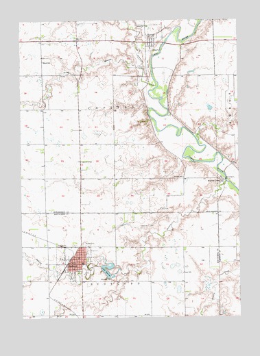
Scotland, SD USGS Topographic Map
Click on map above to begin viewing in our Map Viewer.

This topographic map contains these locations and features:
Feature Name Type Latitude Longitude GNIS ID View Map
Burke FieldAirportN43.1697°W97.7325°2444013View Map
City of ScotlandCivilN43.1483°W97.7204°1267561View Map
Dawson CreekStreamN43.1819°W97.6323°1254626View Map
Gunn SchoolSchoolN43.1436°W97.6578°1265240View Map
Henry DamDamN43.1434°W97.6988°1260899View Map
Hutchinson County CourthouseBuildingN43.2411°W97.6747°2712665View Map
Hutchinson County Sheriff's OfficeBuildingN43.2411°W97.6748°2755466View Map
Lake HenryReservoirN43.1431°W97.7014°1255516View Map
Lakeview SchoolSchoolN43.1905°W97.7159°1256045View Map
Landmann - Jungman Memorial HospitalHospitalN43.1490°W97.7290°2610931View Map
Lonetree CreekStreamN43.2244°W97.6720°1256218View Map
Mann SchoolSchoolN43.2328°W97.7373°1256316View Map
Maxwell ColonyPopulated PlaceN43.1822°W97.6345°1256359View Map
Maxwell Colony Elementary SchoolSchoolN43.1844°W97.6360°2728979View Map
OlivetPopulated PlaceN43.2408°W97.6753°1256880View Map
Olivet Post OfficePost OfficeN43.2406°W97.6748°2711081View Map
Rose Hill CemeteryCemeteryN43.1558°W97.7151°1257464View Map
Saint George Catholic CemeteryCemeteryN43.1552°W97.7135°2773568View Map
Schatz SchoolSchoolN43.1839°W97.6573°1257830View Map
ScotlandPopulated PlaceN43.1497°W97.7176°1258001View Map
Scotland City HallBuildingN43.1499°W97.7178°2725274View Map
Scotland Community Ambulance ServiceBuildingN43.1488°W97.7199°2658991View Map
Scotland Community LibraryBuildingN43.1484°W97.7155°2723667View Map
Scotland Elementary SchoolSchoolN43.1481°W97.7155°2729509View Map
Scotland Fire DepartmentBuildingN43.1489°W97.7197°2580902View Map
Scotland High SchoolSchoolN43.1481°W97.7155°2729510View Map
Scotland Middle SchoolSchoolN43.1481°W97.7155°2729512View Map
Scotland Police DepartmentBuildingN43.1487°W97.7195°2755613View Map
Scotland Post OfficePost OfficeN43.1491°W97.7205°2711884View Map
South Branch Lonetree CreekStreamN43.2308°W97.6817°1258167View Map
Town of OlivetCivilN43.2412°W97.6742°1267522View Map
Township of CapitalCivilN43.2125°W97.6974°1268059View Map
Township of OlivetCivilN43.2486°W97.6867°1268099View Map
Township of ScotlandCivilN43.1264°W97.6962°1269078View Map

Note: Coordinates in the location and feature list above are referenced to NAD83 datum.


Copyright (C) 2008-2024 Ryan Niemi / Sunset Dynamics ... All Rights Reserved