TopoQuest Logo
Do you find TopoQuest useful?
Help keep TopoQuest running and adding new maps/features by donating!
Bitcoin:  19c7KJd3qBynnjoSw5npx9KScwjBe4ifkT
Litecoin:  LXs6TkuXGGXo1vDsWCkWVdjQX94eUKd6ui
Home View Maps Find Maps Find Places Resources & Links


Bismark Mountain, Idaho Topographic Map

USGS Map Title: Bismark Mountain, ID
USGS Map MRC: 45115B2
DRG (GeoTIFF) Download: o45115b2.tif


Neighboring USGS Topographic Map Quads:


  Mosquito Peak, ID  
45115C3
 

  Lodgepole Creek, ID  
45115C2
 

  Wapiti Creek, ID  
45115C1
 

  Big Creek, ID  
45115B3
 

  Bismark Mountain, ID  
45115B2
 

  Acorn Butte, ID  
45115B1
 

  Edwardsburg, ID  
45115A3
 

  Center Mountain, ID  
45115A2
 

  Monument, ID  
45115A1


Map MRC Location:

N46°
W116°
N46°
W115°
H8 H7 H6 H5 H4 H3 H2 H1
G8 G7 G6 G5 G4 G3 G2 G1
F8 F7 F6 F5 F4 F3 F2 F1
E8 E7 E6 E5 E4 E3 E2 E1
D8 D7 D6 D5 D4 D3 D2 D1
C8 C7 C6 C5 C4 C3 C2 C1
B8 B7 B6 B5 B4 B3 B2 B1
A8 A7 A6 A5 A4 A3 A2 A1
N45°
W116°
N45°
W115°

Bismark Mountain, ID USGS 1:24K Topographic Map Preview:
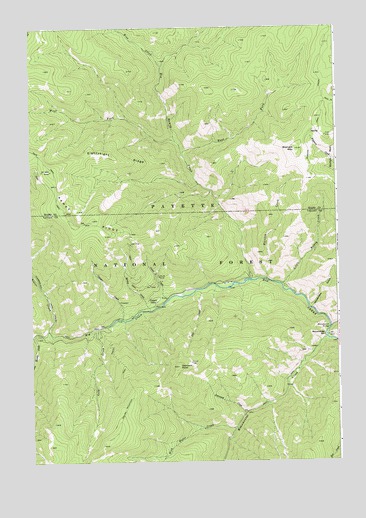
Bismark Mountain, ID USGS Topographic Map
Click on map above to begin viewing in our Map Viewer.

This topographic map contains these locations and features:
Feature Name Type Latitude Longitude GNIS ID View Map
Beaver CreekStreamN45.1630°W115.2434°377253View Map
Big Ramey CreekStreamN45.1777°W115.1612°377576View Map
Bismark MountainSummitN45.2149°W115.1421°396127View Map
Bismark TrailTrailN45.2182°W115.1379°377701View Map
Camp CreekStreamN45.1719°W115.1957°378768View Map
Carpenters GulchValleyN45.1699°W115.1365°378949View Map
Center Mountain TrailTrailN45.1496°W115.2137°379136View Map
Copper CampLocaleN45.1710°W115.1996°379695View Map
Copper CreekStreamN45.1663°W115.2134°379699View Map
Crooked CreekStreamN45.1635°W115.1287°380086View Map
Diamond CreekStreamN45.1388°W115.1637°380567View Map
Diamond PointSummitN45.1524°W115.1909°380580View Map
East Fork Big Ramey CreekStreamN45.2138°W115.1890°381057View Map
Eightyeight RidgeRidgeN45.2130°W115.2143°381288View Map
Fall CreekStreamN45.1744°W115.1818°381539View Map
Gold CreekStreamN45.1630°W115.2237°382357View Map
Little Marble CreekStreamN45.1610°W115.2496°384892View Map
Little Ramey CreekStreamN45.1757°W115.1484°399962View Map
Monumental BarBarN45.1610°W115.1307°387119View Map
Monumental BridgeBridgeN45.1635°W115.1290°387120View Map
Monumental CreekStreamN45.1602°W115.1309°387122View Map
Spring CreekStreamN45.1685°W115.2023°391175View Map
West Fork Big Ramey CreekStreamN45.2174°W115.1923°393054View Map
Whiskey CreekStreamN45.1777°W115.1548°393290View Map
Wild Horse CreekStreamN45.1346°W115.1679°393425View Map
Wise CreekStreamN45.2391°W115.1973°393607View Map

Note: Coordinates in the location and feature list above are referenced to NAD83 datum.


Copyright (C) 2008-2025 Ryan Niemi / Sunset Dynamics ... All Rights Reserved