TopoQuest Logo
Do you find TopoQuest useful?
Help keep TopoQuest running and adding new maps/features by donating!
Bitcoin:  19c7KJd3qBynnjoSw5npx9KScwjBe4ifkT
Litecoin:  LXs6TkuXGGXo1vDsWCkWVdjQX94eUKd6ui
Home View Maps Find Maps Find Places Resources & Links


Sears, Florida Topographic Map

USGS Map Title: Sears, FL
USGS Map MRC: 26081F4
DRG (GeoTIFF) Download: o26081f4.tif


Neighboring USGS Topographic Map Quads:


  Telegraph Swamp SE, FL  
26081G5
 

  La Belle, FL  
26081G4
 

  Goodno, FL  
26081G3
 

  Alva, FL  
26081F5
 

  Sears, FL  
26081F4
 

  Felda NE, FL  
26081F3
 

  Alva SE, FL  
26081E5
 

  Felda, FL  
26081E4
 

  Felda SE, FL  
26081E3


Map MRC Location:

N27°
W82°
N27°
W81°
H8 H7 H6 H5 H4 H3 H2 H1
G8 G7 G6 G5 G4 G3 G2 G1
F8 F7 F6 F5 F4 F3 F2 F1
E8 E7 E6 E5 E4 E3 E2 E1
D8 D7 D6 D5 D4 D3 D2 D1
C8 C7 C6 C5 C4 C3 C2 C1
B8 B7 B6 B5 B4 B3 B2 B1
A8 A7 A6 A5 A4 A3 A2 A1
N26°
W82°
N26°
W81°

Sears, FL USGS 1:24K Topographic Map Preview:
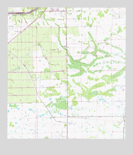
Sears, FL USGS Topographic Map
Click on map above to begin viewing in our Map Viewer.

This topographic map contains these locations and features:
Feature Name Type Latitude Longitude GNIS ID View Map
Berry Grove Airport (historical)AirportN26.6959°W81.4904°309578View Map
Bob Paul AirportAirportN26.6902°W81.4432°309576View Map
City of LaBelleCivilN26.7220°W81.4505°2404850View Map
Edison State College - Hendry Glades CenterSchoolN26.7476°W81.3901°2548627View Map
Elizondos Trailer ParkPopulated PlaceN26.6778°W81.4348°2450069View Map
Faith Chapel Pentecostal Church of GodChurchN26.7419°W81.4386°2450079View Map
Hendry County Emergency Medical Services Station 219BuildingN26.7462°W81.4265°2661751View Map
La Belle Municipal AirportAirportN26.7454°W81.4318°309570View Map
LaBelle Elementary SchoolSchoolN26.7476°W81.4405°297846View Map
Port LaBelle Census Designated PlaceCensusN26.7493°W81.3877°2403438View Map
Roberts CanalCanalN26.6578°W81.4606°289778View Map
SearsPopulated PlaceN26.6467°W81.3756°294920View Map
Southwest Citrus Airport (historical)AirportN26.6631°W81.4231°309574View Map
WKZY-FM (La Belle)TowerN26.6540°W81.4292°309038View Map
WKZY-FM (La Belle)TowerN26.7401°W81.4620°309039View Map

Note: Coordinates in the location and feature list above are referenced to NAD83 datum.


Copyright (C) 2008-2024 Ryan Niemi / Sunset Dynamics ... All Rights Reserved