TopoQuest Logo
Do you find TopoQuest useful?
Help keep TopoQuest running and adding new maps/features by donating!
Bitcoin:  19c7KJd3qBynnjoSw5npx9KScwjBe4ifkT
Litecoin:  LXs6TkuXGGXo1vDsWCkWVdjQX94eUKd6ui
Home View Maps Find Maps Find Places Resources & Links


Seligman East, Arizona Topographic Map

USGS Map Title: Seligman East, AZ
USGS Map MRC: 35112C7
DRG (GeoTIFF) Download: o35112c7.tif


Neighboring USGS Topographic Map Quads:


  Red Mesa, AZ  
35112D8
 

  Trinity Mountain, AZ  
35112D7
 

  Mount Floyd, AZ  
35112D6
 

  Seligman West, AZ  
35112C8
 

  Seligman East, AZ  
35112C7
 

  Crookton, AZ  
35112C6
 

  Purcell Canyon, AZ  
35112B8
 

  Turkey Canyon NE, AZ  
35112B7
 

  Picacho Butte, AZ  
35112B6


Map MRC Location:

N36°
W113°
N36°
W112°
H8 H7 H6 H5 H4 H3 H2 H1
G8 G7 G6 G5 G4 G3 G2 G1
F8 F7 F6 F5 F4 F3 F2 F1
E8 E7 E6 E5 E4 E3 E2 E1
D8 D7 D6 D5 D4 D3 D2 D1
C8 C7 C6 C5 C4 C3 C2 C1
B8 B7 B6 B5 B4 B3 B2 B1
A8 A7 A6 A5 A4 A3 A2 A1
N35°
W113°
N35°
W112°

Seligman East, AZ USGS 1:24K Topographic Map Preview:
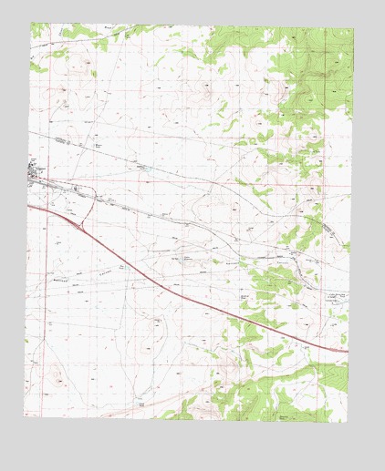
Seligman East, AZ USGS Topographic Map
Click on map above to begin viewing in our Map Viewer.

This topographic map contains these locations and features:
Feature Name Type Latitude Longitude GNIS ID View Map
Cedar Berry Bob TankReservoirN35.2892°W112.7523°21214View Map
Click TankReservoirN35.2551°W112.8319°21224View Map
Hoffman TankReservoirN35.3290°W112.8291°21288View Map
Maverick TankReservoirN35.2500°W112.7773°31592View Map
Padre ReservoirReservoirN35.3003°W112.8156°21373View Map
Pan DamDamN35.3008°W112.8166°21376View Map
Pan TankReservoirN35.2978°W112.8369°21377View Map
Seligman Census Designated PlaceCensusN35.3256°W112.8572°2409305View Map
Seligman Compressor StationLocaleN35.2886°W112.7549°43429View Map
Seligman Elementary SchoolSchoolN35.3298°W112.8748°2543642View Map
Seligman High SchoolSchoolN35.3299°W112.8739°21425View Map
Seligman InterchangeCrossingN35.3103°W112.8557°21426View Map
Seligman Kampgrounds of AmericaLocaleN35.3226°W112.8542°2670143View Map
Seligman SubstationLocaleN35.2889°W112.7560°21429View Map
Sinkhole TankReservoirN35.2892°W112.7930°21442View Map
Thirtysix TankReservoirN35.3357°W112.7665°21064View Map
Wagner TankReservoirN35.3363°W112.8507°21106View Map

Note: Coordinates in the location and feature list above are referenced to NAD83 datum.


Copyright (C) 2008-2025 Ryan Niemi / Sunset Dynamics ... All Rights Reserved