TopoQuest Logo
Do you find TopoQuest useful?
Help keep TopoQuest running and adding new maps/features by donating!
Bitcoin:  19c7KJd3qBynnjoSw5npx9KScwjBe4ifkT
Litecoin:  LXs6TkuXGGXo1vDsWCkWVdjQX94eUKd6ui
Home View Maps Find Maps Find Places Resources & Links


Senath, Missouri Topographic Map

USGS Map Title: Senath, MO
USGS Map MRC: 36090B2
DRG (GeoTIFF) Download: o36090b2.tif


Neighboring USGS Topographic Map Quads:


  Rector, AR  
36090C3
 

  Greenway, AR  
36090C2
 

  Kennett North, MO  
36090C1
 

  Mounds, AR  
36090B3
 

  Senath, MO  
36090B2
 

  Kennett South, MO  
36090B1
 

  Cardwell, MO  
36090A3
 

  Arbyrd, MO  
36090A2
 

  Hornersville, MO  
36090A1


Map MRC Location:

N37°
W91°
N37°
W90°
H8 H7 H6 H5 H4 H3 H2 H1
G8 G7 G6 G5 G4 G3 G2 G1
F8 F7 F6 F5 F4 F3 F2 F1
E8 E7 E6 E5 E4 E3 E2 E1
D8 D7 D6 D5 D4 D3 D2 D1
C8 C7 C6 C5 C4 C3 C2 C1
B8 B7 B6 B5 B4 B3 B2 B1
A8 A7 A6 A5 A4 A3 A2 A1
N36°
W91°
N36°
W90°

Senath, MO USGS 1:24K Topographic Map Preview:
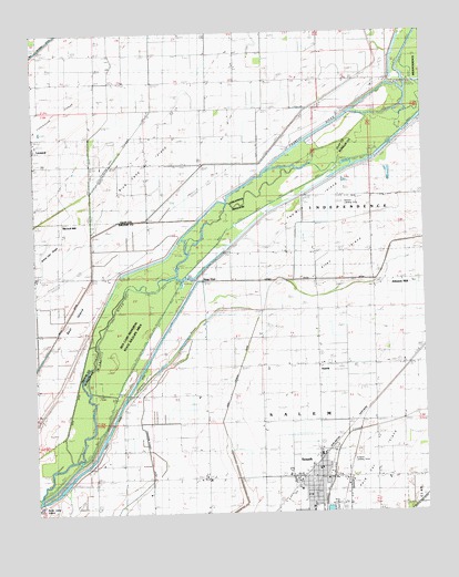
Senath, MO USGS Topographic Map
Click on map above to begin viewing in our Map Viewer.

This topographic map contains these locations and features:
Feature Name Type Latitude Longitude GNIS ID View Map
Allen IslandAreaN36.1948°W90.1462°713221View Map
Allen Island Church (historical)ChurchN36.1917°W90.1587°713222View Map
Allen Island School (historical)SchoolN36.1926°W90.1601°730046View Map
AustinPopulated PlaceN36.1609°W90.1593°713491View Map
Austin SchoolSchoolN36.1626°W90.1582°746676View Map
Aviation Landing Strip (historical)AirportN36.1384°W90.1493°743109View Map
Bear IslandIslandN36.1801°W90.2357°46230View Map
Beech Corner School (historical)SchoolN36.1348°W90.1957°713874View Map
Ben Cash Memorial State Wildlife AreaParkN36.1720°W90.2193°743110View Map
Bethel Church (historical)ChurchN36.1484°W90.1418°746677View Map
Bible Grove Church (historical)ChurchN36.1331°W90.1987°731531View Map
Blue Cane ChapelChurchN36.2165°W90.2129°46741View Map
Blue Cane IslandIslandN36.2095°W90.2245°46742View Map
Buffalo Ditch Number 39CanalN36.1276°W90.1279°755018View Map
City of SenathCivilN36.1340°W90.1614°2396573View Map
Cypress PointCliffN36.1381°W90.2432°48318View Map
Ditch Number 34CanalN36.1570°W90.2145°755102View Map
Ditch Number 5CanalN36.2009°W90.1515°755120View Map
Drag OverLocaleN36.1873°W90.1962°717042View Map
Grassy SloughStreamN36.2081°W90.2318°49583View Map
Hickory DonnickLocaleN36.2120°W90.1762°50052View Map
Holly Island GageLocaleN36.2365°W90.1318°50231View Map
Johnson MillPopulated PlaceN36.1856°W90.1315°720378View Map
KTMO-FM (Kennett)TowerN36.1315°W90.1929°759105View Map
Lanier CemeteryCemeteryN36.1359°W90.1776°720812View Map
LeonardPopulated PlaceN36.2198°W90.2495°58057View Map
Leonard CemeteryCemeteryN36.2164°W90.2481°51067View Map
Leonard ChurchChurchN36.2153°W90.2495°51068View Map
Main DitchCanalN36.1856°W90.1532°721762View Map
McGrew CemeteryCemeteryN36.1276°W90.2176°722119View Map
Mill Town ChurchChurchN36.1712°W90.2493°52051View Map
Mitchell MillPopulated PlaceN36.1976°W90.2412°58199View Map
Octa Church (historical)ChurchN36.1826°W90.1507°746675View Map
Old Channel Varney RiverStreamN36.1540°W90.2309°723740View Map
Pentecost Church (historical)ChurchN36.1345°W90.1732°746674View Map
Pole Cat IslandAreaN36.1353°W90.1437°724700View Map
SenathPopulated PlaceN36.1342°W90.1598°726200View Map
Senath CemeteryCemeteryN36.1415°W90.1548°2702113View Map
Senath Fire DepartmentBuildingN36.1333°W90.1590°2620892View Map
Senath Police DepartmentBuildingN36.1344°W90.1615°2752101View Map
Senath Post OfficePost OfficeN36.1343°W90.1610°2783198View Map
Simmons ChurchChurchN36.2370°W90.1890°54857View Map
Skelton Landing Strip (historical)AirportN36.2067°W90.1484°742787View Map
Tar Blanket Lodge (historical)LocaleN36.1787°W90.1776°727459View Map
Township of Blue Cane (historical)CivilN36.2348°W90.2001°63711View Map
Two Mile IslandIslandN36.2055°W90.1549°727937View Map
Ward SchoolSchoolN36.1348°W90.1362°746678View Map
White OakPopulated PlaceN36.1865°W90.2495°64896View Map
White Oak ChurchChurchN36.1859°W90.2495°56269View Map
White Oak RidgeRidgeN36.1953°W90.2465°56295View Map
White Oak School (historical)SchoolN36.1876°W90.2490°56297View Map

Note: Coordinates in the location and feature list above are referenced to NAD83 datum.


Copyright (C) 2008-2024 Ryan Niemi / Sunset Dynamics ... All Rights Reserved