TopoQuest Logo
Do you find TopoQuest useful?
Help keep TopoQuest running and adding new maps/features by donating!
Bitcoin:  19c7KJd3qBynnjoSw5npx9KScwjBe4ifkT
Litecoin:  LXs6TkuXGGXo1vDsWCkWVdjQX94eUKd6ui
Home View Maps Find Maps Find Places Resources & Links


Seul Choix Point, Michigan Topographic Map

USGS Map Title: Seul Choix Point, MI
USGS Map MRC: 45085H8
DRG (GeoTIFF) Download: o45085h8.tif


Neighboring USGS Topographic Map Quads:


  Merwin Lake, MI  
46086A1
 

  Blaney Park, MI  
46085A8
 

  Milakokia Lake, MI  
46085A7
 

  Gulliver, MI  
45086H1
 

  Seul Choix Point, MI  
45085H8
 

  Hughes Point, MI  
45085H7


Map MRC Location:

N46°
W86°
N46°
W85°
H8 H7 H6 H5 H4 H3 H2 H1
G8 G7 G6 G5 G4 G3 G2 G1
F8 F7 F6 F5 F4 F3 F2 F1
E8 E7 E6 E5 E4 E3 E2 E1
D8 D7 D6 D5 D4 D3 D2 D1
C8 C7 C6 C5 C4 C3 C2 C1
B8 B7 B6 B5 B4 B3 B2 B1
A8 A7 A6 A5 A4 A3 A2 A1
N45°
W86°
N45°
W85°

Seul Choix Point, MI USGS 1:24K Topographic Map Preview:
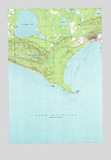
Seul Choix Point, MI USGS Topographic Map
Click on map above to begin viewing in our Map Viewer.

This topographic map contains these locations and features:
Feature Name Type Latitude Longitude GNIS ID View Map
Anderson CreekStreamN45.9991°W85.9737°620091View Map
Bulldog CreekStreamN45.9561°W85.9123°622222View Map
Fernia CreekStreamN45.9958°W85.9854°625914View Map
Goadreaus HarborBayN45.9278°W85.9409°626906View Map
McDonald LakeLakeN45.9850°W85.9747°631879View Map
Milakokia RiverStreamN45.9672°W85.8937°632301View Map
Millaquaka LakeLakeN45.9984°W85.9195°632347View Map
Seul Choix BayBayN45.9519°W85.8890°637588View Map
Seul Choix PointCapeN45.9217°W85.9109°637589View Map
Seul Choix Point LighthouseLocaleN45.9211°W85.9114°2356711View Map
Shoepac LakeLakeN45.9950°W85.8796°637832View Map
Shuberts LakeLakeN45.9874°W85.9257°637858View Map
Stone RapidsRapidsN45.9844°W85.9040°638872View Map

Note: Coordinates in the location and feature list above are referenced to NAD83 datum.


Copyright (C) 2008-2025 Ryan Niemi / Sunset Dynamics ... All Rights Reserved