TopoQuest Logo
Do you find TopoQuest useful?
Help keep TopoQuest running and adding new maps/features by donating!
Bitcoin:  19c7KJd3qBynnjoSw5npx9KScwjBe4ifkT
Litecoin:  LXs6TkuXGGXo1vDsWCkWVdjQX94eUKd6ui
Home View Maps Find Maps Find Places Resources & Links


Seven Springs, Arizona Topographic Map

USGS Map Title: Seven Springs, AZ
USGS Map MRC: 34109G5
DRG (GeoTIFF) Download: o34109g5.tif


Neighboring USGS Topographic Map Quads:


  Sorrel Horse Mesa, AZ  
34109H6
 

  Ninemile Seep, AZ  
34109H5
 

  Hogan Well, AZ  
34109H4
 

  Milky Ranch, AZ  
34109G6
 

  Seven Springs, AZ  
34109G5
 

  Long H Ranch, AZ  
34109G4
 

  Potter Mesa Tank, AZ  
34109F6
 

  Stinking Springs Mountain, AZ  
34109F5
 

  Cedar Lake Wash, AZ  
34109F4


Map MRC Location:

N35°
W110°
N35°
W109°
H8 H7 H6 H5 H4 H3 H2 H1
G8 G7 G6 G5 G4 G3 G2 G1
F8 F7 F6 F5 F4 F3 F2 F1
E8 E7 E6 E5 E4 E3 E2 E1
D8 D7 D6 D5 D4 D3 D2 D1
C8 C7 C6 C5 C4 C3 C2 C1
B8 B7 B6 B5 B4 B3 B2 B1
A8 A7 A6 A5 A4 A3 A2 A1
N34°
W110°
N34°
W109°

Seven Springs, AZ USGS 1:24K Topographic Map Preview:
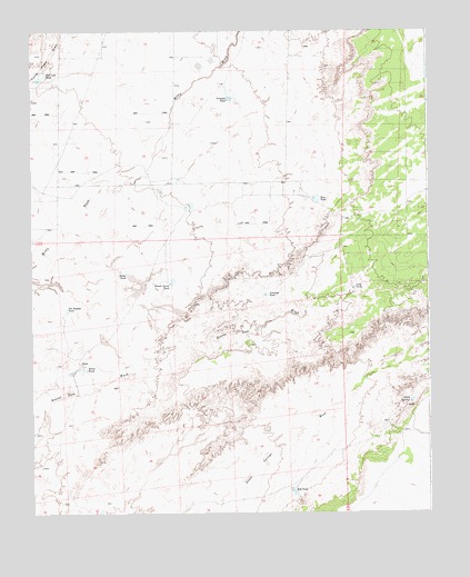
Seven Springs, AZ USGS Topographic Map
Click on map above to begin viewing in our Map Viewer.

This topographic map contains these locations and features:
Feature Name Type Latitude Longitude GNIS ID View Map
Antelope TankReservoirN34.8067°W109.5518°701View Map
Clay TankReservoirN34.8082°W109.5241°2993View Map
Milky TankReservoirN34.8122°W109.5951°8056View Map
Pablo TankReservoirN34.7877°W109.6086°9080View Map
Pat Hughes TankReservoirN34.8029°W109.6141°9252View Map
Red Lake TankReservoirN34.8631°W109.6228°10083View Map
Red TankReservoirN34.7559°W109.5438°10158View Map
Reuell Jarvis TankReservoirN34.8096°W109.5817°10236View Map
Rim TankReservoirN34.8314°W109.5365°10287View Map
Seven SpringsSpringN34.7792°W109.5059°11103View Map
Triangle TankReservoirN34.8574°W109.5626°12711View Map

Note: Coordinates in the location and feature list above are referenced to NAD83 datum.


Copyright (C) 2008-2025 Ryan Niemi / Sunset Dynamics ... All Rights Reserved