TopoQuest Logo
Do you find TopoQuest useful?
Help keep TopoQuest running and adding new maps/features by donating!
Bitcoin:  19c7KJd3qBynnjoSw5npx9KScwjBe4ifkT
Litecoin:  LXs6TkuXGGXo1vDsWCkWVdjQX94eUKd6ui
Home View Maps Find Maps Find Places Resources & Links


Shawnee, Colorado Topographic Map

USGS Map Title: Shawnee, CO
USGS Map MRC: 39105D5
DRG (GeoTIFF) Download: o39105d5.tif


Neighboring USGS Topographic Map Quads:


  Mount Evans, CO  
39105E6
 

  Harris Park, CO  
39105E5
 

  Meridian Hill, CO  
39105E4
 

  Mount Logan, CO  
39105D6
 

  Shawnee, CO  
39105D5
 

  Bailey, CO  
39105D4
 

  Observatory Rock, CO  
39105C6
 

  Topaz Mountain, CO  
39105C5
 

  Windy Peak, CO  
39105C4


Map MRC Location:

N40°
W106°
N40°
W105°
H8 H7 H6 H5 H4 H3 H2 H1
G8 G7 G6 G5 G4 G3 G2 G1
F8 F7 F6 F5 F4 F3 F2 F1
E8 E7 E6 E5 E4 E3 E2 E1
D8 D7 D6 D5 D4 D3 D2 D1
C8 C7 C6 C5 C4 C3 C2 C1
B8 B7 B6 B5 B4 B3 B2 B1
A8 A7 A6 A5 A4 A3 A2 A1
N39°
W106°
N39°
W105°

Shawnee, CO USGS 1:24K Topographic Map Preview:
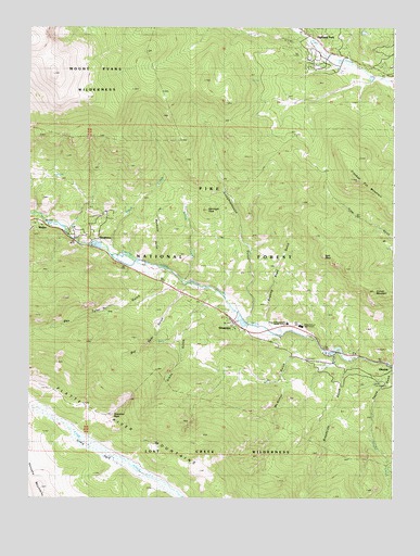
Shawnee, CO USGS Topographic Map
Click on map above to begin viewing in our Map Viewer.

This topographic map contains these locations and features:
Feature Name Type Latitude Longitude GNIS ID View Map
Baldwin CemeteryCemeteryN39.4119°W105.5005°2514168View Map
Ben Tyler GulchValleyN39.4352°W105.5783°183217View Map
Bill Tyler GulchValleyN39.4317°W105.5715°183239View Map
Boxwood GulchValleyN39.4365°W105.5806°183228View Map
Brookside GulchValleyN39.4124°W105.5120°183236View Map
Case SchoolSchoolN39.4386°W105.5978°183225View Map
Craig Creek TrailTrailN39.3836°W105.5872°169407View Map
Craig ParkFlatN39.3872°W105.6028°202931View Map
Crooked Top MountainSummitN39.4594°W105.5125°202930View Map
Derringer PeakSummitN39.4517°W105.5644°183230View Map
Foster GulchValleyN39.4497°W105.6227°183220View Map
Gibbs GulchValleyN39.4303°W105.5615°183238View Map
GlenislePopulated PlaceN39.4089°W105.5097°183235View Map
Grouse MountainSummitN39.4300°W105.5069°202932View Map
Highland ParkPopulated PlaceN39.4989°W105.5292°202929View Map
Jeffries Crawford DitchCanalN39.4926°W105.5229°2722998View Map
McArthur GulchValleyN39.4175°W105.5268°183237View Map
Payne CreekStreamN39.4103°W105.5000°183243View Map
Payne Creek TrailTrailN39.3753°W105.5003°202944View Map
Payne GulchValleyN39.4088°W105.5006°183242View Map
Platte River MountainsRangeN39.4042°W105.6194°183245View Map
Redskin MinesMineN39.4080°W105.5419°1703732View Map
ShawneePopulated PlaceN39.4211°W105.5542°183232View Map
Shawnee CemeteryCemeteryN39.4218°W105.5549°2379358View Map
Shawnee PeakSummitN39.3967°W105.5969°183240View Map
Shawnee Post OfficePost OfficeN39.4221°W105.5557°2759214View Map
SingletonPopulated PlaceN39.4430°W105.6019°183224View Map
Slaughterhouse GulchValleyN39.4224°W105.5506°183227View Map
Smith CreekStreamN39.4397°W105.5972°183226View Map
Snaking Road GulchValleyN39.4208°W105.5430°183233View Map
Split RockSummitN39.4394°W105.5247°183234View Map
WellerPopulated PlaceN39.4475°W105.6206°183223View Map
Whiteford Lake DamDamN39.4150°W105.5172°198814View Map
Whiteford ReservoirReservoirN39.4148°W105.5196°198815View Map
Willow CreekStreamN39.4322°W105.5728°183231View Map
Willow Creek RanchLocaleN39.4505°W105.5714°183229View Map
Wonder DitchCanalN39.4879°W105.5111°2724484View Map

Note: Coordinates in the location and feature list above are referenced to NAD83 datum.


Copyright (C) 2008-2024 Ryan Niemi / Sunset Dynamics ... All Rights Reserved