TopoQuest Logo
Do you find TopoQuest useful?
Help keep TopoQuest running and adding new maps/features by donating!
Bitcoin:  19c7KJd3qBynnjoSw5npx9KScwjBe4ifkT
Litecoin:  LXs6TkuXGGXo1vDsWCkWVdjQX94eUKd6ui
Home View Maps Find Maps Find Places Resources & Links


Shawnee, Wyoming Topographic Map

USGS Map Title: Shawnee, WY
USGS Map MRC: 42105F1
DRG (GeoTIFF) Download: o42105f1.tif


Neighboring USGS Topographic Map Quads:


  Simpson Draw, WY  
42105G2
 

  The Park, WY  
42105G1
 

  Lost Springs, WY  
42104G8
 

  Orin, WY  
42105F2
 

  Shawnee, WY  
42105F1
 

  Amend Ranch, WY  
42104F8
 

  Cedar Hill, WY  
42105E2
 

  Glendo, WY  
42105E1
 

  Jewel Springs, WY  
42104E8


Map MRC Location:

N43°
W106°
N43°
W105°
H8 H7 H6 H5 H4 H3 H2 H1
G8 G7 G6 G5 G4 G3 G2 G1
F8 F7 F6 F5 F4 F3 F2 F1
E8 E7 E6 E5 E4 E3 E2 E1
D8 D7 D6 D5 D4 D3 D2 D1
C8 C7 C6 C5 C4 C3 C2 C1
B8 B7 B6 B5 B4 B3 B2 B1
A8 A7 A6 A5 A4 A3 A2 A1
N42°
W106°
N42°
W105°

Shawnee, WY USGS 1:24K Topographic Map Preview:
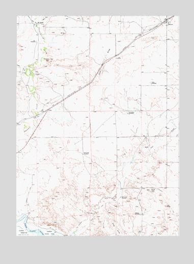
Shawnee, WY USGS Topographic Map
Click on map above to begin viewing in our Map Viewer.

This topographic map contains these locations and features:
Feature Name Type Latitude Longitude GNIS ID View Map
Bobcat HillSummitN42.7241°W105.0997°1585728View Map
Cedar DrawValleyN42.7180°W105.1178°1596786View Map
Deadmans CornerPopulated PlaceN42.6375°W105.0686°1597283View Map
East Fork Shawnee CreekStreamN42.7450°W105.1083°1588095View Map
Faith Number Two and Three MineMineN42.7289°W105.0386°1747113View Map
Fero DrawValleyN42.6927°W105.1053°1588428View Map
FisherLocaleN42.6969°W105.1008°1597315View Map
Fox Numbers Eight and Ten MineMineN42.6994°W105.0389°1747114View Map
Grey HillsSummitN42.6283°W105.0480°1589143View Map
Kornegay HomesteadLocaleN42.6372°W105.0297°1590411View Map
Lane HomesteadLocaleN42.7355°W105.1097°1590512View Map
May HomesteadLocaleN42.6469°W105.0450°1591277View Map
Mickey One MineMineN42.7064°W105.1183°1746891View Map
Nelson HomesteadLocaleN42.7114°W105.0219°1592004View Map
Pickinpaugh HomesteadLocaleN42.6719°W105.0741°1592733View Map
ShawneePopulated PlaceN42.7477°W105.0097°1594167View Map
Twin ButtesSummitN42.6419°W105.0100°1595776View Map
West Fork Shawnee CreekStreamN42.7450°W105.1083°1596208View Map
White HillsSummitN42.6500°W105.0214°1596306View Map
Worthington HomesteadLocaleN42.6947°W105.0394°1596630View Map
XH CrossingCrossingN42.7455°W105.1089°1597552View Map

Note: Coordinates in the location and feature list above are referenced to NAD83 datum.


Copyright (C) 2008-2025 Ryan Niemi / Sunset Dynamics ... All Rights Reserved