TopoQuest Logo
Do you find TopoQuest useful?
Help keep TopoQuest running and adding new maps/features by donating!
Bitcoin:  19c7KJd3qBynnjoSw5npx9KScwjBe4ifkT
Litecoin:  LXs6TkuXGGXo1vDsWCkWVdjQX94eUKd6ui
Home View Maps Find Maps Find Places Resources & Links


Shelby, Iowa Topographic Map

USGS Map Title: Shelby, IA
USGS Map MRC: 41095E4
DRG (GeoTIFF) Download: o41095e4.tif


Neighboring USGS Topographic Map Quads:


  Portsmouth, IA  
41095F5
 

  Panama, IA  
41095F4
 

  Harlan, IA  
41095F3
 

  Persia, IA  
41095E5
 

  Shelby, IA  
41095E4
 

  Corley, IA  
41095E3
 

  Neola, IA  
41095D5
 

  Avoca NW, IA  
41095D4
 

  Avoca, IA  
41095D3


Map MRC Location:

N42°
W96°
N42°
W95°
H8 H7 H6 H5 H4 H3 H2 H1
G8 G7 G6 G5 G4 G3 G2 G1
F8 F7 F6 F5 F4 F3 F2 F1
E8 E7 E6 E5 E4 E3 E2 E1
D8 D7 D6 D5 D4 D3 D2 D1
C8 C7 C6 C5 C4 C3 C2 C1
B8 B7 B6 B5 B4 B3 B2 B1
A8 A7 A6 A5 A4 A3 A2 A1
N41°
W96°
N41°
W95°

Shelby, IA USGS 1:24K Topographic Map Preview:
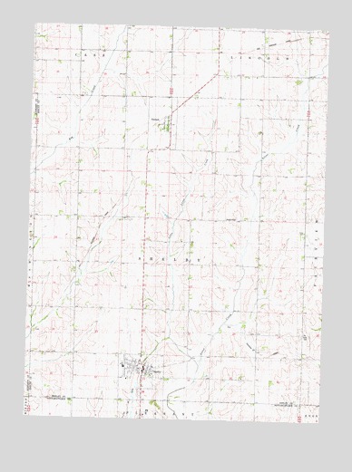
Shelby, IA USGS Topographic Map
Click on map above to begin viewing in our Map Viewer.

This topographic map contains these locations and features:
Feature Name Type Latitude Longitude GNIS ID View Map
City of ShelbyCivilN41.5067°W95.4506°2395863View Map
City of TennantCivilN41.5941°W95.4449°2396039View Map
First Presbyterian ChurchChurchN41.5172°W95.4558°1982620View Map
Little Silver CreekStreamN41.5172°W95.4269°458502View Map
Old Stone Arch BridgeBridgeN41.5242°W95.4369°1982694View Map
Olson CemeteryCemeteryN41.5273°W95.3808°459862View Map
Rock Island Old Stone Arch TrailTrailN41.5186°W95.4497°1982695View Map
ShelbyPopulated PlaceN41.5161°W95.4503°461554View Map
Shelby (historical)LocaleN41.5153°W95.4508°1982623View Map
Shelby City HallBuildingN41.5244°W95.4503°1982615View Map
Shelby ElevatorLocaleN41.5244°W95.4503°1982617View Map
Shelby Fire and RescueBuildingN41.5160°W95.4515°1982619View Map
Shelby Medical ClinicHospitalN41.5244°W95.4503°1982618View Map
Shelby Post OfficePost OfficeN41.5244°W95.4503°1982616View Map
Shelby Township CemeteryCemeteryN41.5086°W95.4517°1982660View Map
Shelby United Methodist ChurchChurchN41.5244°W95.4489°1982621View Map
TennantPopulated PlaceN41.5936°W95.4411°462194View Map
Tennant (historical)LocaleN41.5955°W95.4447°1982624View Map
Tennant Methodist ChurchChurchN41.5936°W95.4425°1982626View Map
Tennant Post Office (historical)Post OfficeN41.5936°W95.4411°1982625View Map
Township of ShelbyCivilN41.5542°W95.4407°468688View Map
United Lutheran ChurchChurchN41.5167°W95.4467°1982622View Map

Note: Coordinates in the location and feature list above are referenced to NAD83 datum.


Copyright (C) 2008-2025 Ryan Niemi / Sunset Dynamics ... All Rights Reserved