TopoQuest Logo
Do you find TopoQuest useful?
Help keep TopoQuest running and adding new maps/features by donating!
Bitcoin:  19c7KJd3qBynnjoSw5npx9KScwjBe4ifkT
Litecoin:  LXs6TkuXGGXo1vDsWCkWVdjQX94eUKd6ui
Home View Maps Find Maps Find Places Resources & Links


Shellsburg, Iowa Topographic Map

USGS Map Title: Shellsburg, IA
USGS Map MRC: 42091A7
DRG (GeoTIFF) Download: o42091a7.tif


Neighboring USGS Topographic Map Quads:


  Center Point NW, IA  
42091B8
 

  Center Point, IA  
42091B7
 

  Lafayette, IA  
42091B6
 

  Center Point SW, IA  
42091A8
 

  Shellsburg, IA  
42091A7
 

  Cedar Rapids North, IA  
42091A6
 

  Newhall, IA  
41091H8
 

  Fairfax, IA  
41091H7
 

  Cedar Rapids South, IA  
41091H6


Map MRC Location:

N43°
W92°
N43°
W91°
H8 H7 H6 H5 H4 H3 H2 H1
G8 G7 G6 G5 G4 G3 G2 G1
F8 F7 F6 F5 F4 F3 F2 F1
E8 E7 E6 E5 E4 E3 E2 E1
D8 D7 D6 D5 D4 D3 D2 D1
C8 C7 C6 C5 C4 C3 C2 C1
B8 B7 B6 B5 B4 B3 B2 B1
A8 A7 A6 A5 A4 A3 A2 A1
N42°
W92°
N42°
W91°

Shellsburg, IA USGS 1:24K Topographic Map Preview:
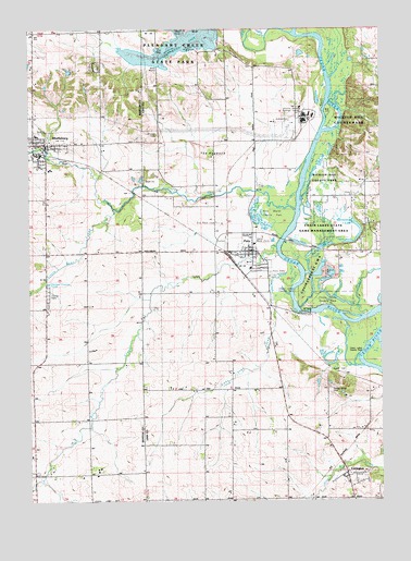
Shellsburg, IA USGS Topographic Map
Click on map above to begin viewing in our Map Viewer.

This topographic map contains these locations and features:
Feature Name Type Latitude Longitude GNIS ID View Map
Bear CreekStreamN42.0767°W91.7799°454419View Map
Benton Linn Ambulance ServiceBuildingN42.0659°W91.8009°2599845View Map
Canton - Benton - Shellsburg Fire AdministrationBuildingN42.0944°W91.8690°2577353View Map
Chain Lakes BridgeBridgeN42.0500°W91.7755°2048137View Map
Chain Lakes County ParkParkN42.0528°W91.7707°455334View Map
Chain-O-Lakes Wildlife Management AreaParkN42.0722°W91.7724°2046610View Map
City of PaloCivilN42.0646°W91.8001°2396132View Map
City of ShellsburgCivilN42.0929°W91.8710°468690View Map
CovingtonPopulated PlaceN42.0072°W91.7624°455681View Map
Covington (historical)LocaleN42.0106°W91.7641°2046622View Map
Covington Post Office (historical)Post OfficeN42.0072°W91.7624°2046623View Map
DAEC HelipadAirportN42.1019°W91.7771°466914View Map
Dry CreekStreamN42.0672°W91.7868°456024View Map
Duane Arnold Energy CenterLocaleN42.1042°W91.7771°465919View Map
First Presbyterian ChurchChurchN42.0944°W91.8668°2000261View Map
Hanging Bog State PreserveParkN42.0375°W91.7682°2046609View Map
Horseshoe LakeLakeN42.0703°W91.7574°457668View Map
Lincoln Church (historical)ChurchN42.0217°W91.8132°465944View Map
Little Bear CreekStreamN42.0775°W91.8452°458438View Map
Lone Tree CreekStreamN42.0567°W91.7816°458582View Map
Mud LakeLakeN42.0652°W91.7756°459390View Map
Oak Grove Post Office (historical)Post OfficeN42.1194°W91.8155°2046611View Map
Old Palo CemeteryCemeteryN42.0742°W91.8088°459831View Map
Otter CreekStreamN42.0500°W91.7546°459936View Map
PaloLocaleN42.0661°W91.8043°2048038View Map
PaloPopulated PlaceN42.0661°W91.7955°460004View Map
Palo CemeteryCemeteryN42.0606°W91.7896°460006View Map
Palo City HallBuildingN42.0661°W91.7955°2048043View Map
Palo City Police DepartmentBuildingN42.0661°W91.7955°2048044View Map
Palo Fire DepartmentBuildingN42.0655°W91.8132°2048041View Map
Palo Marsh County ParkParkN42.0750°W91.7880°460007View Map
Palo Post OfficePost OfficeN42.0661°W91.7960°2048039View Map
Palo United Methodist ChurchChurchN42.0675°W91.7968°2048040View Map
Pleasant Creek State ParkParkN42.1236°W91.8196°2048133View Map
ShellsburgPopulated PlaceN42.0944°W91.8693°461565View Map
ShellsburgLocaleN42.0922°W91.8718°2000264View Map
Shellsburg BridgeBridgeN42.0936°W91.8693°2000365View Map
Shellsburg Elementary SchoolSchoolN42.0967°W91.8724°2000263View Map
Shellsburg ElevatorLocaleN42.0919°W91.8705°2000260View Map
Shellsburg Post OfficePost OfficeN42.0942°W91.8696°2000259View Map
Shellsburg Public LibraryBuildingN42.0939°W91.8746°2000258View Map
Spring Grove CemeteryCemeteryN42.0300°W91.7685°461893View Map
Strawn CemeteryCemeteryN42.0971°W91.8291°462033View Map
The HogbackSummitN42.0925°W91.8113°462205View Map
Township of FayetteCivilN42.0950°W91.8056°467828View Map
Wickup Hill County ParkParkN42.1042°W91.7610°463025View Map
Zeller Memorial ParkParkN42.0689°W91.7952°465920View Map
Zion Lutheran ChurchChurchN42.0906°W91.8713°2000262View Map

Note: Coordinates in the location and feature list above are referenced to NAD83 datum.


Copyright (C) 2008-2024 Ryan Niemi / Sunset Dynamics ... All Rights Reserved