TopoQuest Logo
Do you find TopoQuest useful?
Help keep TopoQuest running and adding new maps/features by donating!
Bitcoin:  19c7KJd3qBynnjoSw5npx9KScwjBe4ifkT
Litecoin:  LXs6TkuXGGXo1vDsWCkWVdjQX94eUKd6ui
Home View Maps Find Maps Find Places Resources & Links


Shepard Reservoir, Wyoming Topographic Map

USGS Map Title: Shepard Reservoir, WY
USGS Map MRC: 44104H2
DRG (GeoTIFF) Download: o44104h2.tif


Neighboring USGS Topographic Map Quads:


  Sevenmile Creek, MT  
45104A3
 

  Elkhorn Creek SW, MT  
45104A2
 

  Elkhorn Creek SE, MT  
45104A1
 

  Devils Run, WY  
44104H3
 

  Shepard Reservoir, WY  
44104H2
 

  Gravel Draw, WY  
44104H1
 

  Stoney Point, WY  
44104G3
 

  Kruger Lake, WY  
44104G2
 

  Middle Creek Butte, SD  
44104G1


Map MRC Location:

N45°
W105°
N45°
W104°
H8 H7 H6 H5 H4 H3 H2 H1
G8 G7 G6 G5 G4 G3 G2 G1
F8 F7 F6 F5 F4 F3 F2 F1
E8 E7 E6 E5 E4 E3 E2 E1
D8 D7 D6 D5 D4 D3 D2 D1
C8 C7 C6 C5 C4 C3 C2 C1
B8 B7 B6 B5 B4 B3 B2 B1
A8 A7 A6 A5 A4 A3 A2 A1
N44°
W105°
N44°
W104°

Shepard Reservoir, WY USGS 1:24K Topographic Map Preview:
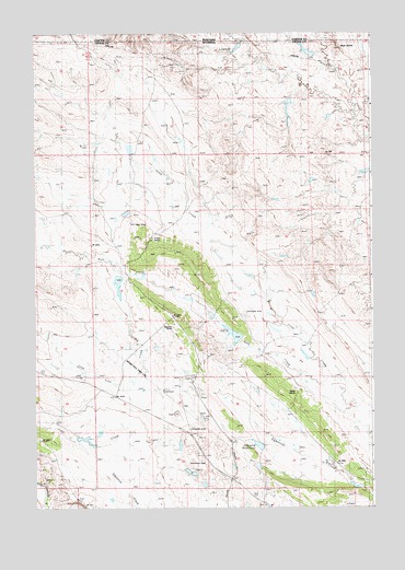
Shepard Reservoir, WY USGS Topographic Map
Click on map above to begin viewing in our Map Viewer.

This topographic map contains these locations and features:
Feature Name Type Latitude Longitude GNIS ID View Map
Antelope Hill DamDamN44.9217°W104.1405°1607408View Map
Antelope Hill ReservoirReservoirN44.9228°W104.1398°1607409View Map
Bull CreekStreamN44.9086°W104.1394°1586095View Map
Bull Creek DamDamN44.9200°W104.1722°1608434View Map
Bull Creek ReservoirReservoirN44.9205°W104.1763°1608435View Map
Colony MineMineN44.9203°W104.1986°1726274View Map
Colony Radar Bomb Scoring SiteMilitaryN44.8917°W104.1870°2512151View Map
Crago RanchLocaleN44.9472°W104.2072°1587171View Map
Crow Creek DamDamN44.9000°W104.1322°1607232View Map
Crow Creek MineMineN44.8855°W104.2447°1726276View Map
Crow Creek ReservoirReservoirN44.9000°W104.1322°1607233View Map
King DamDamN44.9183°W104.2455°1607226View Map
King ReservoirReservoirN44.9183°W104.2455°1607227View Map
Lone Tree CreekStreamN44.9367°W104.2180°1590949View Map
Lone Tree DamDamN44.9350°W104.2188°1607606View Map
Lone Tree ReservoirReservoirN44.9338°W104.2190°1607607View Map
Mud ButteSummitN44.9961°W104.1369°1591824View Map
Newland RanchLocaleN44.9233°W104.1988°1592020View Map
Raber RanchLocaleN44.9061°W104.1527°1593116View Map
Shepard ReservoirReservoirN44.8914°W104.1673°1594246View Map
South Fork Owl CreekStreamN44.9781°W104.1303°1594669View Map
Strawberry Hill DamDamN44.9317°W104.2255°1607218View Map
Strawberry Hill ReservoirReservoirN44.9317°W104.2255°1607219View Map

Note: Coordinates in the location and feature list above are referenced to NAD83 datum.


Copyright (C) 2008-2024 Ryan Niemi / Sunset Dynamics ... All Rights Reserved