TopoQuest Logo
Do you find TopoQuest useful?
Help keep TopoQuest running and adding new maps/features by donating!
Bitcoin:  19c7KJd3qBynnjoSw5npx9KScwjBe4ifkT
Litecoin:  LXs6TkuXGGXo1vDsWCkWVdjQX94eUKd6ui
Home View Maps Find Maps Find Places Resources & Links


Shepherds Point, Wyoming Topographic Map

USGS Map Title: Shepherds Point, WY
USGS Map MRC: 42104H2
DRG (GeoTIFF) Download: o42104h2.tif


Neighboring USGS Topographic Map Quads:


  Coyote Gap, WY  
43104A3
 

  South Oat Creek, WY  
43104A2
 

  Oat Creek, WY  
43104A1
 

  Hat Creek, WY  
42104H3
 

  Shepherds Point, WY  
42104H2
 

  Sherrill Hills, WY  
42104H1
 

  Signature Rock, WY  
42104G3
 

  Kirtley SW, WY  
42104G2
 

  Kirtley, WY  
42104G1


Map MRC Location:

N43°
W105°
N43°
W104°
H8 H7 H6 H5 H4 H3 H2 H1
G8 G7 G6 G5 G4 G3 G2 G1
F8 F7 F6 F5 F4 F3 F2 F1
E8 E7 E6 E5 E4 E3 E2 E1
D8 D7 D6 D5 D4 D3 D2 D1
C8 C7 C6 C5 C4 C3 C2 C1
B8 B7 B6 B5 B4 B3 B2 B1
A8 A7 A6 A5 A4 A3 A2 A1
N42°
W105°
N42°
W104°

Shepherds Point, WY USGS 1:24K Topographic Map Preview:
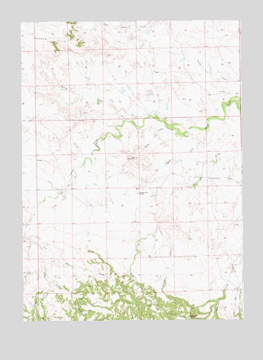
Shepherds Point, WY USGS Topographic Map
Click on map above to begin viewing in our Map Viewer.

This topographic map contains these locations and features:
Feature Name Type Latitude Longitude GNIS ID View Map
Cedar DrawValleyN42.9566°W104.1661°1586491View Map
Clifton Number 1 DamDamN42.9650°W104.1772°1606654View Map
Clifton Number 1 ReservoirReservoirN42.9650°W104.1772°1606655View Map
East Niobrara DivisionCivilN42.9889°W104.2110°1939725View Map
Fitzsimmons CreekStreamN42.8958°W104.1308°1588524View Map
Indian Creek SchoolSchoolN42.9339°W104.1438°1589893View Map
Middle CreekStreamN42.8914°W104.2330°1591514View Map
Mill CreekStreamN42.9102°W104.2488°1591590View Map
Sand DrawValleyN42.9530°W104.1469°1593860View Map
Seaman HillsRangeN42.9939°W104.2377°1594069View Map
Shepherds PointSummitN42.9283°W104.1830°1594248View Map
Spring DrawValleyN42.9577°W104.1863°1594891View Map
Swanski CreekStreamN42.9133°W104.1722°1595232View Map
Swanski RockSummitN42.8764°W104.1552°1595233View Map
Table MountainSummitN42.9427°W104.1852°1595279View Map
The PointCliffN42.9833°W104.1944°1595463View Map
Thomas DamDamN42.8933°W104.1622°1607134View Map
Thomas ReservoirReservoirN42.8933°W104.1622°1607135View Map
Thompson DamDamN42.9916°W104.1772°1607058View Map
Thompson Number 2 DamDamN43.0000°W104.1838°1606514View Map
Thompson Number 2 ReservoirReservoirN43.0000°W104.1838°1606515View Map
Thompson ReservoirReservoirN42.9916°W104.1772°1607059View Map
Three TubsSummitN42.9114°W104.1988°1595541View Map

Note: Coordinates in the location and feature list above are referenced to NAD83 datum.


Copyright (C) 2008-2025 Ryan Niemi / Sunset Dynamics ... All Rights Reserved