TopoQuest Logo
Do you find TopoQuest useful?
Help keep TopoQuest running and adding new maps/features by donating!
Bitcoin:  19c7KJd3qBynnjoSw5npx9KScwjBe4ifkT
Litecoin:  LXs6TkuXGGXo1vDsWCkWVdjQX94eUKd6ui
Home View Maps Find Maps Find Places Resources & Links


Shields Creek, California Topographic Map

USGS Map Title: Shields Creek, CA
USGS Map MRC: 41120D3
DRG (GeoTIFF) Download: o41120d3.tif


Neighboring USGS Topographic Map Quads:


  Surprise Station, CA  
41120E4
 

  Payne Peak, CA  
41120E3
 

  Cedarville, CA  
41120E2
 

  Dorris Reservoir, CA  
41120D4
 

  Shields Creek, CA  
41120D3
 

  Warren Peak, CA  
41120D2
 

  Little Juniper Reservoir, CA  
41120C4
 

  Soup Creek, CA  
41120C3
 

  Eagle Peak, CA  
41120C2


Map MRC Location:

N42°
W121°
N42°
W120°
H8 H7 H6 H5 H4 H3 H2 H1
G8 G7 G6 G5 G4 G3 G2 G1
F8 F7 F6 F5 F4 F3 F2 F1
E8 E7 E6 E5 E4 E3 E2 E1
D8 D7 D6 D5 D4 D3 D2 D1
C8 C7 C6 C5 C4 C3 C2 C1
B8 B7 B6 B5 B4 B3 B2 B1
A8 A7 A6 A5 A4 A3 A2 A1
N41°
W121°
N41°
W120°

Shields Creek, CA USGS 1:24K Topographic Map Preview:
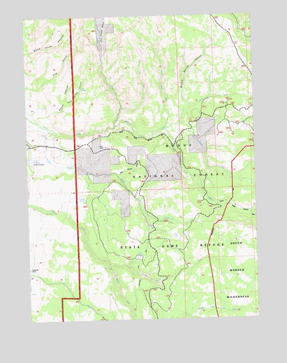
Shields Creek, CA USGS Topographic Map
Click on map above to begin viewing in our Map Viewer.

This topographic map contains these locations and features:
Feature Name Type Latitude Longitude GNIS ID View Map
Dry CreekStreamN41.4549°W120.3280°222634View Map
Dry Creek BasinBasinN41.4952°W120.3336°222635View Map
East Dry CreekStreamN41.4621°W120.3247°222876View Map
Fern SpringSpringN41.4706°W120.3452°223470View Map
Fern Spring CanyonValleyN41.4646°W120.3536°223471View Map
Fitzhugh SpringsSpringN41.4249°W120.3447°223563View Map
Little North Fork Parker CreekStreamN41.4541°W120.2997°227318View Map
Middle Fork Parker CreekStreamN41.4557°W120.2924°228600View Map
Middle Fork Pine CreekStreamN41.3960°W120.3322°228601View Map
Mud Spring GulchValleyN41.4349°W120.3261°229265View Map
North Fork Parker CreekStreamN41.4532°W120.3008°229708View Map
North Fork Pine CreekStreamN41.3960°W120.3319°229710View Map
North Fork Shields CreekStreamN41.4188°W120.3136°229717View Map
Payne CanyonValleyN41.4591°W120.3649°230422View Map
Pine SpringSpringN41.4015°W120.3165°230722View Map
Plum Canyon 139 DamDamN41.4416°W120.3727°1663750View Map
South Fork Parker CreekStreamN41.4532°W120.3008°235039View Map
South Fork Shields CreekStreamN41.4188°W120.3136°235051View Map
Telephone Line TrailTrailN41.3866°W120.3155°236090View Map
Warner MountainsRangeN41.4499°W120.2511°268783View Map
Willow Spring CanyonValleyN41.4643°W120.2888°237944View Map

Note: Coordinates in the location and feature list above are referenced to NAD83 datum.


Copyright (C) 2008-2024 Ryan Niemi / Sunset Dynamics ... All Rights Reserved