TopoQuest Logo
Do you find TopoQuest useful?
Help keep TopoQuest running and adding new maps/features by donating!
Bitcoin:  19c7KJd3qBynnjoSw5npx9KScwjBe4ifkT
Litecoin:  LXs6TkuXGGXo1vDsWCkWVdjQX94eUKd6ui
Home View Maps Find Maps Find Places Resources & Links


Ship Island, Mississippi Topographic Map

USGS Map Title: Ship Island, MS
USGS Map MRC: 30088B8
DRG (GeoTIFF) Download: o30088b8.tif


Neighboring USGS Topographic Map Quads:


  Gulfport South, MS  
30089C1


  Deer Island, MS  
30088C7
 

  Cat Island, MS  
30089B1
 

  Ship Island, MS  
30088B8
 

  Dog Keys Pass, MS  
30088B7


Map MRC Location:

N31°
W89°
N31°
W88°
H8 H7 H6 H5 H4 H3 H2 H1
G8 G7 G6 G5 G4 G3 G2 G1
F8 F7 F6 F5 F4 F3 F2 F1
E8 E7 E6 E5 E4 E3 E2 E1
D8 D7 D6 D5 D4 D3 D2 D1
C8 C7 C6 C5 C4 C3 C2 C1
B8 B7 B6 B5 B4 B3 B2 B1
A8 A7 A6 A5 A4 A3 A2 A1
N30°
W89°
N30°
W88°

Ship Island, MS USGS 1:24K Topographic Map Preview:
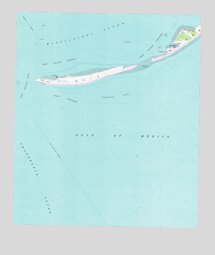
Ship Island, MS USGS Topographic Map
Click on map above to begin viewing in our Map Viewer.

This topographic map contains these locations and features:
Feature Name Type Latitude Longitude GNIS ID View Map
East ChannelChannelN30.2002°W88.9673°669564View Map
Gulf Island National SeashoreParkN30.2085°W88.9848°1985756View Map
Loggerhead ShoalBarN30.2016°W88.9303°672771View Map
Middle GroundBarN30.1946°W88.9695°688822View Map
Northwest BluffCliffN30.2410°W88.8814°674976View Map
Old Fort MassachusettsLocaleN30.2124°W88.9723°675187View Map
Ship IslandIslandN30.2199°W88.9186°691612View Map
Ship Island BarBarN30.1891°W88.9681°710398View Map
Ship Island Bar ChannelChannelN30.1641°W88.9684°677718View Map
Ship Island ChannelChannelN30.2327°W88.9064°677719View Map
Ship Island FlatsBarN30.2216°W88.9123°677720View Map
Ship Island HarborBayN30.2219°W88.9717°677721View Map
Ship Island LighthouseBuildingN30.2127°W88.9664°677722View Map
Ship Island PassChannelN30.2035°W88.9945°677723View Map
South ChannelChannelN30.1919°W88.9778°688864View Map
Table HillSummitN30.2169°W88.9320°688867View Map
The KnollBarN30.1863°W88.9931°688879View Map
The LagoonBayN30.2327°W88.8945°678664View Map
The NeckCapeN30.2180°W88.9320°688828View Map
Walker ShoalBarN30.2338°W88.9267°679274View Map
West HeadCapeN30.2105°W88.9556°688876View Map
West PointCapeN30.2102°W88.9856°679516View Map

Note: Coordinates in the location and feature list above are referenced to NAD83 datum.


Copyright (C) 2008-2025 Ryan Niemi / Sunset Dynamics ... All Rights Reserved