TopoQuest Logo
Do you find TopoQuest useful?
Help keep TopoQuest running and adding new maps/features by donating!
Bitcoin:  19c7KJd3qBynnjoSw5npx9KScwjBe4ifkT
Litecoin:  LXs6TkuXGGXo1vDsWCkWVdjQX94eUKd6ui
Home View Maps Find Maps Find Places Resources & Links


Shipp Ranch, Texas Topographic Map

USGS Map Title: Shipp Ranch, TX
USGS Map MRC: 27099E1
DRG (GeoTIFF) Download: o27099e1.tif


Neighboring USGS Topographic Map Quads:


  Piedra Parada Tank, TX  
27099F2
 

  Piedra Parada Ranch, TX  
27099F1
 

  Mills Bennett NW, TX  
27098F8
 

  Burrito Tank, TX  
27099E2
 

  Shipp Ranch, TX  
27099E1
 

  Mills Bennett SW, TX  
27098E8
 

  Retama Creek, TX  
27099D2
 

  Mirando City, TX  
27099D1
 

  Oilton, TX  
27098D8


Map MRC Location:

N28°
W100°
N28°
W99°
H8 H7 H6 H5 H4 H3 H2 H1
G8 G7 G6 G5 G4 G3 G2 G1
F8 F7 F6 F5 F4 F3 F2 F1
E8 E7 E6 E5 E4 E3 E2 E1
D8 D7 D6 D5 D4 D3 D2 D1
C8 C7 C6 C5 C4 C3 C2 C1
B8 B7 B6 B5 B4 B3 B2 B1
A8 A7 A6 A5 A4 A3 A2 A1
N27°
W100°
N27°
W99°

Shipp Ranch, TX USGS 1:24K Topographic Map Preview:
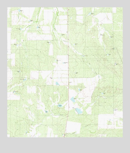
Shipp Ranch, TX USGS Topographic Map
Click on map above to begin viewing in our Map Viewer.

This topographic map contains these locations and features:
Feature Name Type Latitude Longitude GNIS ID View Map
Anzuelo TankReservoirN27.5786°W99.0437°1372314View Map
Baltazar TankReservoirN27.5913°W99.0790°1372384View Map
Bandido TankReservoirN27.6121°W99.1010°1372386View Map
Blackio TankReservoirN27.5624°W99.0516°1372612View Map
Borrego TankReservoirN27.5859°W99.0092°1372684View Map
Caballero TankReservoirN27.5364°W99.0541°1372863View Map
Caballo TankReservoirN27.5548°W99.1073°1372864View Map
Certificado TankReservoirN27.5987°W99.0669°1373039View Map
Chenecas TankReservoirN27.5574°W99.0762°1373066View Map
Colorado TankReservoirN27.5967°W99.0139°1373166View Map
Escondido TankReservoirN27.5265°W99.0095°1373667View Map
Evan TankReservoirN27.5246°W99.0830°1373682View Map
Herarradura TankReservoirN27.5890°W99.1142°1374041View Map
Huisachosa TankReservoirN27.5716°W99.0644°1374173View Map
Javalina TankReservoirN27.5797°W99.0163°1374272View Map
Leona TankReservoirN27.5708°W99.0082°1374507View Map
Little Colorado TankReservoirN27.5988°W99.0250°1374566View Map
McElrow TankReservoirN27.5894°W99.0527°1374847View Map
Oliver TankReservoirN27.5435°W99.1177°1375290View Map
Pelon TankReservoirN27.5458°W99.0475°1375405View Map
Pola TankReservoirN27.6055°W99.0926°1375517View Map
Potrero Arriba TankReservoirN27.6045°W99.1105°1375547View Map
Quiros LakeReservoirN27.5303°W99.0720°1858709View Map
Quiros Lake DamDamN27.5303°W99.0720°1858708View Map
Ranch Viejo TankReservoirN27.5740°W99.0724°1375625View Map
Reynolds TankReservoirN27.6192°W99.0359°1375722View Map
Shipp RanchLocaleN27.5281°W99.0525°1376108View Map
Tinajas TankReservoirN27.5420°W99.0223°1376466View Map
Trap TankReservoirN27.5211°W99.0688°1376491View Map
Vaquillas Dam Number 2DamN27.5220°W99.0536°1858710View Map
Vaquillas Lake Number 1 DamDamN27.5370°W99.0570°1858712View Map
Vaquillas Lake Number 2ReservoirN27.5220°W99.0536°1858711View Map
Venado TankReservoirN27.5636°W99.1119°1376581View Map
Vinateria TankReservoirN27.5306°W99.0685°1376599View Map

Note: Coordinates in the location and feature list above are referenced to NAD83 datum.


Copyright (C) 2008-2025 Ryan Niemi / Sunset Dynamics ... All Rights Reserved