TopoQuest Logo
Do you find TopoQuest useful?
Help keep TopoQuest running and adding new maps/features by donating!
Bitcoin:  19c7KJd3qBynnjoSw5npx9KScwjBe4ifkT
Litecoin:  LXs6TkuXGGXo1vDsWCkWVdjQX94eUKd6ui
Home View Maps Find Maps Find Places Resources & Links


Shirley, Montana Topographic Map

USGS Map Title: Shirley, MT
USGS Map MRC: 46105E5
DRG (GeoTIFF) Download: o46105e5.tif


Neighboring USGS Topographic Map Quads:


  Kinsey NW, MT  
46105F6
 

  Kinsey NE, MT  
46105F5
 

  Zero, MT  
46105F4
 

  Kinsey, MT  
46105E6
 

  Shirley, MT  
46105E5
 

  Corral Butte, MT  
46105E4
 

  Government Hill, MT  
46105D6
 

  The Knob, MT  
46105D5
 

  Buck Mountain, MT  
46105D4


Map MRC Location:

N47°
W106°
N47°
W105°
H8 H7 H6 H5 H4 H3 H2 H1
G8 G7 G6 G5 G4 G3 G2 G1
F8 F7 F6 F5 F4 F3 F2 F1
E8 E7 E6 E5 E4 E3 E2 E1
D8 D7 D6 D5 D4 D3 D2 D1
C8 C7 C6 C5 C4 C3 C2 C1
B8 B7 B6 B5 B4 B3 B2 B1
A8 A7 A6 A5 A4 A3 A2 A1
N46°
W106°
N46°
W105°

Shirley, MT USGS 1:24K Topographic Map Preview:
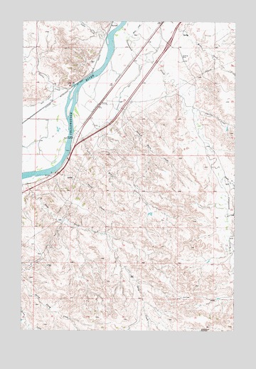
Shirley, MT USGS Topographic Map
Click on map above to begin viewing in our Map Viewer.

This topographic map contains these locations and features:
Feature Name Type Latitude Longitude GNIS ID View Map
09N49E05CBC_01 WellWellN46.5608°W105.5956°816823View Map
09N49E06BBBA01 WellWellN46.5708°W105.6164°816870View Map
09N49E07DDBC01 WellWellN46.5447°W105.6028°816747View Map
09N49E13BDAA01 WellWellN46.5378°W105.5028°816717View Map
10N48E24ACAC01 WellWellN46.6094°W105.6242°817098View Map
10N48E36DAAD01 WellWellN46.5767°W105.6178°816893View Map
10N49E14DDDD01 WellWellN46.6150°W105.5128°817132View Map
10N49E17DBDA01 WellWellN46.6200°W105.5817°817188View Map
10N49E30ABCD01 WellWellN46.5969°W105.6061°817029View Map
10N49E30DBBC01 WellWellN46.5911°W105.6069°816975View Map
10N49E31BAAA01 WellWellN46.5850°W105.6075°816928View Map
10N49E31BBBB01 WellWellN46.5853°W105.6161°816933View Map
10N49E31CCAC01 WellWellN46.5731°W105.6147°816877View Map
10N49E33ADD_01 WellWellN46.5792°W105.5561°816904View Map
10N49E35DACD01 WellWellN46.5747°W105.5158°816885View Map
Ainslie Post Office (historical)Post OfficeN46.5917°W105.5783°1716898View Map
Cabin CreekStreamN46.6197°W105.5756°769483View Map
Charlie CreekStreamN46.5889°W105.5242°769767View Map
Cottonwood CreekStreamN46.6222°W105.5683°770180View Map
Dead Horse CreekStreamN46.5853°W105.5742°770507View Map
Deep CreekStreamN46.5622°W105.6178°770555View Map
E-2 CreekStreamN46.5472°W105.5044°770946View Map
Harris CreekStreamN46.5967°W105.5978°772169View Map
Hay CreekStreamN46.5817°W105.5958°772241View Map
Interchange 159CrossingN46.6161°W105.5394°1721474View Map
Kinsey Main CanalCanalN46.5931°W105.6119°773067View Map
Miles CreekStreamN46.6200°W105.5636°774206View Map
Prairie CreekStreamN46.5603°W105.5083°775434View Map
ShirleyPopulated PlaceN46.5914°W105.5800°776491View Map
ShirleyLocaleN46.5917°W105.5811°1716842View Map
Shirley Post Office (historical)Post OfficeN46.5917°W105.5811°1716843View Map
Shirley School (historical)SchoolN46.5917°W105.5783°1716922View Map
Short CreekStreamN46.5642°W105.6064°776512View Map

Note: Coordinates in the location and feature list above are referenced to NAD83 datum.


Copyright (C) 2008-2025 Ryan Niemi / Sunset Dynamics ... All Rights Reserved