TopoQuest Logo
Do you find TopoQuest useful?
Help keep TopoQuest running and adding new maps/features by donating!
Bitcoin:  19c7KJd3qBynnjoSw5npx9KScwjBe4ifkT
Litecoin:  LXs6TkuXGGXo1vDsWCkWVdjQX94eUKd6ui
Home View Maps Find Maps Find Places Resources & Links


Shissler Peak, Idaho Topographic Map

USGS Map Title: Shissler Peak, ID
USGS Map MRC: 46114B8
DRG (GeoTIFF) Download: o46114b8.tif


Neighboring USGS Topographic Map Quads:


  Fish Lake, ID  
46115C1
 

  McConnell Mountain, ID  
46114C8
 

  Hungry Rock, ID  
46114C7
 

  Big Rock Mountain, ID  
46115B1
 

  Shissler Peak, ID  
46114B8
 

  Freeman Peak, ID  
46114B7
 

  Mink Peak, ID  
46115A1
 

  Moose Ridge, ID  
46114A8
 

  Dog Creek, ID  
46114A7


Map MRC Location:

N47°
W115°
N47°
W114°
H8 H7 H6 H5 H4 H3 H2 H1
G8 G7 G6 G5 G4 G3 G2 G1
F8 F7 F6 F5 F4 F3 F2 F1
E8 E7 E6 E5 E4 E3 E2 E1
D8 D7 D6 D5 D4 D3 D2 D1
C8 C7 C6 C5 C4 C3 C2 C1
B8 B7 B6 B5 B4 B3 B2 B1
A8 A7 A6 A5 A4 A3 A2 A1
N46°
W115°
N46°
W114°

Shissler Peak, ID USGS 1:24K Topographic Map Preview:
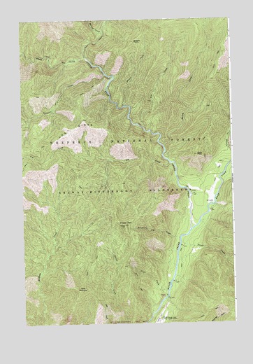
Shissler Peak, ID USGS Topographic Map
Click on map above to begin viewing in our Map Viewer.

This topographic map contains these locations and features:
Feature Name Type Latitude Longitude GNIS ID View Map
Bailey CreekStreamN46.1983°W114.9162°376851View Map
Barren CreekStreamN46.2446°W114.9507°376976View Map
Cone PeakSummitN46.1944°W114.8962°379614View Map
Crew CreekStreamN46.1908°W114.8757°380062View Map
East Fork Moose CreekStreamN46.1649°W114.8979°381141View Map
Fitting CreekStreamN46.1916°W114.8751°381792View Map
Freeman PlaceLocaleN46.1369°W114.9165°395402View Map
Goat MountainSummitN46.1388°W114.9665°382337View Map
Log CreekStreamN46.1908°W114.9126°385965View Map
Log RidgeRidgeN46.2052°W114.9709°393802View Map
Moose Creek /USFS AirportAirportN46.1260°W114.9208°400878View Map
North Fork Moose CreekStreamN46.1649°W114.8979°387740View Map
Pipe CreekStreamN46.2060°W114.9276°388559View Map
Rhoda CreekStreamN46.2341°W114.9612°389329View Map
Shasta CreekStreamN46.2146°W114.9396°390158View Map
Shasta PointCliffN46.2410°W114.9323°390160View Map
Shissler PeakCliffN46.1658°W114.9398°390339View Map
Sixtytwo CreekStreamN46.2274°W114.9504°390507View Map
Three Forks Ranger StationLocaleN46.1771°W114.8968°399233View Map
Trout CreekStreamN46.1585°W114.9065°392417View Map
Vista CreekStreamN46.1385°W114.9151°392749View Map
Whistling Pig CreekStreamN46.1599°W114.9076°393307View Map

Note: Coordinates in the location and feature list above are referenced to NAD83 datum.


Copyright (C) 2008-2025 Ryan Niemi / Sunset Dynamics ... All Rights Reserved