TopoQuest Logo
Do you find TopoQuest useful?
Help keep TopoQuest running and adding new maps/features by donating!
Bitcoin:  19c7KJd3qBynnjoSw5npx9KScwjBe4ifkT
Litecoin:  LXs6TkuXGGXo1vDsWCkWVdjQX94eUKd6ui
Home View Maps Find Maps Find Places Resources & Links


Si Merrell Slough, Montana Topographic Map

USGS Map Title: Si Merrell Slough, MT
USGS Map MRC: 48105H3
DRG (GeoTIFF) Download: o48105h3.tif


Neighboring USGS Topographic Map Quads:


  Scobey NW, MT  
48105H4
 

  Si Merrell Slough, MT  
48105H3
 

  Whitetail, MT  
48105H2
 

  Scobey, MT  
48105G4
 

  Madoc, MT  
48105G3
 

  Flaxville, MT  
48105G2


Map MRC Location:

N49°
W106°
N49°
W105°
H8 H7 H6 H5 H4 H3 H2 H1
G8 G7 G6 G5 G4 G3 G2 G1
F8 F7 F6 F5 F4 F3 F2 F1
E8 E7 E6 E5 E4 E3 E2 E1
D8 D7 D6 D5 D4 D3 D2 D1
C8 C7 C6 C5 C4 C3 C2 C1
B8 B7 B6 B5 B4 B3 B2 B1
A8 A7 A6 A5 A4 A3 A2 A1
N48°
W106°
N48°
W105°

Si Merrell Slough, MT USGS 1:24K Topographic Map Preview:
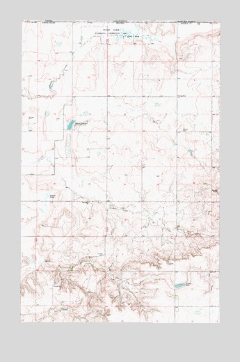
Si Merrell Slough, MT USGS Topographic Map
Click on map above to begin viewing in our Map Viewer.

This topographic map contains these locations and features:
Feature Name Type Latitude Longitude GNIS ID View Map
36N49E03CBBD01 WellWellN48.9022°W105.2980°1636981View Map
36N49E04CCCD01 WellWellN48.8967°W105.3203°1636961View Map
36N49E05CCAD01 WellWellN48.8986°W105.3389°1636966View Map
36N49E07ACAC01 WellWellN48.8914°W105.3525°1636941View Map
36N49E07DDCB01 WellWellN48.8836°W105.3489°1636920View Map
36N49E09BDAA01 WellWellN48.8922°W105.3125°1636944View Map
37N48E23BBDC01 WellWellN48.9509°W105.3625°1637156View Map
37N48E23CDBB01 WellWellN48.9428°W105.3586°1637131View Map
37N48E23CDBB02 WellWellN48.9425°W105.3592°1637130View Map
37N48E25CBCD01 WellWellN48.9292°W105.3405°1637075View Map
37N48E26CBCA01 WellWellN48.9303°W105.3642°1637085View Map
37N48E26DAAC01 WellWellN48.9309°W105.3455°1637088View Map
37N48E35CBCD01 WellWellN48.9150°W105.3605°1637030View Map
37N49E04CCCB01 WellWellN48.9842°W105.2761°1637297View Map
37N49E05AAAA01 WellWellN48.9986°W105.2778°1637362View Map
37N49E05AAAB01 WellWellN48.9986°W105.2789°1637363View Map
37N49E10BCCC01 WellWellN48.9767°W105.2544°1637261View Map
37N49E16CDAA01 WellWellN48.9572°W105.2664°1637191View Map
37N49E16DCBB01 WellWellN48.9572°W105.2655°1637190View Map
37N49E16DDDD01 WellWellN48.9553°W105.2564°1637180View Map
37N49E17DDDD01 WellWellN48.9550°W105.2780°1637175View Map
37N49E18ABAD01 WellWellN48.9675°W105.3064°1637223View Map
37N49E18ABAD02 WellWellN48.9678°W105.3064°1637224View Map
37N49E18BCCC01 WellWellN48.9617°W105.3203°1637202View Map
37N49E18BCCC02 WellWellN48.9622°W105.3200°1637208View Map
37N49E19BCCC01 WellWellN48.9478°W105.3208°1637149View Map
37N49E19DD__01 WellWellN48.9417°W105.3044°1637128View Map
37N49E20AAAA01 WellWellN48.9542°W105.2778°1637174View Map
37N49E20CCCC01 WellWellN48.9403°W105.2983°1637117View Map
37N49E20CCCC02 WellWellN48.9403°W105.2986°1637118View Map
37N49E28DDAA01 WellWellN48.9284°W105.2567°1637073View Map
37N49E30CCDB01 WellWellN48.9270°W105.3183°1637068View Map
37N49E32DBBD01 WellWellN48.9161°W105.2864°1637041View Map
37N49E33DCBD01 WellWellN48.9128°W105.2650°1637018View Map
Baby Blue DamDamN48.9467°W105.2839°798145View Map
Daniels County Waterfowl Production AreaParkN48.9949°W105.3049°2765264View Map
Jagiello Waterfowl Production AreaParkN48.9570°W105.3439°772787View Map
Julian (historical)Populated PlaceN48.9425°W105.3589°1637394View Map
Julian Erickson School (historical)SchoolN48.9425°W105.3589°1637445View Map
Julian Post Office (historical)Post OfficeN48.9425°W105.3589°1637395View Map
Outlet Marsh Waterfowl Production AreaParkN48.9961°W105.3122°775005View Map
Paradis PondLakeN48.8906°W105.2755°775074View Map
Si Merrell SloughLakeN48.9942°W105.3063°776532View Map
Square ButteSummitN48.9297°W105.2505°791363View Map
Willard SloughSwampN48.9275°W105.3586°778508View Map

Note: Coordinates in the location and feature list above are referenced to NAD83 datum.


Copyright (C) 2008-2025 Ryan Niemi / Sunset Dynamics ... All Rights Reserved