TopoQuest Logo
Do you find TopoQuest useful?
Help keep TopoQuest running and adding new maps/features by donating!
Bitcoin:  19c7KJd3qBynnjoSw5npx9KScwjBe4ifkT
Litecoin:  LXs6TkuXGGXo1vDsWCkWVdjQX94eUKd6ui
Home View Maps Find Maps Find Places Resources & Links


Sibley Hole, New Mexico Topographic Map

USGS Map Title: Sibley Hole, NM
USGS Map MRC: 32107A4
DRG (GeoTIFF) Download: o32107a4.tif


Neighboring USGS Topographic Map Quads:


  Florida Gap, NM  
32107B5
 

  Akela, NM  
32107B4
 

  Cambray, NM  
32107B3
 

  Gym Peak, NM  
32107A5
 

  Sibley Hole, NM  
32107A4
 

  X-7 Ranch, NM  
32107A3
 

  Columbus NE, NM  
31107H5
 

  Mesquite Lake, NM  
31107H4
 

  P O L Ranch, NM  
31107H3


Map MRC Location:

N33°
W108°
N33°
W107°
H8 H7 H6 H5 H4 H3 H2 H1
G8 G7 G6 G5 G4 G3 G2 G1
F8 F7 F6 F5 F4 F3 F2 F1
E8 E7 E6 E5 E4 E3 E2 E1
D8 D7 D6 D5 D4 D3 D2 D1
C8 C7 C6 C5 C4 C3 C2 C1
B8 B7 B6 B5 B4 B3 B2 B1
A8 A7 A6 A5 A4 A3 A2 A1
N32°
W108°
N32°
W107°

Sibley Hole, NM USGS 1:24K Topographic Map Preview:
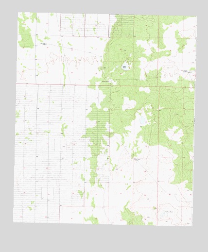
Sibley Hole, NM USGS Topographic Map
Click on map above to begin viewing in our Map Viewer.

This topographic map contains these locations and features:
Feature Name Type Latitude Longitude GNIS ID View Map
01465 Water WellWellN32.1045°W107.4781°930195View Map
01628 Water WellWellN32.0379°W107.4167°930289View Map
01629 Water WellWellN32.0393°W107.4164°922431View Map
01678 Water WellWellN32.0918°W107.3807°922432View Map
06052 Water WellWellN32.1034°W107.4989°921644View Map
06053 Water WellWellN32.0918°W107.3805°930296View Map
06067 Water WellWellN32.0279°W107.4803°930205View Map
06068 Water WellWellN32.0606°W107.4847°930199View Map
06069 Water WellWellN32.0823°W107.4592°930294View Map
10292 Water WellWellN32.1115°W107.4992°930301View Map
Blanco TankReservoirN32.0066°W107.3966°886485View Map
Board Ranch WindmillLocaleN32.0393°W107.4167°886546View Map
Brushy TankReservoirN32.0850°W107.4350°886806View Map
High Lonesome WindmillLocaleN32.0918°W107.3806°889962View Map
Sibley HoleLakeN32.0938°W107.4246°894824View Map
Wet King MineMineN32.0501°W107.4172°915425View Map
White House RanchLocaleN32.1059°W107.4803°896501View Map

Note: Coordinates in the location and feature list above are referenced to NAD83 datum.


Copyright (C) 2008-2025 Ryan Niemi / Sunset Dynamics ... All Rights Reserved