TopoQuest Logo
Do you find TopoQuest useful?
Help keep TopoQuest running and adding new maps/features by donating!
Bitcoin:  19c7KJd3qBynnjoSw5npx9KScwjBe4ifkT
Litecoin:  LXs6TkuXGGXo1vDsWCkWVdjQX94eUKd6ui
Home View Maps Find Maps Find Places Resources & Links


Sierra Blanca, Texas Topographic Map

USGS Map Title: Sierra Blanca, TX
USGS Map MRC: 31105B3
DRG (GeoTIFF) Download: o31105b3.tif


Neighboring USGS Topographic Map Quads:


  Gunsight Hills South, TX  
31105C4
 

  Pierce Ranch, TX  
31105C3
 

  Movie Mountain, TX  
31105C2
 

  Lasca, TX  
31105B4
 

  Sierra Blanca, TX  
31105B3
 

  Dome Peak, TX  
31105B2
 

  Sierra Blanca SW, TX  
31105A4
 

  Devil Ridge, TX  
31105A3
 

  Grayton Lake, TX  
31105A2


Map MRC Location:

N32°
W106°
N32°
W105°
H8 H7 H6 H5 H4 H3 H2 H1
G8 G7 G6 G5 G4 G3 G2 G1
F8 F7 F6 F5 F4 F3 F2 F1
E8 E7 E6 E5 E4 E3 E2 E1
D8 D7 D6 D5 D4 D3 D2 D1
C8 C7 C6 C5 C4 C3 C2 C1
B8 B7 B6 B5 B4 B3 B2 B1
A8 A7 A6 A5 A4 A3 A2 A1
N31°
W106°
N31°
W105°

Sierra Blanca, TX USGS 1:24K Topographic Map Preview:
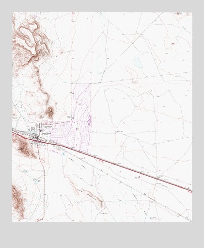
Sierra Blanca, TX USGS Topographic Map
Click on map above to begin viewing in our Map Viewer.

This topographic map contains these locations and features:
Feature Name Type Latitude Longitude GNIS ID View Map
ArispePopulated PlaceN31.1512°W105.2750°1379359View Map
Blount TankReservoirN31.1791°W105.3036°1352435View Map
Corner TankReservoirN31.1875°W105.3348°1355008View Map
Cross Tracks TankReservoirN31.1273°W105.2802°1355409View Map
Faskin RanchLocaleN31.1479°W105.2750°1357263View Map
Gladys TankReservoirN31.1302°W105.3138°1358047View Map
Hudspeth County Constable's Office Precinct 1BuildingN31.1798°W105.3575°2750779View Map
Hudspeth County Constable's Office Precinct 2BuildingN31.1798°W105.3576°2750778View Map
Hudspeth County JailBuildingN31.1807°W105.3575°2738860View Map
Hudspeth County Sheriff's OfficeBuildingN31.1805°W105.3575°2750483View Map
Sand MountainSummitN31.1437°W105.3258°1367629View Map
Sierra BlancaPopulated PlaceN31.1746°W105.3572°1368253View Map
Sierra Blanca Census Designated PlaceCensusN31.1834°W105.3395°2408735View Map
Sierra Blanca HeliportAirportN31.1668°W105.3591°1387546View Map
Sierra Blanca Post OfficePost OfficeN31.1759°W105.3600°2732001View Map
Sierra Blanca SchoolSchoolN31.1795°W105.3560°2006264View Map
Stray TankReservoirN31.1497°W105.3582°1369271View Map
Stray TankReservoirN31.1553°W105.3654°1369272View Map
Texan MountainSummitN31.1682°W105.3675°1369750View Map
United States Border Patrol StationBuildingN31.1716°W105.3371°2750839View Map

Note: Coordinates in the location and feature list above are referenced to NAD83 datum.


Copyright (C) 2008-2025 Ryan Niemi / Sunset Dynamics ... All Rights Reserved