TopoQuest Logo
Do you find TopoQuest useful?
Help keep TopoQuest running and adding new maps/features by donating!
Bitcoin:  19c7KJd3qBynnjoSw5npx9KScwjBe4ifkT
Litecoin:  LXs6TkuXGGXo1vDsWCkWVdjQX94eUKd6ui
Home View Maps Find Maps Find Places Resources & Links


Sierraville, California Topographic Map

USGS Map Title: Sierraville, CA
USGS Map MRC: 39120E3
DRG (GeoTIFF) Download: o39120e3.tif


Neighboring USGS Topographic Map Quads:


  Calpine, CA  
39120F4
 

  Antelope Valley, CA  
39120F3
 

  Loyalton, CA  
39120F2
 

  Sattley, CA  
39120E4
 

  Sierraville, CA  
39120E3
 

  Sardine Peak, CA  
39120E2
 

  Webber Peak, CA  
39120D4
 

  Independence Lake, CA  
39120D3
 

  Hobart Mills, CA  
39120D2


Map MRC Location:

N40°
W121°
N40°
W120°
H8 H7 H6 H5 H4 H3 H2 H1
G8 G7 G6 G5 G4 G3 G2 G1
F8 F7 F6 F5 F4 F3 F2 F1
E8 E7 E6 E5 E4 E3 E2 E1
D8 D7 D6 D5 D4 D3 D2 D1
C8 C7 C6 C5 C4 C3 C2 C1
B8 B7 B6 B5 B4 B3 B2 B1
A8 A7 A6 A5 A4 A3 A2 A1
N39°
W121°
N39°
W120°

Sierraville, CA USGS 1:24K Topographic Map Preview:
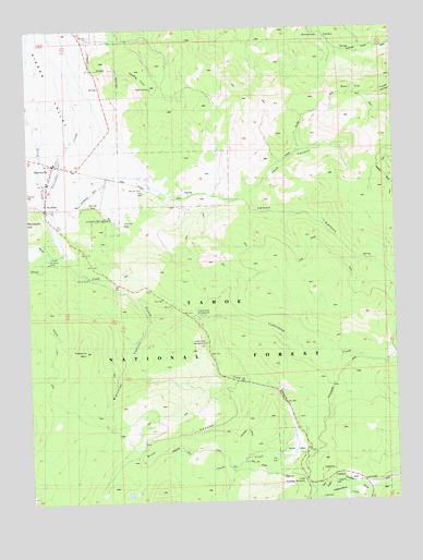
Sierraville, CA USGS Topographic Map
Click on map above to begin viewing in our Map Viewer.

This topographic map contains these locations and features:
Feature Name Type Latitude Longitude GNIS ID View Map
Bear FlatFlatN39.6085°W120.2644°1666575View Map
Blatchley CanyonValleyN39.5474°W120.3355°219446View Map
Bonta CreekStreamN39.5663°W120.3635°254646View Map
Campbell Hot SpringsPopulated PlaceN39.5749°W120.3480°1658205View Map
Canyon RanchLocaleN39.5599°W120.3560°220564View Map
Cold Creek CampgroundLocaleN39.5427°W120.3158°221323View Map
Cold StreamStreamN39.5774°W120.3683°221346View Map
Cottonwood Botanical TrailTrailN39.5482°W120.3155°276093View Map
Cottonwood CampgroundLocaleN39.5493°W120.3174°1666581View Map
Cottonwood CreekStreamN39.5471°W120.3205°221644View Map
Cottonwood Fisherman TrailTrailN39.5463°W120.2977°276092View Map
Cottonwood Overlook TrailTrailN39.5455°W120.3135°276091View Map
Dark CanyonValleyN39.5805°W120.3030°222018View Map
Deer Lake TrailTrailN39.5877°W120.3683°276088View Map
East Sierra DivisionCivilN39.5840°W120.2733°1935087View Map
Harding PointSummitN39.6138°W120.3391°224923View Map
Independence CreekStreamN39.5021°W120.2608°225842View Map
Lemon CanyonValleyN39.5802°W120.3030°227020View Map
Little Truckee SummitGapN39.5049°W120.2819°1666589View Map
Monte Carlo Saloon (historical)BuildingN39.5891°W120.3669°1733172View Map
Onion CreekStreamN39.5291°W120.2921°234413View Map
Onion ValleyValleyN39.5210°W120.2869°230056View Map
RandolphPopulated PlaceN39.5796°W120.3708°1659468View Map
Rice CanyonValleyN39.5307°W120.3044°231525View Map
Sierra County Fire Protection District 1BuildingN39.5892°W120.3666°2621844View Map
SierravillePopulated PlaceN39.5896°W120.3674°233103View Map
Sierraville Census Designated PlaceCensusN39.5750°W120.3638°2583141View Map
Sierraville Dearwater AirportAirportN39.5836°W120.3505°1654012View Map
Sierraville Elementary SchoolSchoolN39.5843°W120.3691°1733182View Map
Sierraville Post OfficePost OfficeN39.5846°W120.3685°1733183View Map
Sierraville Ranger StationLocaleN39.5877°W120.3683°276087View Map
Treasure MountainSummitN39.5399°W120.3574°236530View Map

Note: Coordinates in the location and feature list above are referenced to NAD83 datum.


Copyright (C) 2008-2024 Ryan Niemi / Sunset Dynamics ... All Rights Reserved