TopoQuest Logo
Do you find TopoQuest useful?
Help keep TopoQuest running and adding new maps/features by donating!
Bitcoin:  19c7KJd3qBynnjoSw5npx9KScwjBe4ifkT
Litecoin:  LXs6TkuXGGXo1vDsWCkWVdjQX94eUKd6ui
Home View Maps Find Maps Find Places Resources & Links


Siloam Springs, Arkansas Topographic Map

USGS Map Title: Siloam Springs, AR
USGS Map MRC: 36094B5
DRG (GeoTIFF) Download: o36094b5.tif


Neighboring USGS Topographic Map Quads:


  Colcord, OK  
36094C6
 

  Cherokee City, AR  
36094C5
 

  Gentry, AR  
36094C4
 

  Siloam Springs NW, OK  
36094B6
 

  Siloam Springs, AR  
36094B5
 

  Gallatin, AR  
36094B4
 

  Chance, OK  
36094A6
 

  Watts, OK  
36094A5
 

  Rhea, AR  
36094A4


Map MRC Location:

N37°
W95°
N37°
W94°
H8 H7 H6 H5 H4 H3 H2 H1
G8 G7 G6 G5 G4 G3 G2 G1
F8 F7 F6 F5 F4 F3 F2 F1
E8 E7 E6 E5 E4 E3 E2 E1
D8 D7 D6 D5 D4 D3 D2 D1
C8 C7 C6 C5 C4 C3 C2 C1
B8 B7 B6 B5 B4 B3 B2 B1
A8 A7 A6 A5 A4 A3 A2 A1
N36°
W95°
N36°
W94°

Siloam Springs, AR USGS 1:24K Topographic Map Preview:
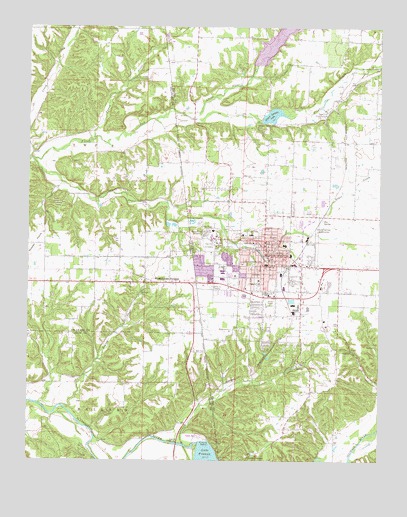
Siloam Springs, AR USGS Topographic Map
Click on map above to begin viewing in our Map Viewer.

This topographic map contains these locations and features:
Feature Name Type Latitude Longitude GNIS ID View Map
Allen ElementarySchoolN36.1989°W94.5438°2121456View Map
Arkansas Baptist CampLocaleN36.1515°W94.5316°75366View Map
Baptist Assembly ChurchChurchN36.1523°W94.5308°75370View Map
Bell CemeteryCemeteryN36.1568°W94.5657°1089978View Map
Blagg CemeteryCemeteryN36.2226°W94.5438°76374View Map
Box SpringSpringN36.1948°W94.5202°46864View Map
City of Siloam SpringsCivilN36.1838°W94.5319°2405464View Map
Dawn HillPopulated PlaceN36.2329°W94.5136°75460View Map
Dawn Hill Country ClubLocaleN36.2265°W94.5186°82012View Map
Duckworth School (historical)SchoolN36.1306°W94.5336°75478View Map
Fagan CreekStreamN36.2179°W94.6011°76893View Map
Frances DamDamN36.1284°W94.5636°1757913View Map
Friendship School (historical)SchoolN36.1429°W94.5186°75520View Map
Gunter CemeteryCemeteryN36.1890°W94.5369°49741View Map
HicoPopulated PlaceN36.1904°W94.5411°75550View Map
Jaybird School (historical)SchoolN36.1734°W94.5152°75570View Map
John Brown UniversitySchoolN36.1912°W94.5588°77380View Map
KLRC-FM (Siloam Springs)TowerN36.1904°W94.5655°85427View Map
KMCK-FM (Siloam Springs)TowerN36.1904°W94.5655°85426View Map
KUOA-AM (Siloam Springs)TowerN36.1904°W94.5655°85342View Map
Lake FrancesReservoirN36.1275°W94.5613°75714View Map
Lake FrancesPopulated PlaceN36.1265°W94.5463°77432View Map
Landmark ChurchChurchN36.1706°W94.5405°50977View Map
Little Flint CreekStreamN36.2240°W94.5649°51266View Map
Little Flint Creek DamDamN36.2384°W94.5419°80916View Map
Northside Elementary SchoolSchoolN36.1904°W94.5459°83477View Map
Oak Hill CemeteryCemeteryN36.1873°W94.5602°52926View Map
Old Baptist CemeteryCemeteryN36.1887°W94.5389°2354449View Map
Perry Williams DamDamN36.1717°W94.6169°1755763View Map
Perry Williams ReservoirReservoirN36.1724°W94.6165°1755764View Map
Prairie View School (historical)SchoolN36.2067°W94.5533°75979View Map
Pulse Emergency Medical ServicesBuildingN36.1851°W94.5418°2119214View Map
Sager CreekStreamN36.2115°W94.6230°73449View Map
Siloam SpringsPopulated PlaceN36.1881°W94.5405°78364View Map
Siloam Springs Advanced Life Support / Rescue Station 2BuildingN36.1848°W94.5412°2119213View Map
Siloam Springs Advanced Life Support Fire Station 2BuildingN36.1851°W94.5418°2117127View Map
Siloam Springs Fire Department Station 1 HeadquartersBuildingN36.1955°W94.5273°2117125View Map
Siloam Springs Fire Department Station 3BuildingN36.1681°W94.5278°2117126View Map
Siloam Springs Golf CourseLocaleN36.1917°W94.5216°82554View Map
Siloam Springs High SchoolSchoolN36.1910°W94.5136°76024View Map
Siloam Springs Junior High SchoolSchoolN36.1759°W94.5430°76025View Map
Siloam Springs LakeReservoirN36.2247°W94.5385°78365View Map
Siloam Springs Lake DamDamN36.2234°W94.5419°79701View Map
Siloam Springs Memorial HospitalHospitalN36.1819°W94.5407°76026View Map
Siloam Springs Memorial Hospital HeliportAirportN36.1815°W94.5411°83835View Map
Siloam Springs Middle SchoolSchoolN36.1804°W94.5558°2038987View Map
Siloam Springs Municipal ParkParkN36.1834°W94.5405°76027View Map
Siloam Springs Police DepartmentBuildingN36.1883°W94.5412°2119001View Map
Siloam Springs Post OfficePost OfficeN36.1867°W94.5402°84636View Map
Southside Elementary SchoolSchoolN36.1768°W94.5432°2038986View Map
Southside Elementary SchoolSchoolN36.1773°W94.5433°76030View Map
Southside West Elementary SchoolSchoolN36.1768°W94.5441°2038988View Map
Town of West Siloam SpringsCivilN36.1756°W94.5941°2413468View Map
Township 12CivilN36.2392°W94.5237°1989197View Map
Township of Hico (historical)CivilN36.1806°W94.5197°69587View Map
Twin SpringsPopulated PlaceN36.1826°W94.5483°76063View Map
Twin Springs ParkParkN36.1829°W94.5458°76062View Map
West Siloam SpringsPopulated PlaceN36.1762°W94.5749°1099609View Map
West Siloam Springs Police DepartmentBuildingN36.1767°W94.5943°2757710View Map

Note: Coordinates in the location and feature list above are referenced to NAD83 datum.


Copyright (C) 2008-2024 Ryan Niemi / Sunset Dynamics ... All Rights Reserved