TopoQuest Logo
Do you find TopoQuest useful?
Help keep TopoQuest running and adding new maps/features by donating!
Bitcoin:  19c7KJd3qBynnjoSw5npx9KScwjBe4ifkT
Litecoin:  LXs6TkuXGGXo1vDsWCkWVdjQX94eUKd6ui
Home View Maps Find Maps Find Places Resources & Links


Silver Canyon, Nevada Topographic Map

USGS Map Title: Silver Canyon, NV
USGS Map MRC: 39114F5
DRG (GeoTIFF) Download: o39114f5.tif


Neighboring USGS Topographic Map Quads:


  Schellbourne, NV  
39114G6
 

  Stonehouse, NV  
39114G5
 

  Rock Springs Pass, NV  
39114G4
 

  Mattier Creek, NV  
39114F6
 

  Silver Canyon, NV  
39114F5
 

  Tippett Pass, NV  
39114F4
 

  Kalamazoo Summit, NV  
39114E6
 

  Kalamazoo Creek, NV  
39114E5
 

  Big Hard Pan, NV  
39114E4


Map MRC Location:

N40°
W115°
N40°
W114°
H8 H7 H6 H5 H4 H3 H2 H1
G8 G7 G6 G5 G4 G3 G2 G1
F8 F7 F6 F5 F4 F3 F2 F1
E8 E7 E6 E5 E4 E3 E2 E1
D8 D7 D6 D5 D4 D3 D2 D1
C8 C7 C6 C5 C4 C3 C2 C1
B8 B7 B6 B5 B4 B3 B2 B1
A8 A7 A6 A5 A4 A3 A2 A1
N39°
W115°
N39°
W114°

Silver Canyon, NV USGS 1:24K Topographic Map Preview:
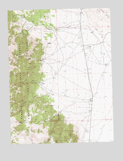
Silver Canyon, NV USGS Topographic Map
Click on map above to begin viewing in our Map Viewer.

This topographic map contains these locations and features:
Feature Name Type Latitude Longitude GNIS ID View Map
Aurum (historical)Populated PlaceN39.7033°W114.5847°862317View Map
Aurum MillLocaleN39.7030°W114.5809°855658View Map
Aurum Post Office (historical)Post OfficeN39.7033°W114.5847°864514View Map
Centerville (historical)Populated PlaceN39.7433°W114.6089°862302View Map
Doutre RanchLocaleN39.7277°W114.5228°862306View Map
Fera Ninty FiveSpringN39.6541°W114.5931°862790View Map
Fera One Hundred FiveSpringN39.6888°W114.5934°862788View Map
Frenchman CreekStreamN39.6630°W114.5481°859770View Map
Greek American MineMineN39.7074°W114.6147°862310View Map
Little Flower MineMineN39.7377°W114.5947°853254View Map
Lucky Deposit MineMineN39.6988°W114.5856°853255View Map
McCurdy GardenAreaN39.7183°W114.5759°862307View Map
Mud SpringsSpringN39.7199°W114.5812°862637View Map
Negro AbesLocaleN39.6638°W114.5264°862316View Map
North CanyonValleyN39.6808°W114.5878°862636View Map
North Canyon SpringSpringN39.6813°W114.5911°862789View Map
North CreekStreamN39.6702°W114.5797°860748View Map
Osborne SpringsSpringN39.7135°W114.5272°862308View Map
Pierce RanchLocaleN39.7458°W114.5361°862303View Map
Ruby CreekStreamN39.6655°W114.5995°862314View Map
Sagehen CanyonValleyN39.6438°W114.5997°862318View Map
Sanford CanyonValleyN39.6974°W114.5872°862312View Map
Siegel (historical)Populated PlaceN39.7310°W114.6017°862304View Map
Siegel CreekStreamN39.7355°W114.5272°861312View Map
Siegel MinesMineN39.7291°W114.6092°862231View Map
Siegel Post Office (historical)Post OfficeN39.7310°W114.6017°864520View Map
Siegel RanchLocaleN39.7310°W114.5661°862305View Map
Signal MineMineN39.7047°W114.5995°853235View Map
Silver CanyonValleyN39.7027°W114.5820°862311View Map
Snowbank CanyonValleyN39.6702°W114.5767°862315View Map
SunkistLocaleN39.6810°W114.5856°862313View Map
Willow SpringSpringN39.6967°W114.5069°862309View Map

Note: Coordinates in the location and feature list above are referenced to NAD83 datum.


Copyright (C) 2008-2025 Ryan Niemi / Sunset Dynamics ... All Rights Reserved