TopoQuest Logo
Do you find TopoQuest useful?
Help keep TopoQuest running and adding new maps/features by donating!
Bitcoin:  19c7KJd3qBynnjoSw5npx9KScwjBe4ifkT
Litecoin:  LXs6TkuXGGXo1vDsWCkWVdjQX94eUKd6ui
Home View Maps Find Maps Find Places Resources & Links


Silver City, Montana Topographic Map

USGS Map Title: Silver City, MT
USGS Map MRC: 46112G2
DRG (GeoTIFF) Download: o46112g2.tif


Neighboring USGS Topographic Map Quads:


  Wilborn, MT  
46112H3
 

  Mitchell Mountain, MT  
46112H2
 

  Sheep Creek, MT  
46112H1
 

  Canyon Creek, MT  
46112G3
 

  Silver City, MT  
46112G2
 

  Rattlesnake Mountain, MT  
46112G1
 

  Greenhorn Mountain, MT  
46112F3
 

  Austin, MT  
46112F2
 

  Scratchgravel Hills, MT  
46112F1


Map MRC Location:

N47°
W113°
N47°
W112°
H8 H7 H6 H5 H4 H3 H2 H1
G8 G7 G6 G5 G4 G3 G2 G1
F8 F7 F6 F5 F4 F3 F2 F1
E8 E7 E6 E5 E4 E3 E2 E1
D8 D7 D6 D5 D4 D3 D2 D1
C8 C7 C6 C5 C4 C3 C2 C1
B8 B7 B6 B5 B4 B3 B2 B1
A8 A7 A6 A5 A4 A3 A2 A1
N46°
W113°
N46°
W112°

Silver City, MT USGS 1:24K Topographic Map Preview:
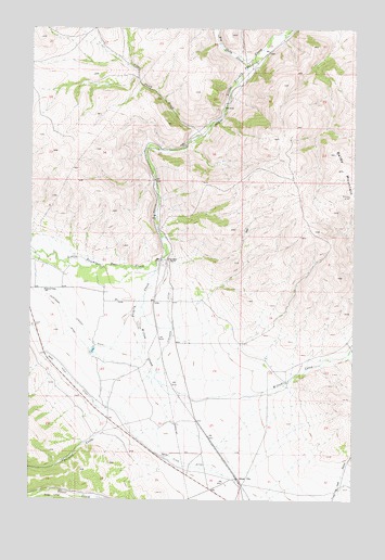
Silver City, MT USGS Topographic Map
Click on map above to begin viewing in our Map Viewer.

This topographic map contains these locations and features:
Feature Name Type Latitude Longitude GNIS ID View Map
Argo MillsiteMineN46.7505°W112.2436°803980View Map
Baldy MountainSummitN46.8308°W112.1275°800383View Map
Bayliss (historical)LocaleN46.7513°W112.2342°1789299View Map
Big Sheep CreekStreamN46.8649°W112.1678°800449View Map
Canyon Creek SchoolSchoolN46.8055°W112.2453°800549View Map
Chevallier RanchLocaleN46.8138°W112.1981°800584View Map
Gans Klein DitchCanalN46.7769°W112.2270°800825View Map
Johns (historical)LocaleN46.8138°W112.1981°1789270View Map
Justisson DitchCanalN46.7963°W112.2367°801004View Map
Little Sheep CreekStreamN46.8497°W112.1814°801079View Map
Marysville Junction (historical)LocaleN46.7505°W112.2397°1789134View Map
Silver CityLocaleN46.7555°W112.1697°1789258View Map
Silver CityPopulated PlaceN46.7555°W112.1697°801454View Map
Silver Post Office (historical)Post OfficeN46.7555°W112.1697°1789259View Map
Silver School (historical)SchoolN46.7555°W112.1697°1789257View Map
Trinity (historical)Populated PlaceN46.7694°W112.2175°1789241View Map
Trinity CreekStreamN46.8124°W112.2025°801617View Map
Vincent DitchCanalN46.7944°W112.2297°801649View Map
Willow CreekStreamN46.8038°W112.2072°801700View Map

Note: Coordinates in the location and feature list above are referenced to NAD83 datum.


Copyright (C) 2008-2024 Ryan Niemi / Sunset Dynamics ... All Rights Reserved