TopoQuest Logo
Do you find TopoQuest useful?
Help keep TopoQuest running and adding new maps/features by donating!
Bitcoin:  19c7KJd3qBynnjoSw5npx9KScwjBe4ifkT
Litecoin:  LXs6TkuXGGXo1vDsWCkWVdjQX94eUKd6ui
Home View Maps Find Maps Find Places Resources & Links


Slaton, Texas Topographic Map

USGS Map Title: Slaton, TX
USGS Map MRC: 33101D6
DRG (GeoTIFF) Download: o33101d6.tif


Neighboring USGS Topographic Map Quads:


  Lubbock East, TX  
33101E7
 

  Buffalo Springs Lake, TX  
33101E6
 

  Acuff, TX  
33101E5
 

  Woodrow, TX  
33101D7
 

  Slaton, TX  
33101D6
 

  Slaton NE, TX  
33101D5
 

  New Home SE, TX  
33101C7
 

  Wilson, TX  
33101C6
 

  Southland, TX  
33101C5


Map MRC Location:

N34°
W102°
N34°
W101°
H8 H7 H6 H5 H4 H3 H2 H1
G8 G7 G6 G5 G4 G3 G2 G1
F8 F7 F6 F5 F4 F3 F2 F1
E8 E7 E6 E5 E4 E3 E2 E1
D8 D7 D6 D5 D4 D3 D2 D1
C8 C7 C6 C5 C4 C3 C2 C1
B8 B7 B6 B5 B4 B3 B2 B1
A8 A7 A6 A5 A4 A3 A2 A1
N33°
W102°
N33°
W101°

Slaton, TX USGS 1:24K Topographic Map Preview:
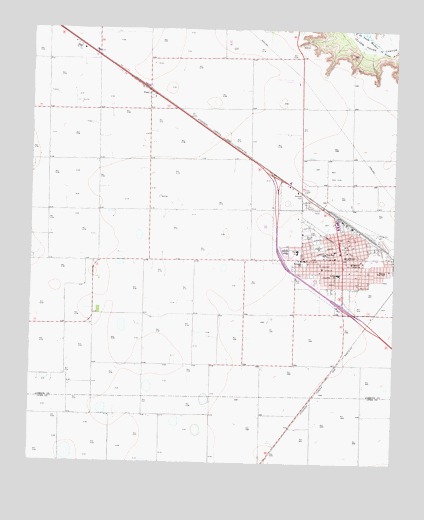
Slaton, TX USGS Topographic Map
Click on map above to begin viewing in our Map Viewer.

This topographic map contains these locations and features:
Feature Name Type Latitude Longitude GNIS ID View Map
Austin Elementary SchoolSchoolN33.4331°W101.6410°2007842View Map
Bible Baptist ChurchChurchN33.4409°W101.6499°2022530View Map
Church of GodChurchN33.4395°W101.6418°2022485View Map
City of SlatonCivilN33.4421°W101.6476°2411908View Map
Englewood CemeteryCemeteryN33.4501°W101.6560°1357027View Map
Evans High SchoolSchoolN33.4306°W101.6285°1357103View Map
First United Methodist Church of SlatonChurchN33.4365°W101.6454°2022397View Map
Freewill Baptist ChurchChurchN33.4287°W101.6313°2022559View Map
Grace Lutheran ChurchChurchN33.4301°W101.6513°2022389View Map
KCAS-AM (Slaton)TowerN33.4495°W101.6554°1387886View Map
KJAK-FM (Slaton)TowerN33.4940°W101.7341°1388086View Map
Lutheran Church GraceChurchN33.4301°W101.6513°2022390View Map
Mercy HospitalHospitalN33.4337°W101.6563°1362627View Map
Number One Church of God and ChristChurchN33.4312°W101.6279°2022488View Map
Our Lady of Guadalupe ChurchChurchN33.4340°W101.6368°2022463View Map
PoseyPopulated PlaceN33.4826°W101.7102°1365617View Map
Saint Joseph SchoolSchoolN33.4337°W101.6577°1367212View Map
Saint Josephs Catholic ChurchChurchN33.4345°W101.6565°2022465View Map
SlatonPopulated PlaceN33.4373°W101.6435°1368404View Map
Slaton City HallBuildingN33.4375°W101.6434°2753930View Map
Slaton DivisionCivilN33.4881°W101.6547°1939200View Map
Slaton Emergency Medical ServiceBuildingN33.4395°W101.6437°2656151View Map
Slaton Fire DepartmentBuildingN33.4365°W101.6422°2552070View Map
Slaton High SchoolSchoolN33.4359°W101.6577°2007702View Map
Slaton Junior High SchoolSchoolN33.4301°W101.6424°2007703View Map
Slaton Municipal AirportAirportN33.4856°W101.6589°1387551View Map
Slaton MuseumBuildingN33.4373°W101.6429°2014566View Map
Slaton Police DepartmentBuildingN33.4390°W101.6434°2750315View Map
Slaton Post OfficePost OfficeN33.4394°W101.6441°2732129View Map
Southland SchoolSchoolN33.4276°W101.6421°2005610View Map
Stephan F Austin SchoolSchoolN33.4329°W101.6402°1369168View Map
Texas Air MuseumBuildingN33.4456°W101.6707°2014567View Map
Tiger FieldParkN33.4409°W101.6518°1369934View Map
Triumph Baptist ChurchChurchN33.4312°W101.6285°2022457View Map
Twenty First Street Baptist ChurchChurchN33.4298°W101.6582°2022458View Map
West Ward Elementary SchoolSchoolN33.4359°W101.6496°2007709View Map
West Ward SchoolSchoolN33.4354°W101.6490°1371258View Map
Westview Baptist ChurchChurchN33.4318°W101.6507°2022462View Map

Note: Coordinates in the location and feature list above are referenced to NAD83 datum.


Copyright (C) 2008-2025 Ryan Niemi / Sunset Dynamics ... All Rights Reserved