TopoQuest Logo
Do you find TopoQuest useful?
Help keep TopoQuest running and adding new maps/features by donating!
Bitcoin:  19c7KJd3qBynnjoSw5npx9KScwjBe4ifkT
Litecoin:  LXs6TkuXGGXo1vDsWCkWVdjQX94eUKd6ui
Home View Maps Find Maps Find Places Resources & Links


Smith Lake, Nebraska Topographic Map

USGS Map Title: Smith Lake, NE
USGS Map MRC: 42102D4
DRG (GeoTIFF) Download: o42102d4.tif


Neighboring USGS Topographic Map Quads:


  Hay Springs SE, NE  
42102E5
 

  Rushville SW, NE  
42102E4
 

  Rushville SE, NE  
42102E3
 

  Skunk Lake NE, NE  
42102D5
 

  Smith Lake, NE  
42102D4
 

  Twin Lakes NE, NE  
42102D3
 

  Skunk Lake, NE  
42102C5
 

  Twin Lakes, NE  
42102C4
 

  Green Lake, NE  
42102C3


Map MRC Location:

N43°
W103°
N43°
W102°
H8 H7 H6 H5 H4 H3 H2 H1
G8 G7 G6 G5 G4 G3 G2 G1
F8 F7 F6 F5 F4 F3 F2 F1
E8 E7 E6 E5 E4 E3 E2 E1
D8 D7 D6 D5 D4 D3 D2 D1
C8 C7 C6 C5 C4 C3 C2 C1
B8 B7 B6 B5 B4 B3 B2 B1
A8 A7 A6 A5 A4 A3 A2 A1
N42°
W103°
N42°
W102°

Smith Lake, NE USGS 1:24K Topographic Map Preview:
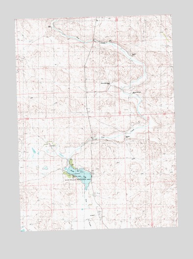
Smith Lake, NE USGS Topographic Map
Click on map above to begin viewing in our Map Viewer.

This topographic map contains these locations and features:
Feature Name Type Latitude Longitude GNIS ID View Map
Blaine and Blake Beguin RanchLocaleN42.4603°W102.4269°835138View Map
Bob Beguin RanchLocaleN42.4291°W102.4158°835139View Map
Boiling Springs Public SchoolSchoolN42.4264°W102.4421°1832172View Map
Britt RanchLocaleN42.4855°W102.4263°835135View Map
Budd RanchLocaleN42.4966°W102.4727°835134View Map
Grayson (historical)Populated PlaceN42.4603°W102.4260°1832155View Map
Grayson Post Office (historical)Post OfficeN42.4603°W102.4260°1832154View Map
Hinn RanchLocaleN42.4247°W102.4755°1812144View Map
Orr AirportAirportN42.3839°W102.4388°837614View Map
Orr RanchLocaleN42.3833°W102.4435°835140View Map
Pine Creek RanchLocaleN42.4761°W102.4096°835136View Map
School Number 112 (historical)SchoolN42.4894°W102.4983°835189View Map
School Number 132SchoolN42.4583°W102.4435°835137View Map
School Number 32 (historical)SchoolN42.4591°W102.4027°835208View Map
Smith LakeLakeN42.4069°W102.4513°1768272View Map
Smith Lake DamDamN42.4131°W102.4597°1768271View Map
Smith Lake State Wildlife Management AreaParkN42.4078°W102.4533°1812143View Map

Note: Coordinates in the location and feature list above are referenced to NAD83 datum.


Copyright (C) 2008-2025 Ryan Niemi / Sunset Dynamics ... All Rights Reserved