TopoQuest Logo
Do you find TopoQuest useful?
Help keep TopoQuest running and adding new maps/features by donating!
Bitcoin:  19c7KJd3qBynnjoSw5npx9KScwjBe4ifkT
Litecoin:  LXs6TkuXGGXo1vDsWCkWVdjQX94eUKd6ui
Home View Maps Find Maps Find Places Resources & Links


Smithland, Texas Topographic Map

USGS Map Title: Smithland, TX
USGS Map MRC: 32094G2
DRG (GeoTIFF) Download: o32094g2.tif


Neighboring USGS Topographic Map Quads:


  Lanier, TX  
32094H3
 

  Kildare, TX  
32094H2
 

  McLeod, TX  
32094H1
 

  Jefferson, TX  
32094G3
 

  Smithland, TX  
32094G2
 

  Trees, LA  
32094G1
 

  Woodlawn, TX  
32094F3
 

  Karnack, TX  
32094F2
 

  Potters Point, TX  
32094F1


Map MRC Location:

N33°
W95°
N33°
W94°
H8 H7 H6 H5 H4 H3 H2 H1
G8 G7 G6 G5 G4 G3 G2 G1
F8 F7 F6 F5 F4 F3 F2 F1
E8 E7 E6 E5 E4 E3 E2 E1
D8 D7 D6 D5 D4 D3 D2 D1
C8 C7 C6 C5 C4 C3 C2 C1
B8 B7 B6 B5 B4 B3 B2 B1
A8 A7 A6 A5 A4 A3 A2 A1
N32°
W95°
N32°
W94°

Smithland, TX USGS 1:24K Topographic Map Preview:
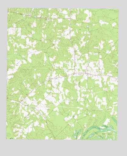
Smithland, TX USGS Topographic Map
Click on map above to begin viewing in our Map Viewer.

This topographic map contains these locations and features:
Feature Name Type Latitude Longitude GNIS ID View Map
Belview ChurchChurchN32.8332°W94.1474°1330397View Map
Bethel ChurchChurchN32.7924°W94.2269°1330508View Map
Douglas CemeteryCemeteryN32.7788°W94.2024°1334553View Map
Douglas ChapelChurchN32.7718°W94.1755°1334554View Map
Goat IslandIslandN32.7560°W94.1369°1373861View Map
Gravier SloughGutN32.7632°W94.1380°1373902View Map
Jefferson DivisionCivilN32.7981°W94.2015°1938964View Map
Jenkins SloughGutN32.7618°W94.1482°1338707View Map
Judea CemeteryCemeteryN32.7971°W94.2338°1338909View Map
Judea ChurchChurchN32.7821°W94.2269°1338910View Map
Logan ChapelChurchN32.8088°W94.1935°1340330View Map
Moseley CemeteryCemeteryN32.8160°W94.1599°1341959View Map
Mount Carmel ChurchChurchN32.8326°W94.2055°1342024View Map
Mount Maria ChurchChurchN32.8687°W94.2330°1342049View Map
Old House SloughGutN32.7565°W94.1607°1343165View Map
Patterson SloughGutN32.7549°W94.1702°1343683View Map
Rand CemeteryCemeteryN32.8565°W94.2177°1344780View Map
Savannah ChurchChurchN32.8718°W94.1785°1346729View Map
Shady Grove ChurchChurchN32.8057°W94.1999°1346942View Map
SmithlandPopulated PlaceN32.8140°W94.1682°1379086View Map
Smithland BranchStreamN32.7785°W94.1530°1347301View Map
Smithland Volunteer Fire DepartmentBuildingN32.8127°W94.1745°2655395View Map
Whatley CemeteryCemeteryN32.8512°W94.1894°1349888View Map

Note: Coordinates in the location and feature list above are referenced to NAD83 datum.


Copyright (C) 2008-2025 Ryan Niemi / Sunset Dynamics ... All Rights Reserved