TopoQuest Logo
Do you find TopoQuest useful?
Help keep TopoQuest running and adding new maps/features by donating!
Bitcoin:  19c7KJd3qBynnjoSw5npx9KScwjBe4ifkT
Litecoin:  LXs6TkuXGGXo1vDsWCkWVdjQX94eUKd6ui
Home View Maps Find Maps Find Places Resources & Links


Snyder Flats, Colorado Topographic Map

USGS Map Title: Snyder Flats, CO
USGS Map MRC: 38108G6
DRG (GeoTIFF) Download: o38108g6.tif


Neighboring USGS Topographic Map Quads:


  Payne Wash, CO  
38108H7
 

  Glade Park, CO  
38108H6
 

  Island Mesa, CO  
38108H5
 

  Fish Creek, CO  
38108G7
 

  Snyder Flats, CO  
38108G6
 

  Jacks Canyon, CO  
38108G5
 

  Pine Mountain, CO  
38108F7
 

  Casto Reservoir, CO  
38108F6
 

  Keith Creek, CO  
38108F5


Map MRC Location:

N39°
W109°
N39°
W108°
H8 H7 H6 H5 H4 H3 H2 H1
G8 G7 G6 G5 G4 G3 G2 G1
F8 F7 F6 F5 F4 F3 F2 F1
E8 E7 E6 E5 E4 E3 E2 E1
D8 D7 D6 D5 D4 D3 D2 D1
C8 C7 C6 C5 C4 C3 C2 C1
B8 B7 B6 B5 B4 B3 B2 B1
A8 A7 A6 A5 A4 A3 A2 A1
N38°
W109°
N38°
W108°

Snyder Flats, CO USGS 1:24K Topographic Map Preview:
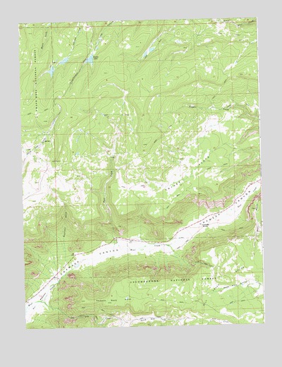
Snyder Flats, CO USGS Topographic Map
Click on map above to begin viewing in our Map Viewer.

This topographic map contains these locations and features:
Feature Name Type Latitude Longitude GNIS ID View Map
Amethyst MineMineN38.7897°W108.6687°1735804View Map
Bean GulchValleyN38.8041°W108.6283°185327View Map
Craig Number 1 DamDamN38.7750°W108.7173°198728View Map
Craig Reservoir Number 1ReservoirN38.7750°W108.7173°198729View Map
Enochs LakeReservoirN38.8594°W108.7133°185331View Map
Fall CreekStreamN38.7797°W108.7054°185326View Map
Gill CreekStreamN38.7614°W108.7420°185322View Map
Gill Creek DivideRidgeN38.7694°W108.6493°185334View Map
Gill Creek TrailTrailN38.7544°W108.7234°185333View Map
Gill MeadowsFlatN38.7611°W108.7437°185324View Map
Glade Park-Gateway DivisionCivilN38.7976°W108.7462°1935472View Map
Gobbo Number 1 DamDamN38.8566°W108.7340°198380View Map
Gobbo Number 3 DamDamN38.8600°W108.7257°198398View Map
Gobbo Reservoir Number 1ReservoirN38.8551°W108.7334°198381View Map
Gobbo Reservoir Number 3ReservoirN38.8591°W108.7265°198399View Map
King Number 1 DamDamN38.8666°W108.6657°198346View Map
King Number 2 DamDamN38.8633°W108.6823°198350View Map
King Number 3 DamDamN38.8616°W108.6857°198358View Map
King Reservoir Number 1ReservoirN38.8658°W108.6666°198347View Map
King Reservoir Number 2ReservoirN38.8629°W108.6809°198351View Map
King Reservoir Number 3ReservoirN38.8610°W108.6843°198359View Map
Mayflower GulchValleyN38.7763°W108.7282°185325View Map
Mesa MineMineN38.7778°W108.7118°1735803View Map
Mirror Lake Number 1 DamDamN38.8616°W108.7157°200074View Map
Mirror Lake Number 1 ReservoirReservoirN38.8616°W108.7157°200075View Map
North Gill CreekStreamN38.7517°W108.6993°185323View Map
Snyder FlatsFlatN38.8122°W108.6620°185328View Map
Thimble Rock PointCliffN38.7608°W108.7207°185321View Map
Unaweep DivideRidgeN38.7905°W108.6551°185320View Map
Yellow Jacket MineMineN38.8180°W108.7340°1735826View Map

Note: Coordinates in the location and feature list above are referenced to NAD83 datum.


Copyright (C) 2008-2024 Ryan Niemi / Sunset Dynamics ... All Rights Reserved