TopoQuest Logo
Do you find TopoQuest useful?
Help keep TopoQuest running and adding new maps/features by donating!
Bitcoin:  19c7KJd3qBynnjoSw5npx9KScwjBe4ifkT
Litecoin:  LXs6TkuXGGXo1vDsWCkWVdjQX94eUKd6ui
Home View Maps Find Maps Find Places Resources & Links


Soldiers Farewell Hill, New Mexico Topographic Map

USGS Map Title: Soldiers Farewell Hill, NM
USGS Map MRC: 32108C3
DRG (GeoTIFF) Download: o32108c3.tif


Neighboring USGS Topographic Map Quads:


  C Bar Ranch, NM  
32108D4
 

  Werney Hill, NM  
32108D3
 

  Cow Springs Mountain, NM  
32108D2
 

  Ninetysix Ranch, NM  
32108C4
 

  Soldiers Farewell Hill, NM  
32108C3
 

  Grandmother Mountain West, NM  
32108C2
 

  Separ, NM  
32108B4
 

  Separ NE, NM  
32108B3
 

  Gage NW, NM  
32108B2


Map MRC Location:

N33°
W109°
N33°
W108°
H8 H7 H6 H5 H4 H3 H2 H1
G8 G7 G6 G5 G4 G3 G2 G1
F8 F7 F6 F5 F4 F3 F2 F1
E8 E7 E6 E5 E4 E3 E2 E1
D8 D7 D6 D5 D4 D3 D2 D1
C8 C7 C6 C5 C4 C3 C2 C1
B8 B7 B6 B5 B4 B3 B2 B1
A8 A7 A6 A5 A4 A3 A2 A1
N32°
W109°
N32°
W108°

Soldiers Farewell Hill, NM USGS 1:24K Topographic Map Preview:
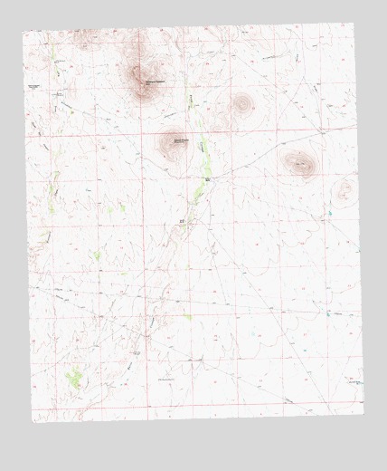
Soldiers Farewell Hill, NM USGS Topographic Map
Click on map above to begin viewing in our Map Viewer.

This topographic map contains these locations and features:
Feature Name Type Latitude Longitude GNIS ID View Map
Barrow WindmillLocaleN32.3543°W108.3634°886088View Map
Bessie Rhoads MountainSummitN32.3387°W108.3200°886270View Map
Big Box WindmillLocaleN32.2629°W108.3259°886286View Map
Butterfield TrailParkN32.3651°W108.2781°932216View Map
Butterfield TrailTrailN32.3651°W108.2781°900150View Map
Hurley DivisionCivilN32.2777°W108.3429°1937541View Map
J P B Water WellWellN32.3654°W108.3634°919501View Map
Japanese Ranch DepositMineN32.3612°W108.3548°936855View Map
Jarrell RanchLocaleN32.3131°W108.3153°890425View Map
Jarrell Tank Number 1ReservoirN32.2600°W108.2511°907330View Map
JPB DrawValleyN32.3345°W108.3637°907279View Map
JPB WindmillLocaleN32.3645°W108.3637°898346View Map
Little Box WindmillLocaleN32.2715°W108.3367°891114View Map
Soldiers Farewell HillSummitN32.3565°W108.3300°920709View Map
Soldiers Farewell Stage StationLocaleN32.3568°W108.3692°894993View Map
South Well CanyonValleyN32.3345°W108.3637°911284View Map
Thorne RanchLocaleN32.3259°W108.3056°895643View Map

Note: Coordinates in the location and feature list above are referenced to NAD83 datum.


Copyright (C) 2008-2025 Ryan Niemi / Sunset Dynamics ... All Rights Reserved