TopoQuest Logo
Do you find TopoQuest useful?
Help keep TopoQuest running and adding new maps/features by donating!
Bitcoin:  19c7KJd3qBynnjoSw5npx9KScwjBe4ifkT
Litecoin:  LXs6TkuXGGXo1vDsWCkWVdjQX94eUKd6ui
Home View Maps Find Maps Find Places Resources & Links


Sonora, Texas Topographic Map

USGS Map Title: Sonora, TX
USGS Map MRC: 30100E6
DRG (GeoTIFF) Download: o30100e6.tif


Neighboring USGS Topographic Map Quads:


  Savell Ranch, TX  
30100F7
 

  Sonora NW, TX  
30100F6
 

  Sonora NE, TX  
30100F5
 

  Caverns of Sonora, TX  
30100E7
 

  Sonora, TX  
30100E6
 

  Sonora SE, TX  
30100E5
 

  Hudspeth Draw, TX  
30100D7
 

  Dunbar Draw NW, TX  
30100D6
 

  Dunbar Draw NE, TX  
30100D5


Map MRC Location:

N31°
W101°
N31°
W100°
H8 H7 H6 H5 H4 H3 H2 H1
G8 G7 G6 G5 G4 G3 G2 G1
F8 F7 F6 F5 F4 F3 F2 F1
E8 E7 E6 E5 E4 E3 E2 E1
D8 D7 D6 D5 D4 D3 D2 D1
C8 C7 C6 C5 C4 C3 C2 C1
B8 B7 B6 B5 B4 B3 B2 B1
A8 A7 A6 A5 A4 A3 A2 A1
N30°
W101°
N30°
W100°

Sonora, TX USGS 1:24K Topographic Map Preview:
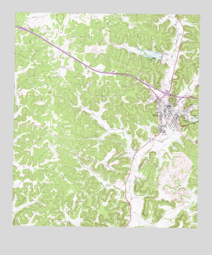
Sonora, TX USGS Topographic Map
Click on map above to begin viewing in our Map Viewer.

This topographic map contains these locations and features:
Feature Name Type Latitude Longitude GNIS ID View Map
Border Line Volunteer Fire DepartmentBuildingN30.5682°W100.6438°2551883View Map
Church of ChristChurchN30.5702°W100.6434°2023430View Map
City of SonoraCivilN30.5708°W100.6440°2411931View Map
Elliott SchoolSchoolN30.5596°W100.6501°1356925View Map
KBIT-TV (Sonora)TowerN30.5524°W100.6570°1386099View Map
KHOS-AM (Sonora)TowerN30.5524°W100.6570°1385697View Map
KHOS-FM (Sonora)TowerN30.5593°W100.6320°1386017View Map
Liberty ParkParkN30.5621°W100.6479°2028934View Map
Lillian M Hudspeth Memorial HospitalHospitalN30.5634°W100.6343°2015709View Map
Lowrey DrawValleyN30.5698°W100.6440°1361940View Map
Meckel Gas FieldOilfieldN30.6132°W100.6926°1362562View Map
Miers Home MuseumBuildingN30.5707°W100.6487°2014459View Map
Old Mercantile BuildingBuildingN30.5716°W100.6445°2031773View Map
Presbyterian Church of the Good ShepherdChurchN30.5721°W100.6476°2023432View Map
Saint Johns Episcopal ChurchChurchN30.5766°W100.6368°2023431View Map
Shurley DrawValleyN30.5206°W100.6713°1368247View Map
Site Number EightReservoirN30.6002°W100.6506°1368350View Map
Site Number ThirteenReservoirN30.5646°W100.6304°1368332View Map
Soil Conservation Service Site 13 DamDamN30.5652°W100.6304°1858798View Map
Soil Conservation Service Site 13 ReservoirReservoirN30.5642°W100.6292°1858799View Map
Soil Conservation Service Site 8 DamDamN30.6002°W100.6504°1858800View Map
Soil Conservation Service Site 8 ReservoirReservoirN30.6004°W100.6537°1858801View Map
SonoraPopulated PlaceN30.5668°W100.6434°1368606View Map
Sonora City HallBuildingN30.5716°W100.6455°2753933View Map
Sonora Elementary SchoolSchoolN30.5657°W100.6418°2008758View Map
Sonora High SchoolSchoolN30.5657°W100.6418°2008705View Map
Sonora Junior High SchoolSchoolN30.5657°W100.6418°2008706View Map
Sonora Municipal AirportAirportN30.5835°W100.6499°1387560View Map
Sonora Police DepartmentBuildingN30.5680°W100.6414°2750402View Map
Sonora Post OfficePost OfficeN30.5710°W100.6471°2731956View Map
Sutton County CourthouseBuildingN30.5730°W100.6451°2030522View Map
Sutton County Emergency Medical ServiceBuildingN30.5677°W100.6420°2655916View Map
Sutton County JailBuildingN30.5734°W100.6441°2738739View Map
Sutton County ParkParkN30.5791°W100.6543°2030117View Map
Sutton County Sheriff's OfficeBuildingN30.5734°W100.6441°2750547View Map

Note: Coordinates in the location and feature list above are referenced to NAD83 datum.


Copyright (C) 2008-2025 Ryan Niemi / Sunset Dynamics ... All Rights Reserved