TopoQuest Logo
Do you find TopoQuest useful?
Help keep TopoQuest running and adding new maps/features by donating!
Bitcoin:  19c7KJd3qBynnjoSw5npx9KScwjBe4ifkT
Litecoin:  LXs6TkuXGGXo1vDsWCkWVdjQX94eUKd6ui
Home View Maps Find Maps Find Places Resources & Links


Souris, North Dakota Topographic Map

USGS Map Title: Souris, ND
USGS Map MRC: 48100H6
DRG (GeoTIFF) Download: o48100h6.tif


Neighboring USGS Topographic Map Quads:


  Roth, ND  
48100H7
 

  Souris, ND  
48100H6
 

  Carbury, ND  
48100H5
 

  Landa SE, ND  
48100G7
 

  Souris SW, ND  
48100G6
 

  Souris SE, ND  
48100G5


Map MRC Location:

N49°
W101°
N49°
W100°
H8 H7 H6 H5 H4 H3 H2 H1
G8 G7 G6 G5 G4 G3 G2 G1
F8 F7 F6 F5 F4 F3 F2 F1
E8 E7 E6 E5 E4 E3 E2 E1
D8 D7 D6 D5 D4 D3 D2 D1
C8 C7 C6 C5 C4 C3 C2 C1
B8 B7 B6 B5 B4 B3 B2 B1
A8 A7 A6 A5 A4 A3 A2 A1
N48°
W101°
N48°
W100°

Souris, ND USGS 1:24K Topographic Map Preview:
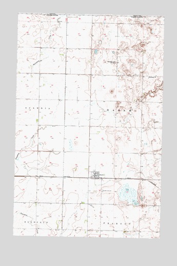
Souris, ND USGS Topographic Map
Click on map above to begin viewing in our Map Viewer.

This topographic map contains these locations and features:
Feature Name Type Latitude Longitude GNIS ID View Map
Bethesda CemeteryCemeteryN48.9651°W100.6379°2782177View Map
Bethesda ChurchChurchN48.9653°W100.6377°1027963View Map
Boundary Creek 3 DamDamN48.9584°W100.6254°1033191View Map
City of SourisCivilN48.9100°W100.6826°1036265View Map
Kornkven AirstripAirportN48.8868°W100.6900°2646291View Map
Mountain View CemeteryCemeteryN48.9013°W100.6753°1030313View Map
Mountain View School Number 3SchoolN48.9734°W100.6654°1030316View Map
SourisPopulated PlaceN48.9097°W100.6815°1032174View Map
Souris City HallBuildingN48.9096°W100.6804°2745281View Map
Souris Fire DepartmentBuildingN48.9096°W100.6807°2637792View Map
Souris Post OfficePost OfficeN48.9101°W100.6820°2743190View Map
Township of HaramCivilN48.9466°W100.6429°1759277View Map

Note: Coordinates in the location and feature list above are referenced to NAD83 datum.


Copyright (C) 2008-2025 Ryan Niemi / Sunset Dynamics ... All Rights Reserved