TopoQuest Logo
Do you find TopoQuest useful?
Help keep TopoQuest running and adding new maps/features by donating!
Bitcoin:  19c7KJd3qBynnjoSw5npx9KScwjBe4ifkT
Litecoin:  LXs6TkuXGGXo1vDsWCkWVdjQX94eUKd6ui
Home View Maps Find Maps Find Places Resources & Links


South Hero, Vermont Topographic Map

USGS Map Title: South Hero, VT
USGS Map MRC: 44073F3
DRG (GeoTIFF) Download: o44073f3.tif


Neighboring USGS Topographic Map Quads:


  Beekmantown, NY  
44073G4
 

  North Hero, VT  
44073G3
 

  Saint Albans Bay, VT  
44073G2
 

  Plattsburgh, NY  
44073F4
 

  South Hero, VT  
44073F3
 

  Georgia Plains, VT  
44073F2
 

  Keeseville, NY  
44073E4
 

  Colchester Point, VT  
44073E3
 

  Colchester, VT  
44073E2


Map MRC Location:

N45°
W74°
N45°
W73°
H8 H7 H6 H5 H4 H3 H2 H1
G8 G7 G6 G5 G4 G3 G2 G1
F8 F7 F6 F5 F4 F3 F2 F1
E8 E7 E6 E5 E4 E3 E2 E1
D8 D7 D6 D5 D4 D3 D2 D1
C8 C7 C6 C5 C4 C3 C2 C1
B8 B7 B6 B5 B4 B3 B2 B1
A8 A7 A6 A5 A4 A3 A2 A1
N44°
W74°
N44°
W73°

South Hero, VT USGS 1:24K Topographic Map Preview:
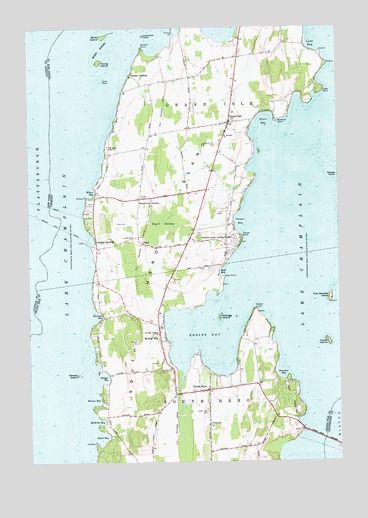
South Hero, VT USGS Topographic Map
Click on map above to begin viewing in our Map Viewer.

This topographic map contains these locations and features:
Feature Name Type Latitude Longitude GNIS ID View Map
Adams LandingPopulated PlaceN44.7362°W73.3321°1460478View Map
Apple Island Campground and MarinaLocaleN44.6364°W73.2682°1460482View Map
Appletree Bay CampgroundLocaleN44.6370°W73.2726°1918553View Map
Barnes BayBayN44.6425°W73.3474°1456261View Map
Beech BayBayN44.6323°W73.3454°1456367View Map
Bixby IslandIslandN44.7475°W73.3429°1456437View Map
Camp MerrycrestLocaleN44.7237°W73.2746°1918512View Map
Cedar IslandIslandN44.6592°W73.2540°1456801View Map
Cooper BayBayN44.6939°W73.2890°1457014View Map
Cooper PointCapeN44.6898°W73.2879°1457016View Map
Fish Bladder IslandIslandN44.6720°W73.2532°1457434View Map
Folsom Educational and Community CenterSchoolN44.6363°W73.3021°1457466View Map
Gordon LandingPopulated PlaceN44.6887°W73.3468°1460421View Map
Grand IslePopulated PlaceN44.7225°W73.2924°1457600View Map
Grand Isle CemeteryCemeteryN44.7164°W73.2974°1457601View Map
Grand Isle FerryLocaleN44.6928°W73.3618°1457602View Map
Grand Isle FerryCrossingN44.6942°W73.3657°970175View Map
Grand Isle Fire DepartmentBuildingN44.7220°W73.2959°2121436View Map
Grand Isle LibraryBuildingN44.7225°W73.2951°1918521View Map
Grand Isle Post OfficePost OfficeN44.7211°W73.2943°1918522View Map
Grand Isle Rescue SquadBuildingN44.7413°W73.2883°2578073View Map
Grand Isle SchoolSchoolN44.7255°W73.2914°1918520View Map
Grand Isle State ParkParkN44.6887°W73.2971°1457603View Map
Grand Isle StationPopulated PlaceN44.7006°W73.3293°1457604View Map
Hoag CemeteryCemeteryN44.7007°W73.3278°1457846View Map
Hoyt BayBayN44.6798°W73.2962°1457920View Map
Hoyt PointCapeN44.6784°W73.2957°1457921View Map
Hyde PointCapeN44.7320°W73.2554°1457956View Map
Jackson PointCapeN44.6300°W73.3479°1461776View Map
Keeler BayBayN44.6628°W73.3029°1458055View Map
Keeler BayPopulated PlaceN44.6598°W73.3196°1458056View Map
Kellogg IslandIslandN44.6667°W73.2971°1458061View Map
Kibbe PointCapeN44.6687°W73.2832°1460507View Map
Ladd BayBayN44.7450°W73.2596°1458129View Map
Long Point IslandIslandN44.7478°W73.3268°1458275View Map
Maycrest CampLocaleN44.7237°W73.2746°1460481View Map
McBride BayBayN44.6367°W73.3468°1458390View Map
Nichols PointCapeN44.7445°W73.3271°1458687View Map
Old Stone Inn (historical)BuildingN44.6462°W73.3024°1918539View Map
Paradise BayBayN44.6512°W73.2729°1458889View Map
PearlPopulated PlaceN44.6875°W73.3268°1458923View Map
Pearl BayBayN44.7228°W73.2787°1458924View Map
Pearl SwampSwampN44.6937°W73.3199°1458925View Map
Quaker and Macomber CemeteryCemeteryN44.7157°W73.3267°1918541View Map
Robinson PointCapeN44.7231°W73.2743°1459224View Map
Rockwell BayBayN44.6673°W73.3468°1459236View Map
Saint Josephs ChurchChurchN44.7187°W73.2949°1459333View Map
Saint Rose of Lima ChurchChurchN44.6620°W73.3224°1459347View Map
Sand Bar BridgeBridgeN44.6312°W73.2551°1459358View Map
Sawyer BayBayN44.6495°W73.3449°1459385View Map
Sawyer IslandIslandN44.6503°W73.3549°1459388View Map
Sister IslandsIslandN44.7409°W73.3446°1459524View Map
Sister ShoalBarN44.7350°W73.3446°1459525View Map
South HeroPopulated PlaceN44.6453°W73.3024°1459588View Map
South Hero Bicentennial MuseumBuildingN44.6425°W73.3118°1918547View Map
South Hero CemeteryCemeteryN44.6396°W73.3030°1459589View Map
South Hero Census Designated PlaceCensusN44.6452°W73.3027°2586654View Map
South Hero Community LibraryBuildingN44.6359°W73.3021°1918548View Map
South Hero IslandIslandN44.6862°W73.3204°1459590View Map
South Hero Post OfficePost OfficeN44.6455°W73.3009°1918549View Map
South Hero Rescue SquadBuildingN44.6459°W73.3050°2578107View Map
South Hero Volunteer Fire DepartmentBuildingN44.6462°W73.3047°2121437View Map
The Lady ChapelChurchN44.7159°W73.3421°1459869View Map
Town of Grand IsleCivilN44.7204°W73.2990°1462107View Map
Town of South HeroCivilN44.6300°W73.3144°1462213View Map
Wilcox BayBayN44.7028°W73.3490°1460246View Map
Wilcox Cove Golf CourseLocaleN44.6987°W73.3496°1918551View Map
Wilcox PointCapeN44.7009°W73.3504°1460251View Map
Young IslandIslandN44.7400°W73.3449°1460340View Map

Note: Coordinates in the location and feature list above are referenced to NAD83 datum.


Copyright (C) 2008-2024 Ryan Niemi / Sunset Dynamics ... All Rights Reserved