TopoQuest Logo
Do you find TopoQuest useful?
Help keep TopoQuest running and adding new maps/features by donating!
Bitcoin:  19c7KJd3qBynnjoSw5npx9KScwjBe4ifkT
Litecoin:  LXs6TkuXGGXo1vDsWCkWVdjQX94eUKd6ui
Home View Maps Find Maps Find Places Resources & Links


South Lake, Utah Topographic Map

USGS Map Title: South Lake, UT
USGS Map MRC: 41111H1
DRG (GeoTIFF) Download: o41111h1.tif


Neighboring USGS Topographic Map Quads:


  Pegram Creek, ID  
42111A2
 

  Boundary Ridge, ID  
42111A1
 

  Cokeville, WY  
42110A8
 

  Sheeppen Creek, UT  
41111H2
 

  South Lake, UT  
41111H1
 

  Beckwith, WY  
41110H8
 

  Sage Creek, UT  
41111G2
 

  Leefe, WY  
41111G1
 

  Sage, WY  
41110G8


Map MRC Location:

N42°
W112°
N42°
W111°
H8 H7 H6 H5 H4 H3 H2 H1
G8 G7 G6 G5 G4 G3 G2 G1
F8 F7 F6 F5 F4 F3 F2 F1
E8 E7 E6 E5 E4 E3 E2 E1
D8 D7 D6 D5 D4 D3 D2 D1
C8 C7 C6 C5 C4 C3 C2 C1
B8 B7 B6 B5 B4 B3 B2 B1
A8 A7 A6 A5 A4 A3 A2 A1
N41°
W112°
N41°
W111°

South Lake, UT USGS 1:24K Topographic Map Preview:
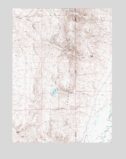
South Lake, UT USGS Topographic Map
Click on map above to begin viewing in our Map Viewer.

This topographic map contains these locations and features:
Feature Name Type Latitude Longitude GNIS ID View Map
Beckwith and Quinn CanalCanalN41.8788°W111.0344°1585344View Map
Big Bend SpringSpringN41.8840°W111.1205°1425460View Map
Boundary HillsRangeN41.9416°W111.0521°1425906View Map
Christy CanyonValleyN41.9837°W111.0041°372020View Map
Christy CreekStreamN41.9997°W111.0599°1454706View Map
Cold SpringSpringN41.9918°W111.1222°1426794View Map
Goblin GulchValleyN41.9380°W111.0052°1428220View Map
Goblin GulchValleyN41.9380°W111.0063°1588948View Map
Lake RidgeRidgeN41.9508°W111.0916°1429440View Map
Mud SpringSpringN41.9066°W111.0640°1430575View Map
North LakeLakeN41.9593°W111.0604°1430823View Map
North Lake CanyonValleyN41.9530°W111.0063°1430824View Map
North Lake CanyonValleyN41.9527°W111.0055°1592231View Map
Red KnollSummitN41.9702°W111.0557°1431662View Map
River DitchCanalN41.8844°W111.0071°1593483View Map
San Francisco Chemical Company Number Four MineMineN41.8777°W111.0127°1747000View Map
South LakeLakeN41.9227°W111.0728°1432732View Map
South Lake CanyonValleyN41.9158°W111.0219°1432733View Map
South Lake CanyonValleyN41.9172°W111.0260°1594704View Map
Stirrup SpringSpringN41.9550°W111.0246°1595064View Map

Note: Coordinates in the location and feature list above are referenced to NAD83 datum.


Copyright (C) 2008-2024 Ryan Niemi / Sunset Dynamics ... All Rights Reserved