TopoQuest Logo
Do you find TopoQuest useful?
Help keep TopoQuest running and adding new maps/features by donating!
Bitcoin:  19c7KJd3qBynnjoSw5npx9KScwjBe4ifkT
Litecoin:  LXs6TkuXGGXo1vDsWCkWVdjQX94eUKd6ui
Home View Maps Find Maps Find Places Resources & Links


South Peak, New Mexico Topographic Map

USGS Map Title: South Peak, NM
USGS Map MRC: 32107A6
DRG (GeoTIFF) Download: o32107a6.tif


Neighboring USGS Topographic Map Quads:


  Bowlin Ranch, NM  
32107B7
 

  Capitol Dome, NM  
32107B6
 

  Florida Gap, NM  
32107B5
 

  Midway Butte, NM  
32107A7
 

  South Peak, NM  
32107A6
 

  Gym Peak, NM  
32107A5
 

  West Lime Hills, NM  
31107H7
 

  North Peak, NM  
31107H6
 

  Columbus NE, NM  
31107H5


Map MRC Location:

N33°
W108°
N33°
W107°
H8 H7 H6 H5 H4 H3 H2 H1
G8 G7 G6 G5 G4 G3 G2 G1
F8 F7 F6 F5 F4 F3 F2 F1
E8 E7 E6 E5 E4 E3 E2 E1
D8 D7 D6 D5 D4 D3 D2 D1
C8 C7 C6 C5 C4 C3 C2 C1
B8 B7 B6 B5 B4 B3 B2 B1
A8 A7 A6 A5 A4 A3 A2 A1
N32°
W108°
N32°
W107°

South Peak, NM USGS 1:24K Topographic Map Preview:
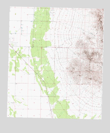
South Peak, NM USGS Topographic Map
Click on map above to begin viewing in our Map Viewer.

This topographic map contains these locations and features:
Feature Name Type Latitude Longitude GNIS ID View Map
00659 Water WellWellN32.0956°W107.6375°930299View Map
00660 Water WellWellN32.0798°W107.6809°930202View Map
00718 Water WellWellN32.1231°W107.7498°923226View Map
00719 Water WellWellN32.1187°W107.7498°930305View Map
00720 Water WellWellN32.1231°W107.7197°930387View Map
00721 Water WellWellN32.1162°W107.7178°922294View Map
00722 Water WellWellN32.1043°W107.7336°930194View Map
00725 Water WellWellN32.1004°W107.7336°930192View Map
00726 Water WellWellN32.1043°W107.7336°930193View Map
00804 Water WellWellN32.0214°W107.6724°923225View Map
00806 Water WellWellN32.0368°W107.7006°930209View Map
00807 Water WellWellN32.0393°W107.6889°922291View Map
00808 Water WellWellN32.0306°W107.6995°930208View Map
00811 Water WellWellN32.0214°W107.6725°923224View Map
00812 Water WellWellN32.0179°W107.6978°930285View Map
00813 Water WellWellN32.0234°W107.7031°930286View Map
00814 Water WellWellN32.0212°W107.6981°922289View Map
00828 Water WellWellN32.0587°W107.7284°930198View Map
00829 Water WellWellN32.0587°W107.7281°930293View Map
00832 Water WellWellN32.0612°W107.7228°930200View Map
00837 Water WellWellN32.0376°W107.7395°922290View Map
01436 Water WellWellN32.0437°W107.7150°922292View Map
06011 Water WellWellN32.0373°W107.7156°930288View Map
06146 Water WellWellN32.1129°W107.7009°930302View Map
10306 Water WellWellN32.1129°W107.7009°930303View Map
10326 Water WellWellN32.1231°W107.7178°930385View Map
10327 Water WellWellN32.1231°W107.7178°930386View Map
10328 Water WellWellN32.1087°W107.7345°930300View Map
10329 Water WellWellN32.1084°W107.7334°922293View Map
10338 Water WellWellN32.0940°W107.7431°930297View Map
10339 Water WellWellN32.0940°W107.7431°930298View Map
10349 Water WellWellN32.0245°W107.7036°923223View Map
10350 Water WellWellN32.0801°W107.7367°930203View Map
10352 Water WellWellN32.0656°W107.7322°930201View Map
Big Pocket-Florida Mountains AreaMineN32.0445°W107.6334°914780View Map
Crawford RanchLocaleN32.0801°W107.6834°888055View Map
Mahoney ParkFlatN32.0951°W107.6384°891546View Map
McBee WindmillLocaleN32.0212°W107.6725°891711View Map
Palayo TankReservoirN32.0165°W107.7451°893035View Map
ParkMineN32.0851°W107.6364°915280View Map
Shaw ProspectMineN32.0823°W107.6350°915262View Map
South PeakSummitN32.0551°W107.6420°895102View Map
South SideMineN32.0345°W107.6384°915265View Map
White HillsSummitN32.1195°W107.6922°896498View Map

Note: Coordinates in the location and feature list above are referenced to NAD83 datum.


Copyright (C) 2008-2024 Ryan Niemi / Sunset Dynamics ... All Rights Reserved