TopoQuest Logo
Do you find TopoQuest useful?
Help keep TopoQuest running and adding new maps/features by donating!
Bitcoin:  19c7KJd3qBynnjoSw5npx9KScwjBe4ifkT
Litecoin:  LXs6TkuXGGXo1vDsWCkWVdjQX94eUKd6ui
Home View Maps Find Maps Find Places Resources & Links


Spalding, Nebraska Topographic Map

USGS Map Title: Spalding, NE
USGS Map MRC: 41098F3
DRG (GeoTIFF) Download: o41098f3.tif


Neighboring USGS Topographic Map Quads:


  School Number 20, NE  
41098G4
 

  Mud Creek, NE  
41098G3
 

  Elgin SW, NE  
41098G2
 

  Spalding NW, NE  
41098F4
 

  Spalding, NE  
41098F3
 

  Akron, NE  
41098F2
 

  Spalding SW, NE  
41098E4
 

  Spalding SE, NE  
41098E3
 

  Cedar Rapids, NE  
41098E2


Map MRC Location:

N42°
W99°
N42°
W98°
H8 H7 H6 H5 H4 H3 H2 H1
G8 G7 G6 G5 G4 G3 G2 G1
F8 F7 F6 F5 F4 F3 F2 F1
E8 E7 E6 E5 E4 E3 E2 E1
D8 D7 D6 D5 D4 D3 D2 D1
C8 C7 C6 C5 C4 C3 C2 C1
B8 B7 B6 B5 B4 B3 B2 B1
A8 A7 A6 A5 A4 A3 A2 A1
N41°
W99°
N41°
W98°

Spalding, NE USGS 1:24K Topographic Map Preview:
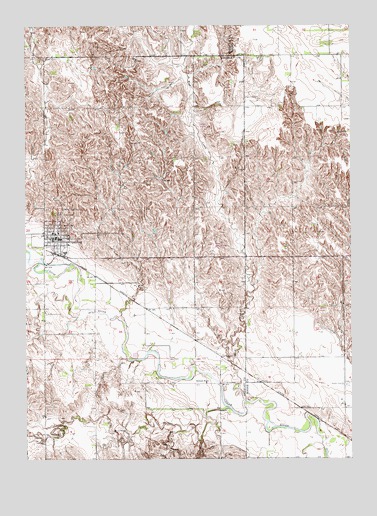
Spalding, NE USGS Topographic Map
Click on map above to begin viewing in our Map Viewer.

This topographic map contains these locations and features:
Feature Name Type Latitude Longitude GNIS ID View Map
Calvary CemeteryCemeteryN41.6958°W98.3620°827869View Map
Dublin CemeteryCemeteryN41.6467°W98.2534°828864View Map
Freeman CreekStreamN41.6397°W98.2970°829404View Map
Friendship VillaHospitalN41.6889°W98.3634°1849851View Map
Glaser Airport (historical)AirportN41.6864°W98.3028°837716View Map
Grand View CemeteryCemeteryN41.6975°W98.3598°829631View Map
Mc Kay AirportAirportN41.7230°W98.3093°837717View Map
Mud CreekStreamN41.6420°W98.2915°835958View Map
Saint Michaels Catholic ChurchChurchN41.6889°W98.3634°1849855View Map
Saint Michaels CemeteryCemeteryN41.6675°W98.3678°833025View Map
School Number 22 (historical)SchoolN41.6539°W98.2628°836406View Map
School Number 35SchoolN41.6686°W98.3109°836621View Map
School Number 39SchoolN41.7261°W98.3098°836673View Map
School Number 4SchoolN41.6470°W98.3062°836686View Map
School Number 47SchoolN41.7245°W98.3673°836767View Map
School Number 70 (historical)SchoolN41.6908°W98.2626°837041View Map
South Akron Public SchoolSchoolN41.7261°W98.2537°836934View Map
SpaldingLocaleN41.6845°W98.3670°1849856View Map
SpaldingPopulated PlaceN41.6889°W98.3634°833638View Map
Spalding AcademySchoolN41.6889°W98.3634°1849852View Map
Spalding City ParkParkN41.6889°W98.3634°1849849View Map
Spalding City Park CampgroundLocaleN41.6889°W98.3634°1849848View Map
Spalding Community ClinicHospitalN41.6889°W98.3634°1849853View Map
Spalding Cooperative ElevatorLocaleN41.6889°W98.3634°1849854View Map
Spalding Dam Site CampgroundLocaleN41.6889°W98.3634°1849847View Map
Spalding Post OfficePost OfficeN41.6890°W98.3615°1849850View Map
Spalding Public LibraryBuildingN41.6889°W98.3634°1849887View Map
Spalding Public SchoolsSchoolN41.6903°W98.3640°1849857View Map
Spalding Volunteer Fire and RescueBuildingN41.6884°W98.3688°2553333View Map
Village of SpaldingCivilN41.6893°W98.3625°2399865View Map

Note: Coordinates in the location and feature list above are referenced to NAD83 datum.


Copyright (C) 2008-2025 Ryan Niemi / Sunset Dynamics ... All Rights Reserved